James Spann: Record warmth possible Friday
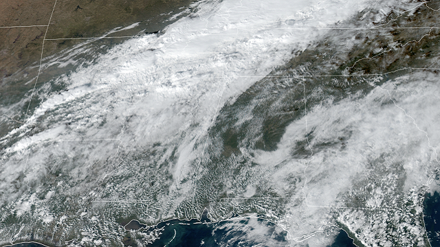
WARM DECEMBER DAY: Temperatures are mostly between 68 and 73 degrees across Alabama this afternoon with a partly sunny sky. We note a few showers over the northwest corner of the state, around the Shoals. Showers remain possible there through the evening; otherwise tonight will be mostly fair with a low in the 50s.
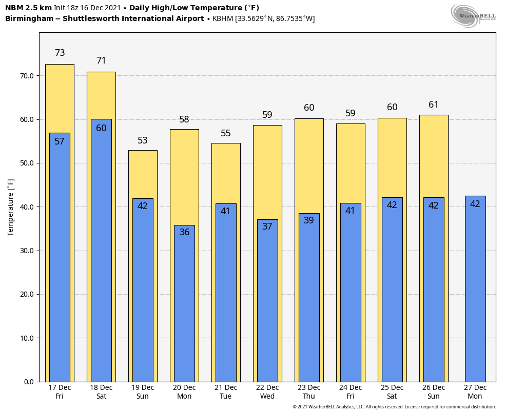
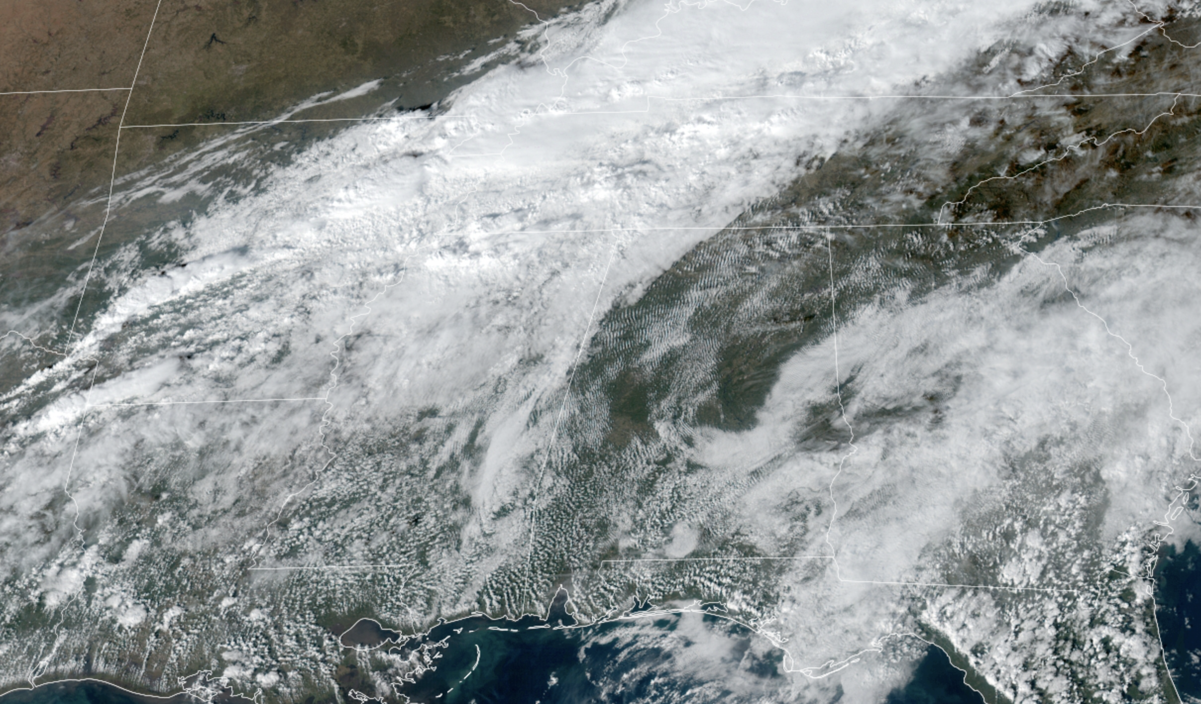 New record highs are possible Friday; we expect a high in the mid 70s for most of the state. Birmingham’s record high for Dec. 17 is 73, set in 1984. Look for a mix of sun and clouds, and a few isolated showers are possible over the southwest counties of the state.
THE ALABAMA WEEKEND: A cold front will bring occasional showers to Alabama Saturday, along with potential for a few thunderstorms. There will be very limited dynamic support, and severe storms are not expected. Rain amounts will be one-half inch or less for most places, and the high will be close to 70 degrees with a cloudy sky. The rain ends Saturday night, and Sunday will be noticeably cooler. The sky becomes partly to mostly sunny with a high in the mid 50s.
NEXT WEEK: Monday will be dry and cool, with a high between 57 and 60 degrees. Clouds increase late in the day Monday, and rain is possible over the southern two-thirds of the state Monday night and Tuesday. Most of the rain will be along and south of I-20, and amounts should be less than one-half inch. Otherwise Tuesday will be cloudy and cool, with a high in the 50s.
Wednesday through Friday will be dry with mostly sunny days and fair nights; highs will be close to 60 degrees.
CHRISTMAS DAY: For now the weather looks dry and pleasant on Saturday, Dec. 25 — mostly sunny with a high at or just over 60 degrees after a morning low in the low 40s.
 ON THIS DATE IN 2000: An EF4 tornado tore through the southern part of Tuscaloosa, killing 11 people and injuring more than 100. Nine of the fatalities occurred in mobile homes, one in a vehicle and one in a commercial building converted to residential use. Six of those killed were females and five were males. Ages ranged from 16 months to 83 years old. The tornado was on the ground for 18 miles, all within Tuscaloosa County. The tornado path was estimated to be 750 yards wide at its maximum intensity.
There was an excellent warning for the tornado; a warning was issued at 12:40 p.m. on that deadly Saturday, 14 minutes before the twister first touched down in a rural area southwest of Tuscaloosa near the Black Warrior River. The tornado crossed Alabama 69 near Shelton State Community College and Hillcrest High School, destroying a shopping center and many homes. The Bear Creek Trailer Park was hit, where many of the deaths occurred. The tornado moved to the east-northeast, south of Skyland Boulevard, and finally crossed I-59/20 near the Cottondale exit.
Later in the day, the same parent storm dropped an F3 tornado that struck the Coats Bend region of Etowah County, near Gadsden, destroying 250 homes and injuring 14 people. Like the Tuscaloosa tornado, excellent warnings were issued by the National Weather Service long before the damage occurred.
BEACH FORECAST: Click here to see the AlabamaWx Beach Forecast Center page.
WEATHER BRAINS: You can listen to our weekly 90-minute show any time on your favorite podcast app. This is the show all about weather featuring many familiar voices, including the meteorologists at ABC 33/40.
CONNECT: You can find me on the major social networks:
For more weather news and information from James Spann and his team, visit AlabamaWx.


