James Spann: Alabama stays cold with some light rain through Tuesday
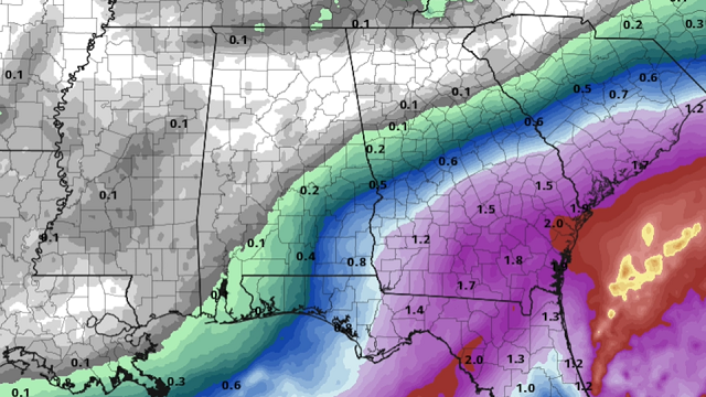
COLD, WET WEATHER: A strong upper-air disturbance over the Ark-La-Tex region is spinning up a surface low in the Gulf of Mexico this afternoon. Clouds cover most of Alabama with temperatures only in the 40s in most areas, and light rain is falling over the southern counties of the state.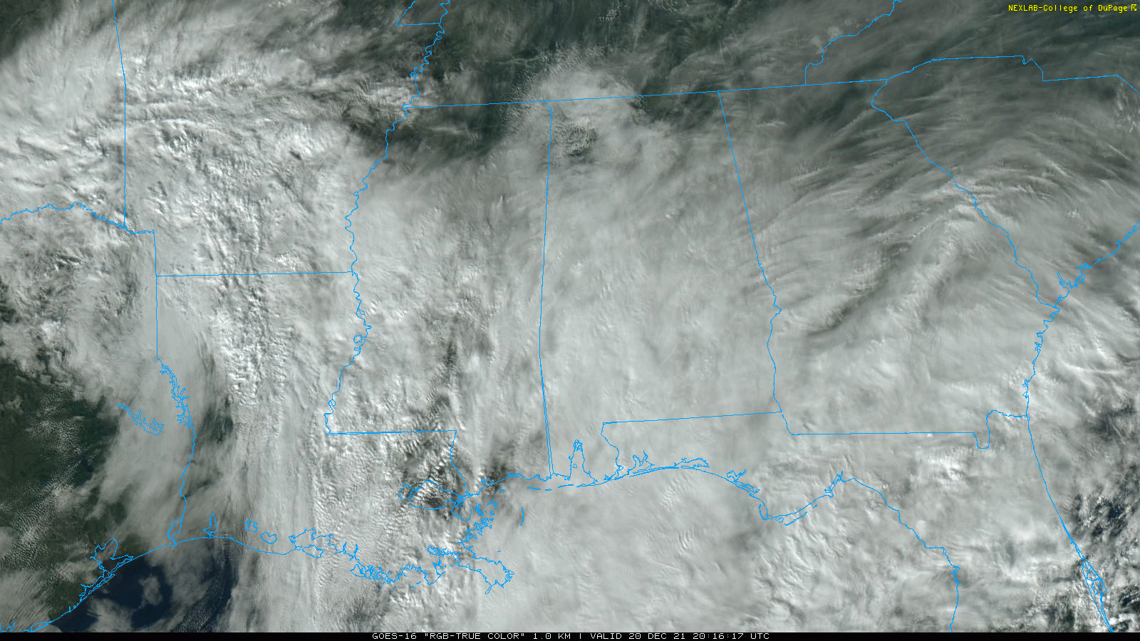
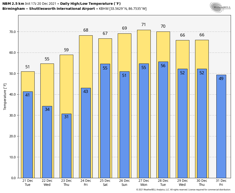
Look for occasional light rain over the southern two-thirds of the state through Tuesday; otherwise the weather will stay cloudy and cold. Temperatures Tuesday won’t get out of the 40s again for much of the state as the cold-core upper trough passes overhead.
WEDNESDAY THROUGH FRIDAY: The sky becomes partly to mostly sunny Wednesday, with a high in the mid 50s. The warming trend continues; the high will be in the low 60s Thursday followed by mid 60s Friday, with a good supply of sunshine both days.
CHRISTMAS WEEKEND: Christmas Day will be mild, with a high between 65 and 70 degrees. We expect a mix of sun and clouds. For now the chance of showers looks very low, although moisture levels will rise a bit.
Here are the years (10 of them since 1900) when temperatures have reached 70 degrees on Dec. 25 at Birmingham:
- 2016 — 78
- 2015 –77
- 1987 — 74
- 1982 — 73
- 1942 — 73
- 1964 — 72
- 1926 — 71
- 1922 — 71
- 1919 — 70
- 1901 — 70
It’s safe to say we won’t have a snow threat this year on Christmas Day, unlike 2010, when parts of the state had more than 5 inches of snow on the ground Dec. 25. Temperatures this year on Christmas will be below average over the western third of the nation, and the weather looks brutally cold over the western half of Canada.
SUNDAY AND NEXT WEEK: At this point the weather looks mild and mostly dry Sunday through most of next week as an upper ridge persists across the Deep South.
ON THIS DATE IN 1836: A famous “sudden freeze” occurred in central Illinois. A cold front with 70 mph winds swept through around noon, dropping the temperature from 40 degrees to near zero in a matter of minutes. Many settlers froze to death. Folklore told of chickens frozen in their tracks and men frozen to saddles. Ice in streams reportedly froze to 6 inches in a few hours.
ON THIS DATE IN 2012: A pre-dawn EF-1 tornado moved through the western part of Mobile. The tornado formed around 4:49 a.m. near Davidson High School and lifted near Telegraph Road in Prichard. The tornado path was approximately 7 miles long and 50 to 75 yards wide.
BEACH FORECAST: Click here to see the AlabamaWx Beach Forecast Center page.
WEATHER BRAINS: You can listen to our weekly 90-minute show any time on your favorite podcast app. This is the show all about weather featuring many familiar voices, including the meteorologists at ABC 33/40.
CONNECT: You can find me on the major social networks:
For more weather news and information from James Spann and his team, visit AlabamaWx.


