James Spann: Alabama stays wet through Wednesday; dry, warmer Thursday
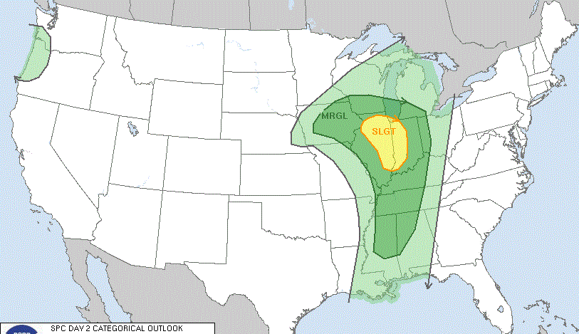
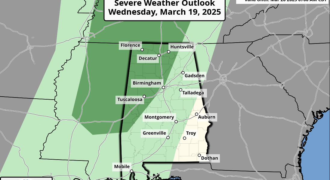
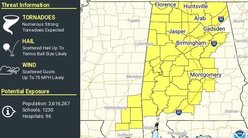
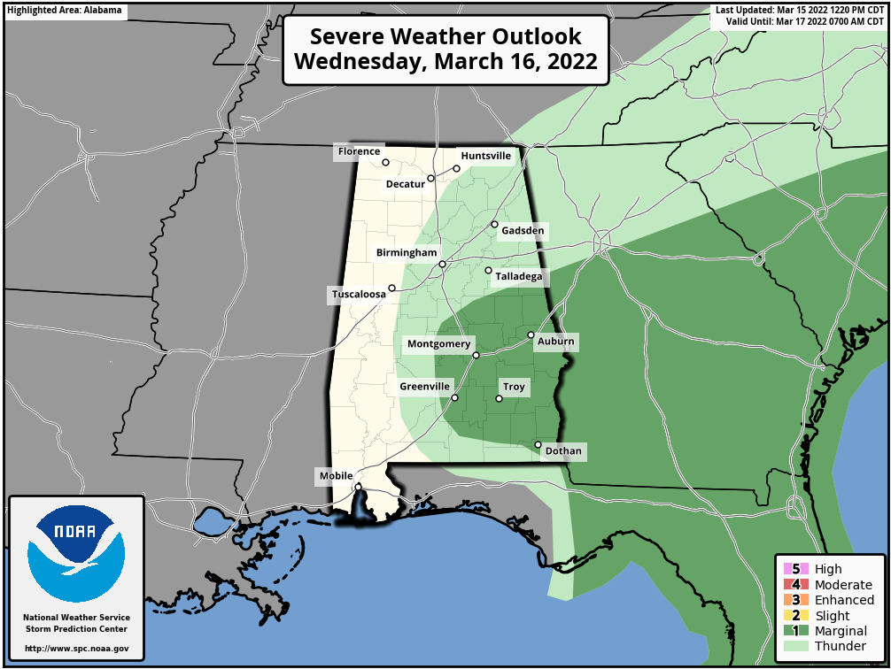
RADAR CHECK: Rain is widespread over the northern two-thirds of Alabama this afternoon ahead of an upper low over north Louisiana. Temperatures are mostly in the upper 50s, about 10 degrees below average for mid-March in Alabama. Periods of rain and a few thunderstorms will continue across the state through Wednesday. Stronger storms Wednesday over east and southeast Alabama could produce some hail due to the cold air aloft associated with the upper low. The Storm Prediction Center maintains a low-end marginal risk (level 1 of 5) for that possibility.
 Rain will end Wednesday evening as the upper low opens up and lifts away; the high Wednesday afternoon will be in the mid to upper 60s for most communities. Thursday will be dry and warmer with a partly to mostly sunny sky; the high will be in the mid 70s.
STRONG STORMS FRIDAY: A cold front will bring showers and thunderstorms to the state Friday; the SPC has roughly the southern half of the state in a severe weather risk. If instability values can rise, a severe threat could evolve over the northern half of the state as well. For now it looks like the main threat will come from strong straight-line winds, but a few isolated tornadoes can’t be ruled out, especially over south Alabama. The high Friday will be in the mid to upper 60s.
THE ALABAMA WEEKEND: The weekend will feature some really nice spring weather with sunny, pleasant days and fair, cool nights. The high will be in the mid 60s Saturday, followed by low 70s Sunday.
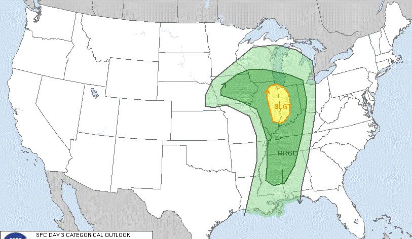
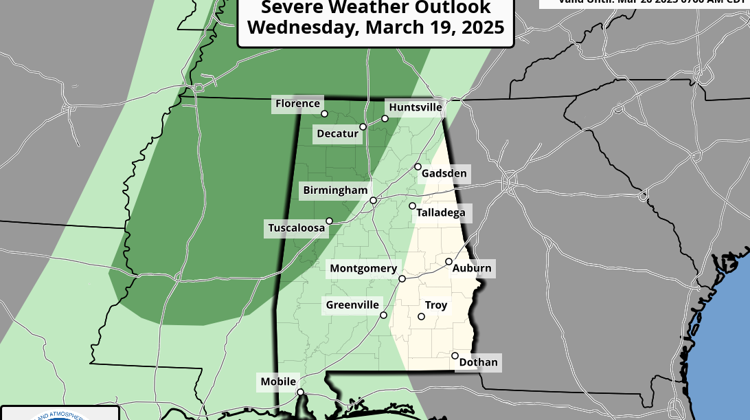
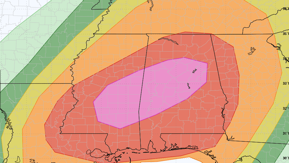
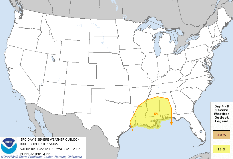
NEXT WEEK: Monday will be dry with a high in the 70s, but a vigorous weather system will bring rain and storms to the state in the Tuesday night-Wednesday time frame. The SPC already has much of Alabama in a severe weather risk for this system. This is only the sixth time the SPC has issued a risk eight days out since 2012; the last one was in 2019. While this has potential to be a significant threat, it is too early to know the details; we are just getting strong model signals in the pattern. We will be much more specific in coming days.
Thursday and Friday look dry. ON THIS DATE IN 1938: A tornado hit McPaul, Iowa, while moving from southeast to northwest. Another tornado raced through Batesville, Illinois, at 60 to 65 mph. A tornado causing F4 damage killed 10 and injured 12 in St. Clair County, Missouri. This tornado was part of an outbreak that produced four tornadoes and was responsible for 11 deaths and 42 injuries.
BEACH FORECAST: Click here to see the AlabamaWx Beach Forecast Center page.
WEATHER BRAINS: You can listen to our weekly 90-minute show any time on your favorite podcast app. This is the show all about weather featuring many familiar voices, including the meteorologists at ABC 33/40.
CONNECT: You can find me on all of the major social networks:
For more weather news and information from James Spann and his team, visit AlabamaWx.