James Spann: Dry weekend ahead for Alabama; storms return Tuesday, Wednesday
James Spann forecasts nice weather for Alabama through the weekend from Alabama NewsCenter on Vimeo.
WONDERFUL WEEKEND AHEAD: Dry air will stay in place across Alabama through the weekend, with sunny, pleasant days and fair, chilly nights. The high will be in the mid 60s today, followed by low 70s Saturday and mid 70s Sunday. The low will be between 33 and 43 degrees Saturday morning and in the 40s early Sunday.
Monday will be another mostly sunny, mild day with a high in the mid to upper 70s.
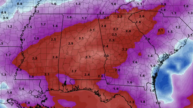
STORMS RETURN: The next weather system will bring rain and thunderstorms to the state Tuesday and Tuesday night. Global models continue to suggest this feature will have strong wind fields and a pretty decent amount of surface-based instability, meaning we will have some risk of strong to severe thunderstorms. The Storm Prediction Center has parts of Alabama in a severe weather threat, mainly from Birmingham south and west, but this will likely be expanded to cover much of the state in future outlooks. It looks like a situation where damaging winds and a few tornadoes will be possible, but it is still too early to be specific on the magnitude of the threat or the timing.
On Wednesday a cold front will sweep through the state, bringing the threat of a line of storms with strong, gusty winds. The SPC has much of the state in a severe weather threat for this event. Rain amounts will be 2-3 inches for most of the state Tuesday and Wednesday, and some flooding problems could develop.
Drier air air returns Thursday, and temperatures will likely be well below average by Friday and Saturday, April 8-9. We could have the potential for a late-season frost or freeze threat by Saturday morning, April 9.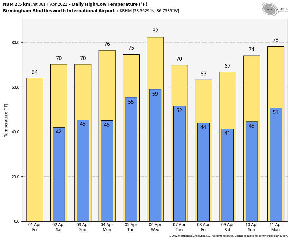 TORNADO SURVEYS: Birmingham National Weather Service has identified five tornadoes in its county warning area.
A tornado that moved through eastern Perry County near Hamburg was rated EF-2. The tornado that moved through parts of Perry, Bibb and Shelby counties (the track ended at the University of Montevallo) was also rated EF-2.
The Pickens-Tuscaloosa county tornado (from south of Gordo to near Brownville) was rated EF-1. A tornado that touched down near the Holt Lock and Dam was also rated EF-1. And the Shelby County tornado near Chelsea was an EF-1 as well.
Survey work continues today in Sumter, Greene, Marengo, Dallas and Lowndes counties.
ON THIS DATE IN 1960: The first weather satellite, TIROS 1 (Television and Infra-Red Observation Satellite) began sending pictures back to Earth. The TIROS series would have little benefit to operational weather forecasters because the image quality was low and inconsistent. The most critical understanding achieved from the new technology was the discovery of the high degree of organization of large-scale weather systems, a fact never apparent from ground and aircraft observations.
ON THIS DATE IN 1981: A high-end F3 tornado tore through Hurtsboro in Russell County, killing two people and injuring 23. The tornado devastated Hurtsboro’s business district and much of the residential area. Eight of the injured were admitted to the hospitals. Damage was estimated at $8.5 million, with about 80% of the property in the city damaged or destroyed. Twenty-five homes, eight mobile homes and 25 businesses were destroyed.
BEACH FORECAST: Click here to see the AlabamaWx Beach Forecast Center page.
WEATHER BRAINS: You can listen to our weekly 90-minute show any time on your favorite podcast app. This is the show all about weather featuring many familiar voices, including the meteorologists at ABC 33/40.
CONNECT: You can find me on the major social networks:
For more weather news and information from James Spann and his team, visit AlabamaWx.


