James Spann: Cooler, drier days ahead for Alabama
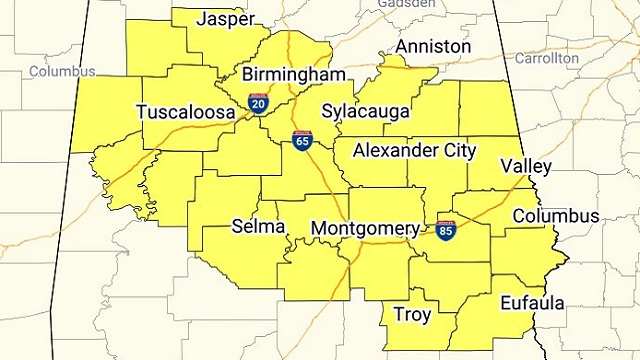
RADAR CHECK: Showers and thunderstorms continue to develop across Alabama this afternoon ahead of a cold front. A severe thunderstorm watch is in effect for much of central Alabama until 9 p.m.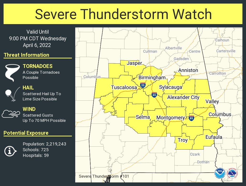 The main threat for Alabama this afternoon and early tonight will come from hail and strong winds. The better atmospheric conditions for tornadoes is to the east over parts of Georgia, where a tornado watch is in effect. Storms will end from west to east early tonight, and by midnight all of the rain should be out of Alabama.
Thursday will be dry with a partly sunny sky; the high will be between 65 and 69 degrees for most places. Friday will be windy and colder, with a high between 55 and 60 degrees. A few showers are possible over northeast Alabama, but most places will be dry.
LATE-SEASON FROST/FREEZE: We are forecasting lows well down in the 30s both Saturday and Sunday mornings over the northern half of Alabama, with potential for widespread frost, and freezing temperatures for colder spots both mornings. Growers will need to monitor temperature forecasts; this type of cold snap is very common in early April, and the reason I always advise people to wait until April 15 to plant anything that might be harmed by frost or a freeze.
Otherwise, the weekend will feature a good supply of sunshine; the high will be between 56 and 61 degrees Saturday, followed by low 70s Sunday as a warming trend begins.
NEXT WEEK: The forecast for next week remains challenging; moisture levels will rise, and there will be some risk of scattered showers Monday through Wednesday, but it will probably be Thursday before organized rain and storms arrive ahead of a cold front. The main severe weather potential for next week should be west of Alabama across parts of Texas, Oklahoma, Kansas and Arkansas.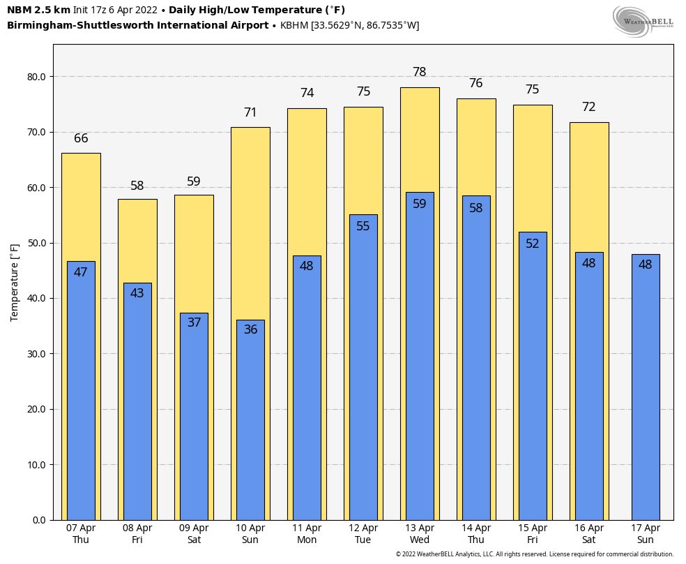 ON THIS DATE IN 2007: In Cleveland, Ohio, April 6-9, the opening-season series between the Indians and Minnesota Twins was wiped out by a snowstorm and a cold snap. The Indians led 4-0 when their home opener was called off by umpires because of heavy snow. The grounds crew who tried to make the field playable with backpack blowers and brooms spent more time on the field than the players during nearly three hours of stoppages. About a foot of snow remained on the ground April 9.
BEACH FORECAST: Click here to see the AlabamaWx Beach Forecast Center page.
WEATHER BRAINS: You can listen to our weekly 90-minute show any time on your favorite podcast app. This is the show all about weather featuring many familiar voices, including the meteorologists at ABC 33/40.
CONNECT: You can find me on the major social networks:
For more weather news and information from James Spann and his team, visit AlabamaWx.


