James Spann: Hot summer day for Alabama; showers few and far between so far
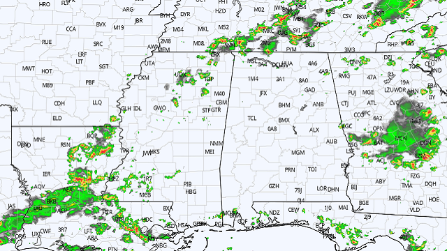
RADAR CHECK: So far showers and storms are slow to develop across Alabama today. Most of them at midafternoon are over the northwest corner of the state, but keep in mind a shower or thunderstorm could form at any place over the next few hours. Temperatures are mostly in the low to mid 90s and the sky is partly sunny. Scattered showers and storms will end after sunset.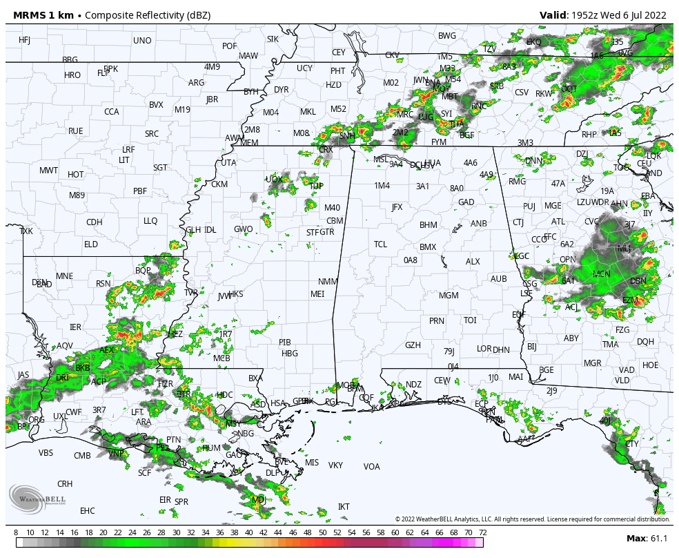 THURSDAY THROUGH THE WEEKEND: Highs will remain in the mid 90s Thursday and Friday, and the heat advisory will remain in effect as some spots could see the heat index touch 105. The sky will be partly sunny both days, and again random, scattered afternoon and evening showers and storms will develop mostly between 2 and 10 p.m. — classic summer weather.
THE WEEKEND AND NEXT WEEK: The core of the upper high will shift to the west and heat levels will drop a bit over the weekend and next week, with afternoon highs closer to 90 degrees. The overall forecast remains the same with partly sunny days and scattered, mostly afternoon and evening showers and thunderstorms daily. Coverage of the afternoon showers will be a little higher, with odds of any one spot getting wet 40-50% most days.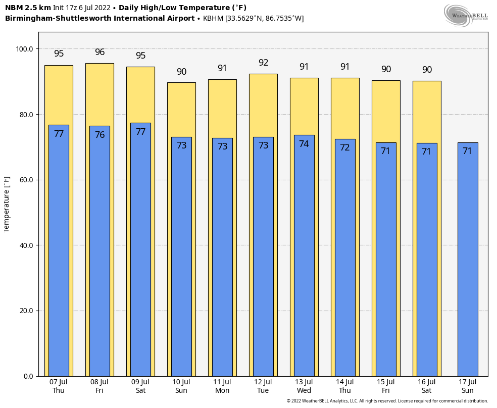 TROPICS: All remains calm across the Atlantic basin, and tropical storm formation is not expected for at least the next seven days. The next named storm will be called Danielle.
ON THIS DATE IN 1893: A violent tornado killed 71 people on its 40-mile track across northwestern Iowa. Forty-nine people were killed around Pomeroy, where 80% of the buildings were destroyed.
ON THIS DATE IN 1928: A hailstone weighing 1.5 pounds fell in Potter, Nebraska. With a circumference of 17 inches, this appeared to be the largest hailstone in the world at that time.
BEACH FORECAST: Click here to see the AlabamaWx Beach Forecast Center page.
For more weather news and information from James Spann and his team, visit AlabamaWx.


