James Spann: Scattered to numerous showers, storms across Alabama today
James Spann forecasts higher rain chances across Alabama today from Alabama NewsCenter on Vimeo.
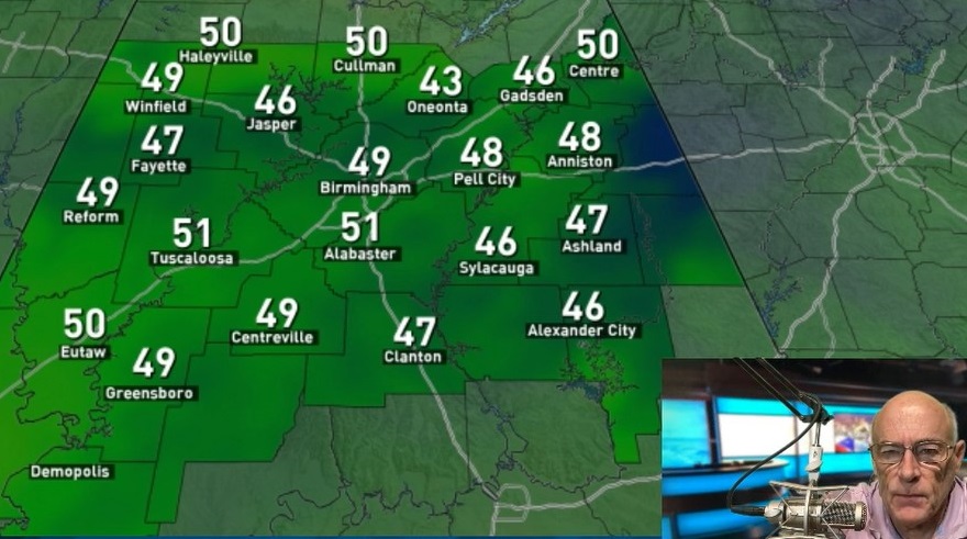
RADAR CHECK: Rain and thunderstorms continue across northwest Alabama early this morning; rain is heavy in spots from Jasper to Muscle Shoals. A few scattered showers are also near the Gulf Coast. Much of central Alabama is dry to start the day. We expect scattered to numerous showers and thunderstorms today statewide as moisture surges northward from the south and a weak surface front approaches from the north. We still can’t promise rain for everyone, but most communities stand a good chance of seeing a decent downpour today. The most widespread rain will come during the afternoon and evening. The high for most places will be in the upper 80s with a limited amount of sun.
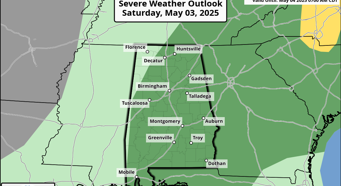
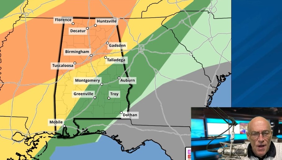
The Storm Prediction Center maintains a marginal risk (level 1 out of 5) of severe thunderstorms for much of the state today; heavier storms this afternoon could produce strong winds. And, of course, all summer storms pack lots of lightning. REST OF THE WEEK AND THE WEEKEND: Drier air filters into north Alabama Thursday, and most of the showers and storms will be found over the southern half of the state. The sky will be partly sunny with a high around 90. Same situation Friday — mostly dry for the northern two-thirds of the state, with a few widely scattered showers and storms over south Alabama. For the weekend, we expect pretty routine summer weather with partly sunny days and a few random, widely scattered afternoon and evening showers or thunderstorms. Highs will remain close to 90 degrees for most places.
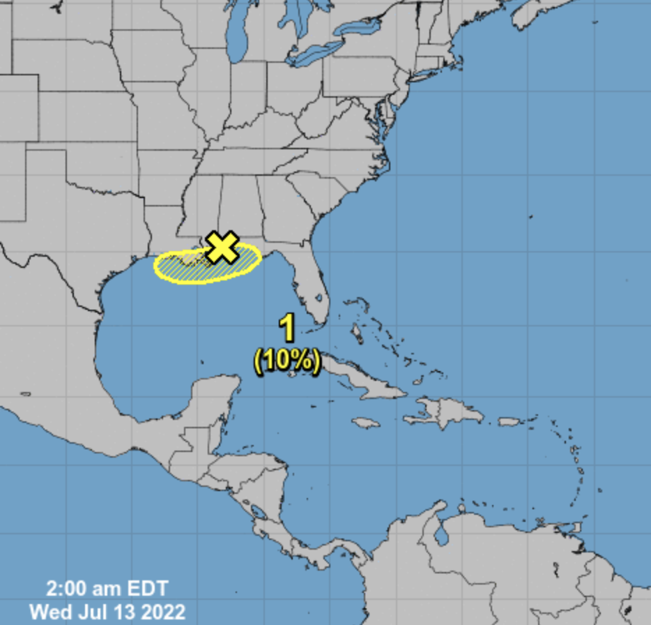
NEXT WEEK: Moisture levels rise a bit early in the week, with potential for scattered showers and storms to be a little more numerous Monday and Tuesday. But the overall pattern will be the same — a classic summer mix of sun and random afternoon and evening thunderstorms. Highs will be in the 88- to 93-degree range.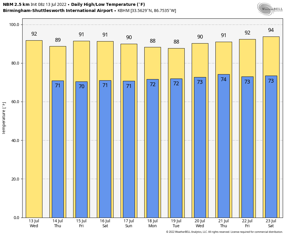 TROPICS: The weak surface trough persists near the Gulf Coast today, but it is not expected to become a tropical depression or storm since it will remain inland; the National Hurricane Center gives it only a 10% chance of development over the next five days. This feature will bring an enhanced coverage of showers and storms to the Gulf Coast through Friday, but we stress it won’t rain all day every day, and the sun will be out at times in the zone from Gulf Shores eastward to Panama City Beach.
The rest of the Atlantic basin is very quiet.
ON THIS DATE IN 1951: Rivers across eastern Kansas crested well above flood stage, causing the most significant destruction from flooding in the midwestern United States at that time. About 500,000 people were left homeless and 24 died in the disaster.
BEACH FORECAST: Click here to see the AlabamaWx Beach Forecast Center page.
For more weather news and information from James Spann and his team, visit AlabamaWx.