James Spann: Summer mix of sun, scattered storms for Alabama
James Spann forecasts showers, storms for parts of Alabama today from Alabama NewsCenter on Vimeo.
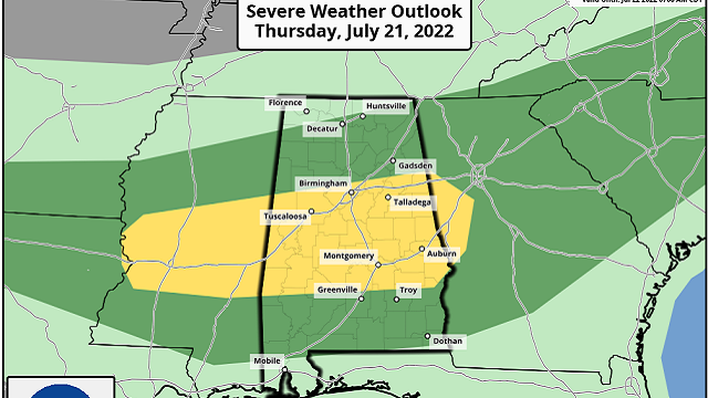
RADAR CHECK: Scattered showers and thunderstorms are moving eastward across Alabama early this morning. Stronger storms are producing heavy rain, strong, gusty winds, lots of lightning and some loud thunder. We will continue to see scattered storms through the day. It won’t rain everywhere, but some spots will see a good summer soaker. Away from the storms, expect a mix of sun and clouds with a high around 90 degrees. The average high for Birmingham on July 19 is 91.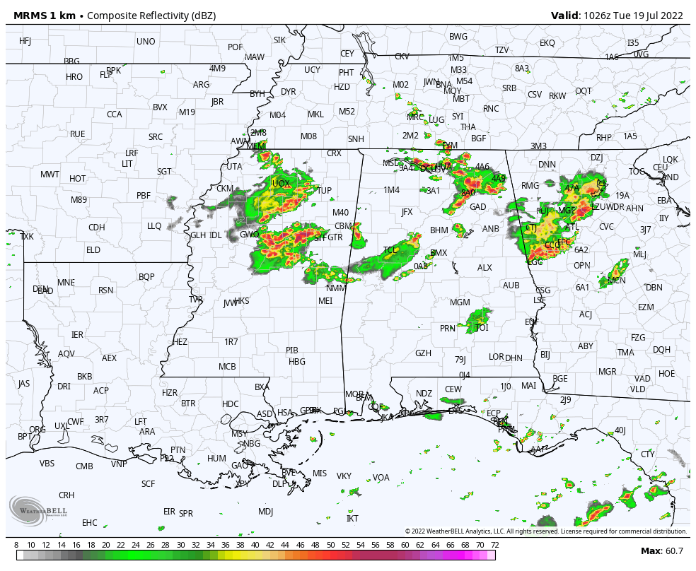 REST OF THE WEEK: Scattered showers and storms will remain possible each day, mostly during the afternoon and evening. A weak surface front will approach from the north Thursday, setting the stage for the potential for strong to severe thunderstorms. The Storm Prediction Center has defined a slight risk (level 2 of 5) for the central counties of Alabama and a marginal risk (level 1) for most of the rest of the state.
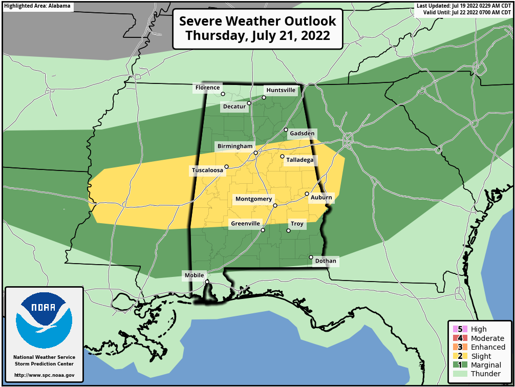
The main concern with this risk Thursday is from wet microbursts, local areas of strong winds with potential for some tree and power line damage. Highs will be mostly in the low 90s Wednesday through Friday.
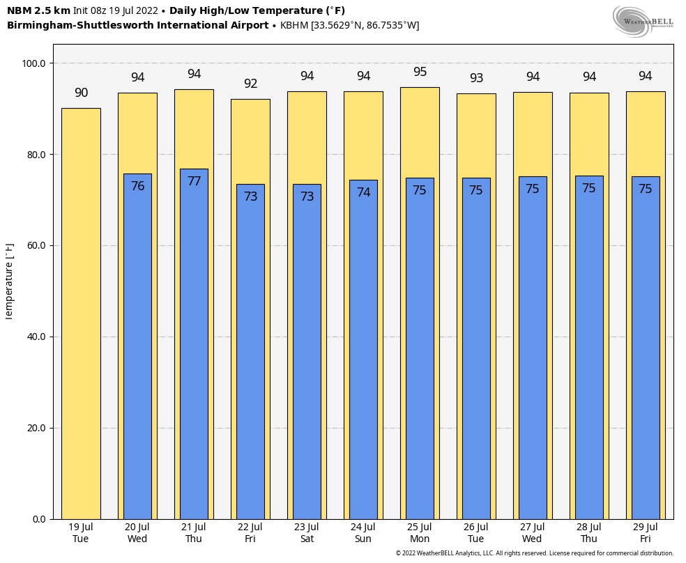
THE WEEKEND AND NEXT WEEK: The upper high will build into the Deep South, meaning higher heat levels and fewer showers and storms. Highs will be mostly in the mid 90s over the weekend and through next week, with potential for upper 90s in spots. You always have the risk of a pop-up storm on a summer afternoon in Alabama, but they should be pretty isolated due to the subsidence associated with the upper high.
 TROPICS: It’s another very quiet day across the vast Atlantic basin. Tropical storm formation is not expected through the next five to seven days.
ON THIS DATE IN 1886: The 1886 Atlantic Hurricane season was very active with 10 hurricanes, seven of which struck the United States. During the evening of July 18, a Category 1 storm made landfall near Homosassa Springs, Florida. Damage was slight as the area was thinly inhabited. The hurricane weakened to tropical storm status south of Gainsville and emerged on the eastern side of Florida, south of Jacksonville, during the morning of July 19. This was the fourth hurricane to make landfall in the United States.
ON THIS DATE IN 2006: A derecho affected a sellout crowd of almost 44,000 St. Louis Cardinals fans packed into the new Busch Stadium. Winds of about 80 mph whirled around the St. Louis area, sending the fans running for shelter. The winds knocked out power and broke windows out of the press box. Nearly two minutes after the winds began at 100 mph, they stopped and it started to rain. About 30 people were injured at the stadium.
BEACH FORECAST: Click here to see the AlabamaWx Beach Forecast Center page.
For more weather news and information from James Spann and his team, visit AlabamaWx.


