James Spann: Dry weekend ahead for much of Alabama
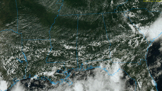
RADAR CHECK: Drier air has worked into the northern half of Alabama this afternoon; widely scattered showers are on radar over south Alabama, but the rain there is not especially heavy or widespread. Temperatures are generally between 87 and 91 degrees; the average high for Birmingham on Aug. 12 is 91.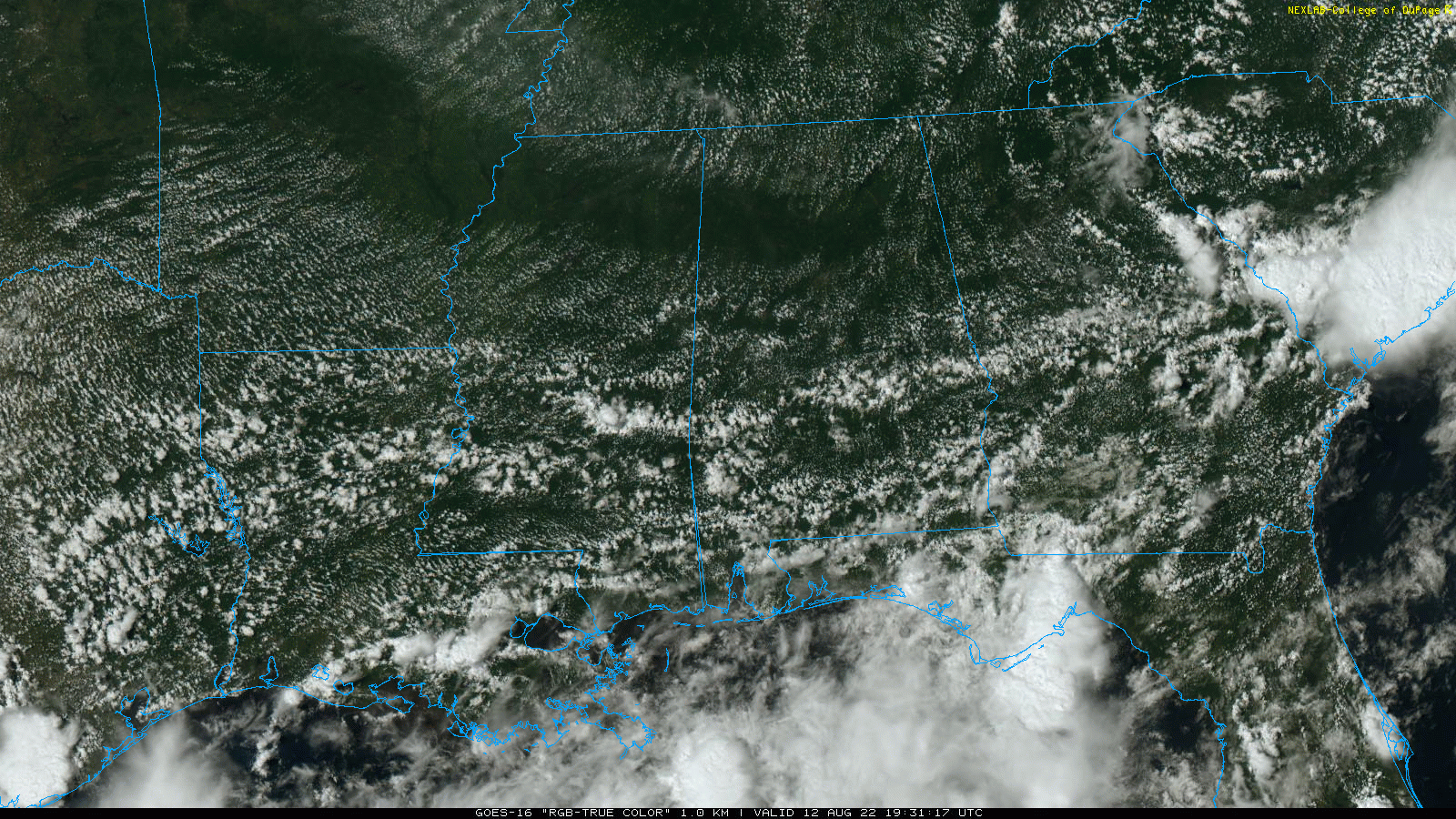
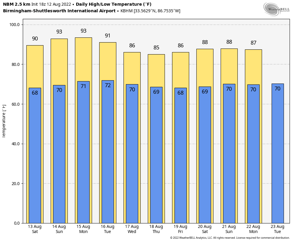
Most of Alabama will stay dry over the weekend with mostly sunny days, fair, pleasant nights and slightly lower humidity. Showers will be confined to the far southern part of the state and near the Gulf Coast. Highs will be close to 90, with lows in the 60s. We expect to see some low 60s early Saturday across cooler pockets of north Alabama for a little touch of fall.
NEXT WEEK: The latest global model data suggests most of the state will remain dry Monday and Tuesday; moisture levels rise over the latter half of the week, with scattered showers and storms returning Wednesday through Friday. The high will be in the low 90s Monday, then between 86 and 90 degrees for the rest of the week.
 TROPICS: Disorganized showers and thunderstorms over the north-central Gulf of Mexico are associated with an area of low pressure centered just offshore of the southern coast of Louisiana. Development, if any, of this system is expected to be slow to occur as it drifts west-southwestward and approaches the Texas coast over the weekend. Regardless of development, locally heavy rains are possible along portions of the Texas coast through the weekend.
The National Hurricane Center gives it only a 10% chance of development over the next five days, and it won’t affect the central Gulf Coast (Gulf Shores to Panama City Beach) directly. The rest of the Atlantic basin is very quiet.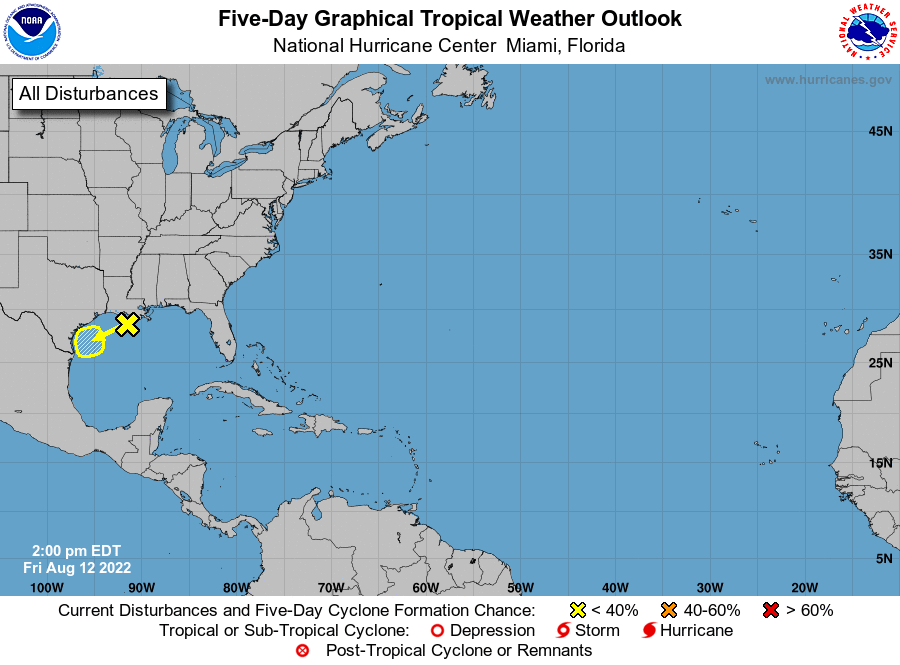 ON THIS DATE IN 1955: Connie made landfall on the North Carolina coast as a Category 3 hurricane. Ahead of the storm, about 2,000 people were evacuated from flood-prone areas in New Bern and up to 14,000 people were evacuated along the North Carolina beaches. As the storm reached landfall near Fort Macon, sustained winds of 75 mph with gusts to 100 mph were observed, while a storm surge of up to 8 feet occurred along the coast.
In Connecticut, rain from Connie, and later in the month from Hurricane Diana, which followed a similar path, set up severe flooding during August. The amount of rain that fell that month in Connecticut is so off the charts no event has come anywhere close to it in the last 100 years. That 21.87 inches at Bradley Airport stands as the wettest month on record – the second-highest, 16.32 inches from October 2005, lags far behind.
ON THIS DATE IN 2005: A tornado struck Wright, Wyoming, a coal-mining community, killing two, destroying 91 homes and damaging about 30 more.
BEACH FORECAST: Click here to see the AlabamaWx Beach Forecast Center page.
For more weather news and information from James Spann and his team, visit AlabamaWx.


