James Spann: Alabama gets wet at times through the weekend
RADAR CHECK: Scattered showers and storms are moving eastward across Alabama this afternoon — nothing severe, but a few spots are seeing heavy rain and some lightning. Otherwise, we have more clouds than sun with temperatures generally in the mid 80s. Showers will remain possible tonight in the soupy air over Alabama.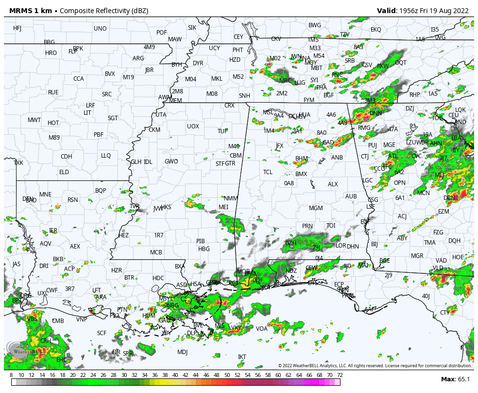
For the weekend, the sky will be mostly cloudy Saturday and Sunday with occasional showers and a few thunderstorms likely. The weekend won’t be a total washout and it won’t rain everywhere each day, but any one spot stands a 70-80% chance of seeing some rain over the two-day period. Temperatures will remain below average, with highs between 80 and 85 degrees.
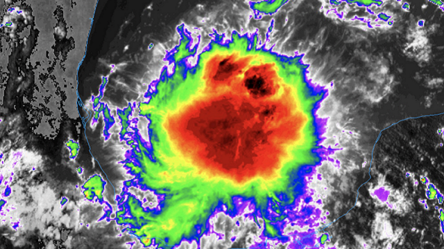
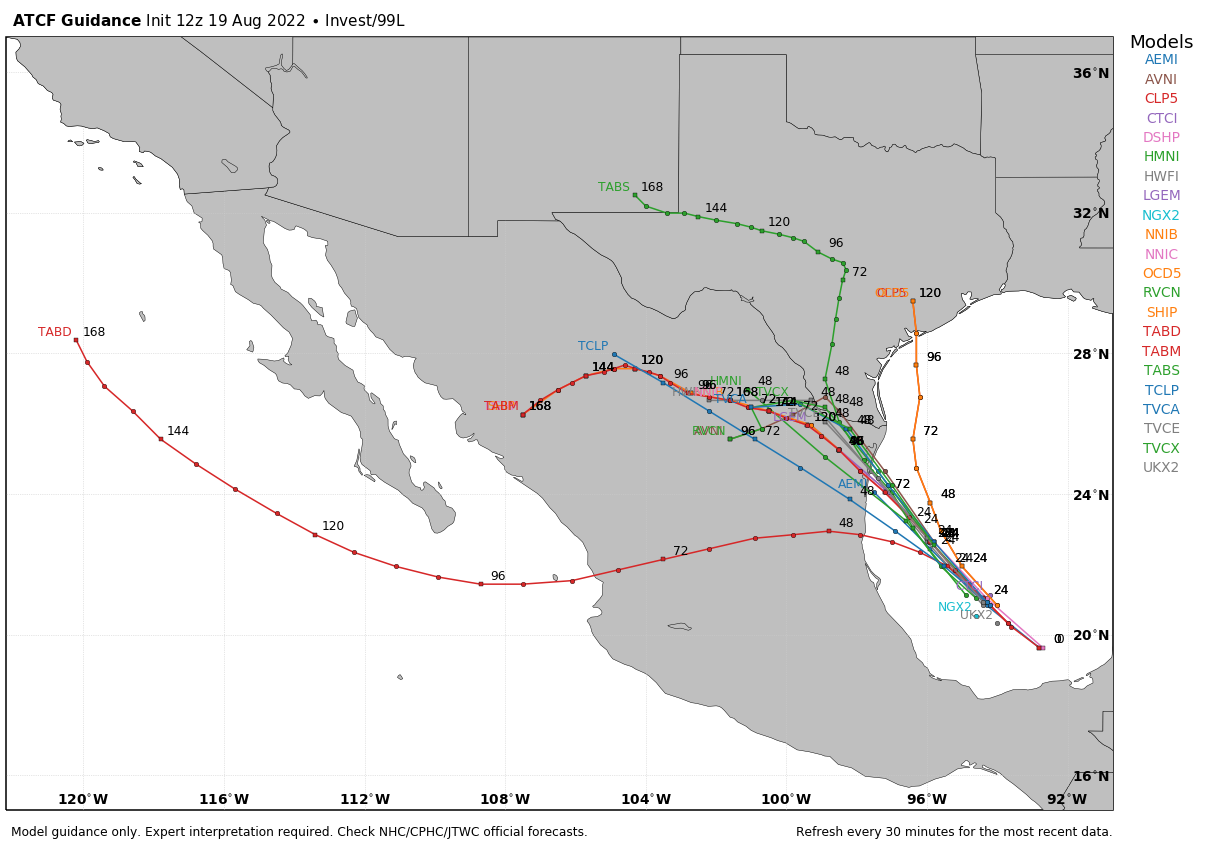
NEXT WEEK: Rain chances will stay elevated Monday and Tuesday with scattered to numerous showers and thunderstorms, but we are seeing evidence the air could be a little drier Wednesday through Friday, with showers becoming fewer in number. Highs will likely stay below 90 through the week.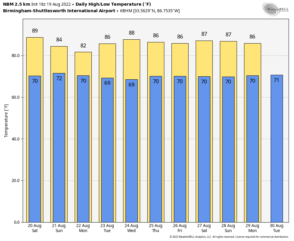 TROPICS: Satellite imagery indicates that showers and thunderstorms associated with the broad low-pressure area (Invest 99L) over the southwestern Gulf of Mexico and the Bay of Campeche continue to become better organized. Environmental conditions appear favorable for additional development, and a tropical depression could form later today, tonight or Saturday while the system moves northwestward across the southwestern and western Gulf of Mexico. However, by Saturday night the system is expected to move inland over northeastern Mexico, which will end its chances of development. An Air Force Reserve Hurricane Hunter aircraft is en route to investigate the system. Interests along the northeastern coast of Mexico and the lower Texas coast should monitor the progress of this system.
One way or another, the main impact will be heavy rain. The rest of the Atlantic basin remains very quiet.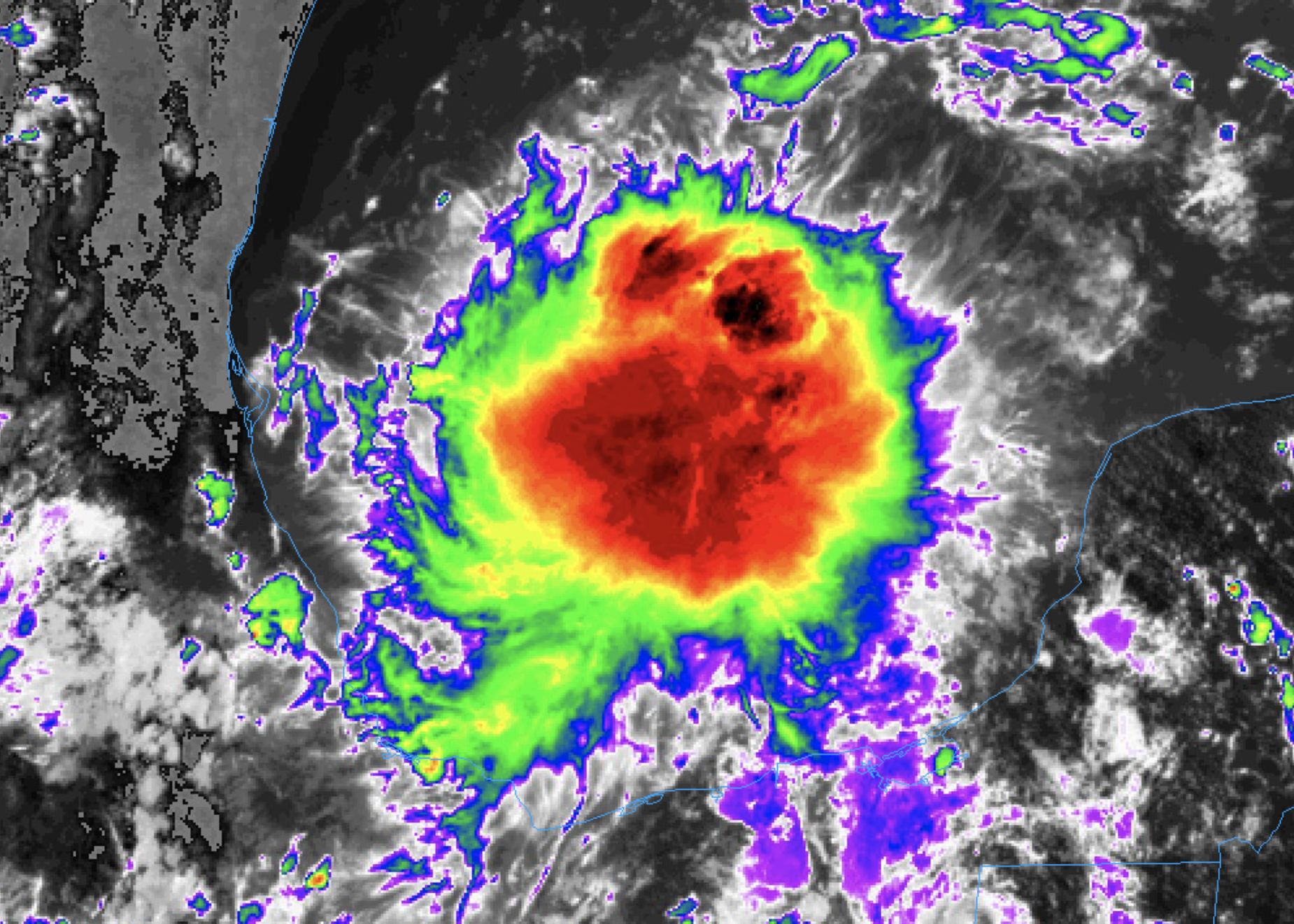
 FOOTBALL: For the high school games tonight, a few random showers and storms will be around in scattered spots, mainly during the first half of the games. Otherwise, the sky will be mostly cloudy with temperatures falling from near 80 at kickoff into the upper 70s during the second half.
ON THIS DATE IN 1955: The remnants of Hurricane Diane continued to drop phenomenal amounts of rain on parts of the eastern U.S., leading to deadly and catastrophic flooding. In Pennsylvania, floods left thousands homeless. The flooded Brodhead Creek killed 37 people at a camp; most of them were children.
ON THIS DATE IN 1969: After blasting the Gulf Coast, the remnants of Hurricane Camille unleashed a monstrous cloudburst over Virginia, which brought massive flooding and mudslides that killed more than 150 people. Some estimates pegged the rainfall at 31 inches.
ON THIS DATE IN 1991: Hurricane Bob made landfall in southeastern New England. Peak wind gusts included 143 mph at Westport Point, Maine, 125 mph on Block Island, Rhode Island, and 120 mph on Martha’s Vineyard, Massachusetts.
BEACH FORECAST: Click here to see the AlabamaWx Beach Forecast Center page.
For more weather news and information from James Spann and his team, visit AlabamaWx.


