James Spann: Alabama weather trends drier by the weekend
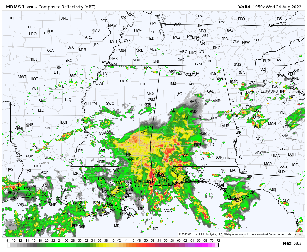
SOAKED: Radar suggests parts of west and southwest Alabama have received 5-10 inches of rain since midnight, and flash flood warnings are in effect for parts of Choctaw, Clarke, Washington and Wilcox counties at mid-afternoon. Showers are more scattered over the rest of the state; the sky is mostly cloudy with temperatures between 75 and 80 degrees for most communities. Rain across southwest Alabama will gradually diminish tonight.
 Thursday will be another mostly cloudy day across Alabama, with scattered to numerous showers and thunderstorms; the high will be in the low 80s.
FRIDAY AND THE WEEKEND: The weather will trend drier as the air becomes more stable. Scattered showers and storms are still possible each day, but they will be mostly during the afternoons and evenings, and we will enjoy partly sunny skies with temperatures rising into the mid 80s Friday and upper 80s over the weekend. The chance of any one spot getting wet is 40-45% Friday and 25-35% Saturday and Sunday.
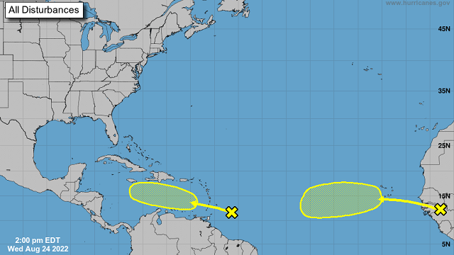
NEXT WEEK: For now the week looks like it will feature routine summer weather with partly sunny days and scattered, mostly afternoon and evening showers and thunderstorms. Highs will be between 87 and 90 degrees most days, not far from seasonal averages. It’s a little too early to be specific about Labor Day weekend weather, but at the moment we don’t see any sign of major weather issues.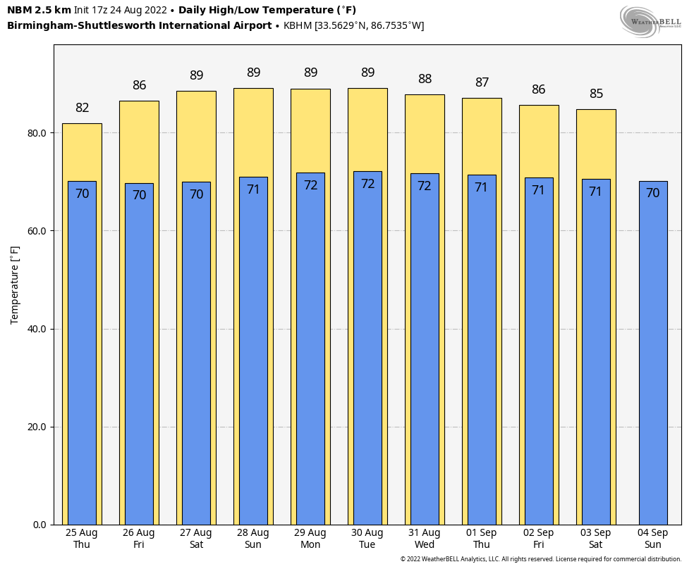 TROPICS: The National Hurricane Center is monitoring two tropical waves this afternoon. One is a few hundred miles east-southeast of the Windward Islands. Environmental conditions could become more conducive for slow development of this system in several days after it crosses the Windward Islands and moves across the eastern and central Caribbean Sea late this week into early next week.
The other is over far western Africa. The wave will move off the coast in the next day or so. Environmental conditions could support some slow development of this system late this week or over the weekend while it moves westward at 10 to 15 mph.
With both waves the chance of development is only 20% over the next five days, and the rest of the Atlantic basin remains very quiet.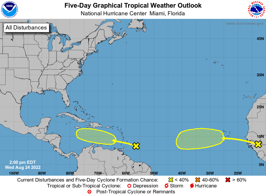 FOOTBALL WEATHER: For the high school games Friday night, a few scattered showers are possible, mostly during the first half of the games. Temperatures will be near 83 at kickoff, falling into the upper 70s during the second half.
Saturday, Jacksonville State will take on Stephen F. Austin at Cramton Bowl in Montgomery (2:30 p.m. kickoff on ESPN). The sky will be partly to mostly sunny with only an outside risk of a shower or storm during the game. The temperature will be near 89 at kickoff, falling back into the mid 80s by the final whistle.
ON THIS DATE IN 1992: Andrew made landfall in southern Florida as a Category 5 hurricane at 4:30 a.m. The high winds caused catastrophic damage in Florida, with the Miami-Dade County cities of Florida City, Homestead and Cutler Ridge receiving the brunt of the storm. About 63,000 homes were destroyed and more than 101,000 others were damaged. This storm left roughly 175,000 people homeless. As many as 1.4 million people were left without electricity at the height of the storm. The death toll in Florida was 44.
Andrew is one of only four hurricanes to make landfall on the U.S. coast at Category 5 strength; the others were the Labor Day hurricane of 1935, Camille in 1969 and Michael in 2018.
BEACH FORECAST: Click here to see the AlabamaWx Beach Forecast Center page.
For more weather news and information from James Spann and his team, visit AlabamaWx.


