James Spann: Alabama gets much cooler Wednesday, even colder this weekend
RECORD WARMTH: Birmingham reports 84 degrees at mid-afternoon, easily beating the old record high for Nov. 7 of 82, set in 2005. Many other places are in the 80s across Alabama today, about 15 degrees above average for early November. We note a few spotty showers on radar over the northern third of the state; those will fade after sunset.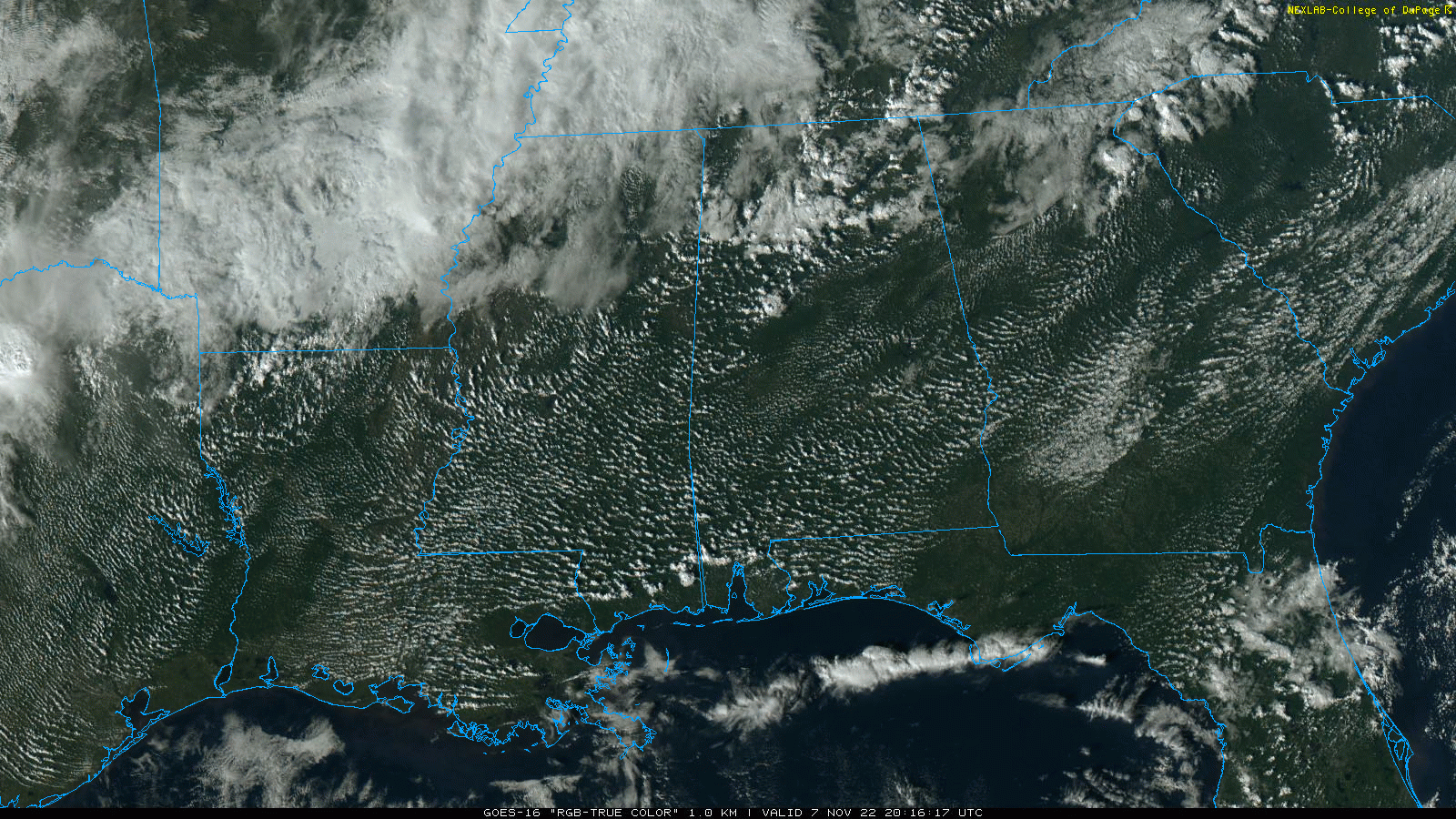 We don’t expect much change Tuesday under a strong upper ridge; the high will be in the low to mid 80s with a partly to mostly sunny sky. Showers should be few and far between.
WEDNESDAY THROUGH FRIDAY: A “backdoor” cold front will pass through in dry fashion Tuesday night, and Wednesday will be much cooler. With a sunny sky, the high Wednesday will be between 67 and 72 degrees for most communities. Thursday will be another mostly sunny day with a high in the mid 70s. On Friday, we can’t rule out some light rain over the eastern counties of the state as Nicole passes to the east, but the main impact from the tropical system will come over Georgia and the Carolinas. The high will be close to 70.
THE ALABAMA WEEKEND: The coldest air so far this season will invade the state over the weekend as highs drop into the 50s and lows into the sub-freezing range by daybreak Sunday. Some places across north Alabama won’t get out of the 40s Sunday, and we expect a low in the 20s over much of the state by early Monday morning. The weekend will be dry with sunny days and clear nights.
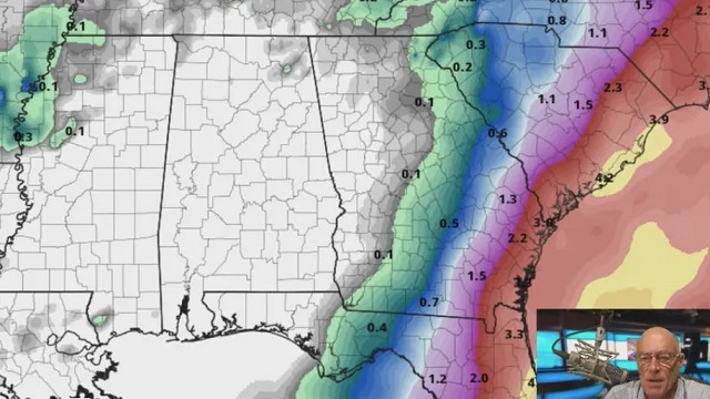
NEXT WEEK: For now, much of the week looks dry with highs in the 50s and lows in the 30s.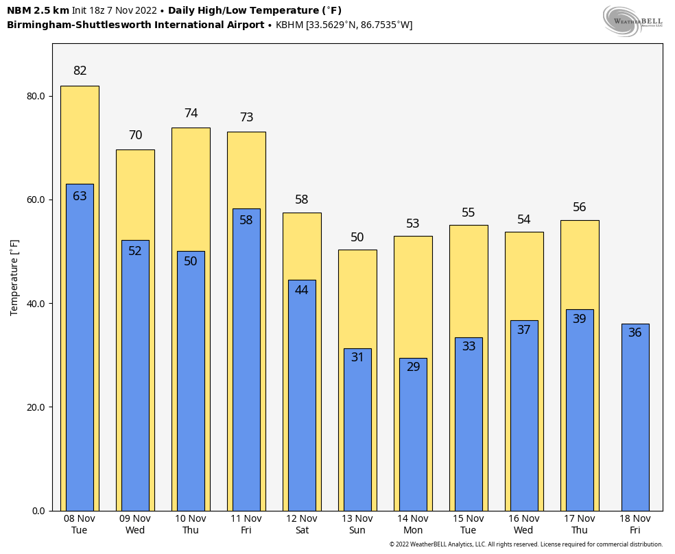 TROPICS: Large Subtropical Storm Nicole, with winds of 45 mph, is about 460 miles east of the northwest Bahamas. A hurricane watch is in effect for the northwestern Bahamas, the east coast of Florida from the Volusia-Brevard County line to Hallandale Beach, and Lake Okeechobee.
Nicole is expected to move into the Florida Peninsula (not the Panhandle) late Wednesday night or early Thursday morning, potentially as a Category 1 hurricane. Do not focus on the exact track of Nicole since it is expected to be a large storm with hazards extending well to the north of the center and outside the cone, affecting much of the Florida Peninsula and portions of the southeastern U.S.
Nicole will produce heavy rainfall by Wednesday night and Thursday across the Florida Peninsula. Flash and urban flooding will be possible across portions of the peninsula along with rises on portions of the St. Johns River.
Most of the wind and rain associated with Nicole will stay east of Alabama.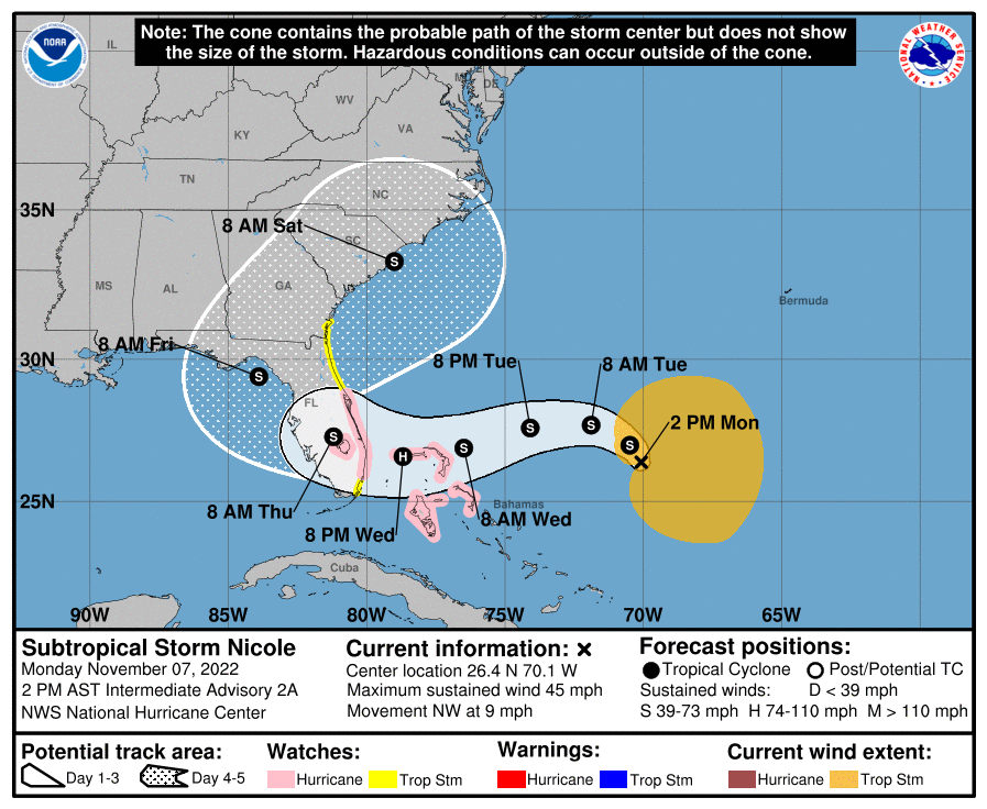 ON THIS DATE IN 1957: A historic tornado outbreak affected southeast Texas and southwestern Louisiana. Ten people were killed.
ON THIS DATE IN 2001: Typhoon Lingling struck the southern Philippines, killing 171 people with 118 missing in Camiguin. The typhoon then struck Vietnam five days later, killing an additional 18 people.
BEACH FORECAST: Click here to see the AlabamaWx Beach Forecast Center page.
For more weather news and information from James Spann and his team, visit AlabamaWx.


