James Spann: Alabama stays warm through the weekend, with scattered showers
RADAR CHECK: Most of Alabama is rain-free this afternoon. With a partly sunny sky temperatures are mostly in the mid to upper 70s, almost 20 degrees above average for Dec. 8 and close to record values for the date. The sky will remain mostly fair tonight, but look out for patchy, dense fog again after midnight.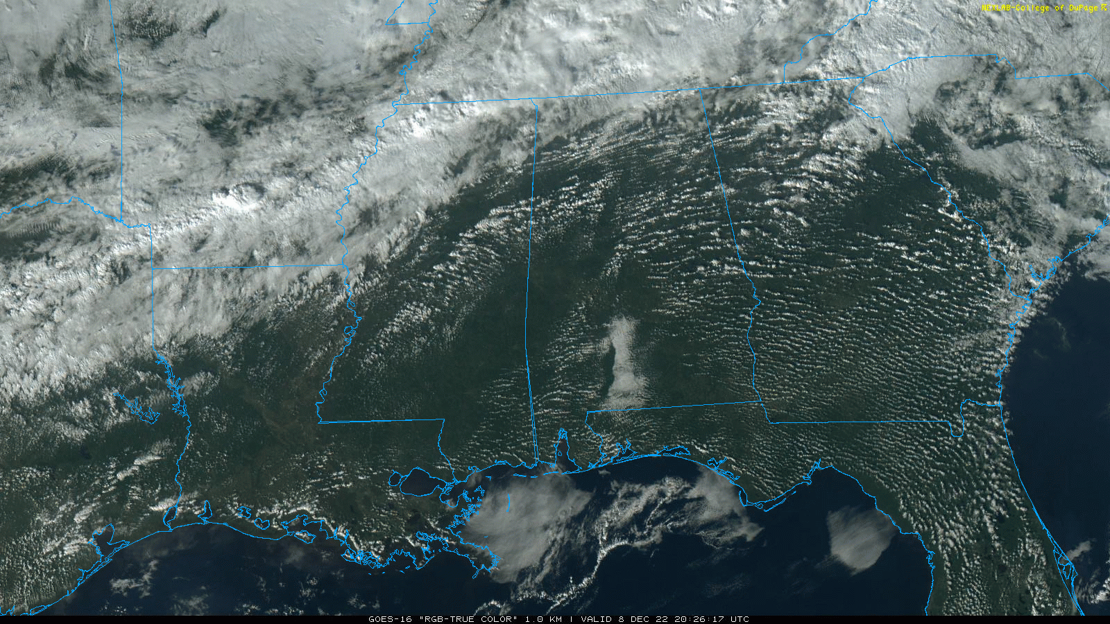 FRIDAY THROUGH THE WEEKEND: Temperatures remain above average with highs mostly in the 70s through Sunday. Expect a mix of sun and clouds daily with a few scattered showers each day. Odds of any one spot getting wet are 20-30% through Saturday, rising to 40-50% Sunday.
NEXT WEEK: We won’t see much change Monday and Tuesday; highs will be between 65 and 70 with only isolated showers. But a severe thunderstorm threat will evolve from Texas and Oklahoma through parts of Arkansas, Louisiana and western Mississippi as a dynamic weather system rolls through. By the time it reaches Alabama Wednesday, it looks like the main dynamic support will pass well to the north, and instability will be limited. Accordingly, the Storm Prediction Center does not have any severe weather risk defined for now. Heavy rain could be the greater threat; amounts Wednesday could exceed 2 inches in many places. Colder, drier air arrives by Thursday and Friday.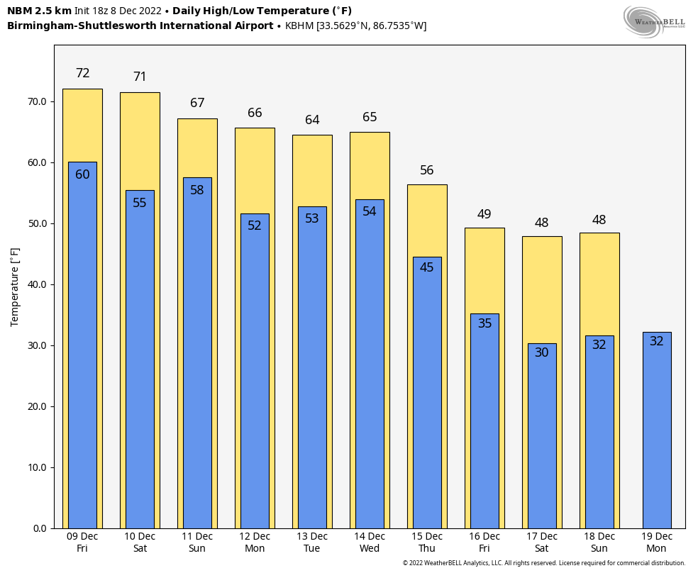
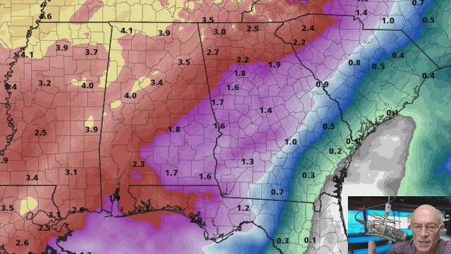
Global models continue to show signals for below-average temperatures across the Deep South (and much of the nation) as we approach Christmas.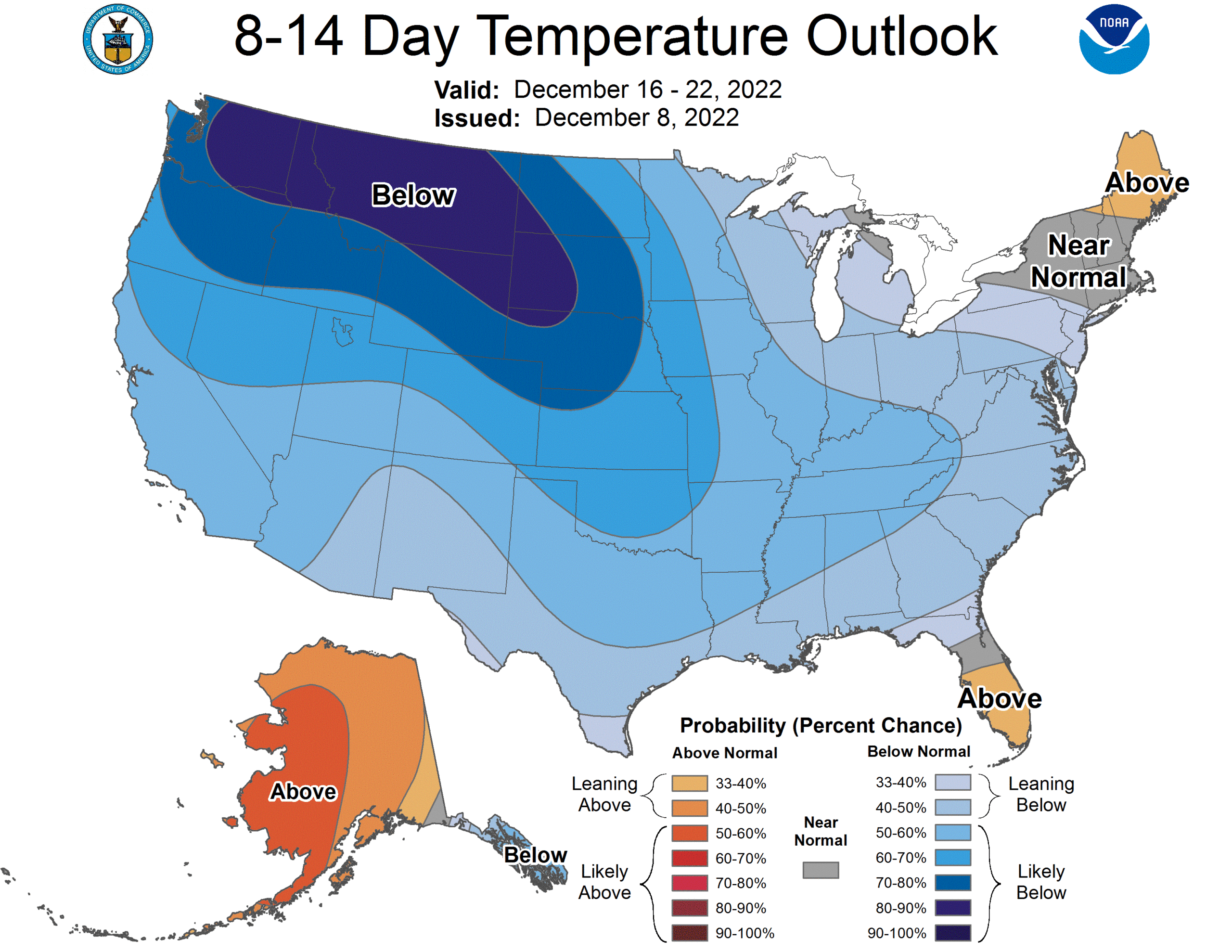 ON THIS DATE IN 2017: Significant snow fell across a large portion of central Alabama along a southwest-to-northeast axis. Within the main corridor of snow, totals of 4 to 8 inches were common, with a few swaths of 8 to 12 inches. A few reports exceeding 12 inches were received from Clay into Cleburne counties: one 15-inch report in Delta (Clay County), and two 13-inch reports (Cleburne County). While public reports are considered unofficial, values were fairly consistent and tend to indicate this event was a top-tier-ranking snowstorm for some locations in east Alabama. Birmingham officially recorded 4 inches of snow, making it the third-snowiest December on record.
BEACH FORECAST: Click here to see the AlabamaWx Beach Forecast Center page.
For more weather news and information from James Spann and his team, visit AlabamaWx.


