James Spann: Alabama temperatures remain above average through the weekend

James Spann forecasts above-average temperatures for Alabama until next week from Alabama NewsCenter on Vimeo.
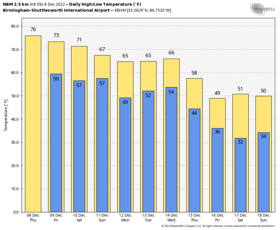
FOGGY START: A dense fog advisory is in effect for all 67 Alabama counties early this morning; the fog will dissipate slowly by mid to late morning, giving way to a partly sunny, warm afternoon with a high between 75 and 79 degrees for most communities. Today’s record high in Birmingham is 79, set in 1978, and the average high for Dec. 8 is 58. A few isolated showers are possible over north Alabama today, but nothing widespread.
FRIDAY THROUGH THE WEEKEND: Temperatures remain above average, with highs mostly in the 70s through Sunday. Expect a mix of sun and clouds daily with just a few scattered showers each day. Odds of any one spot getting wet each day are 20-30%.
NEXT WEEK: Don’t expect much change Monday and Tuesday — highs between 65 and 70 with only isolated showers. But to the west a severe thunderstorm threat will evolve from Texas and Oklahoma through parts of Arkansas, Louisiana and western Mississippi as a dynamic weather system rolls through. By the time it reaches Alabama Wednesday, it looks like the main dynamic support will pass well to the north and instability will be limited, and accordingly the Storm Prediction Center does not have any severe weather risk defined for now. Heavy rain could be the greater threat; rain amounts Wednesday into Thursday could exceed 2 inches in many places. Colder, drier air arrives by Thursday night and Friday.
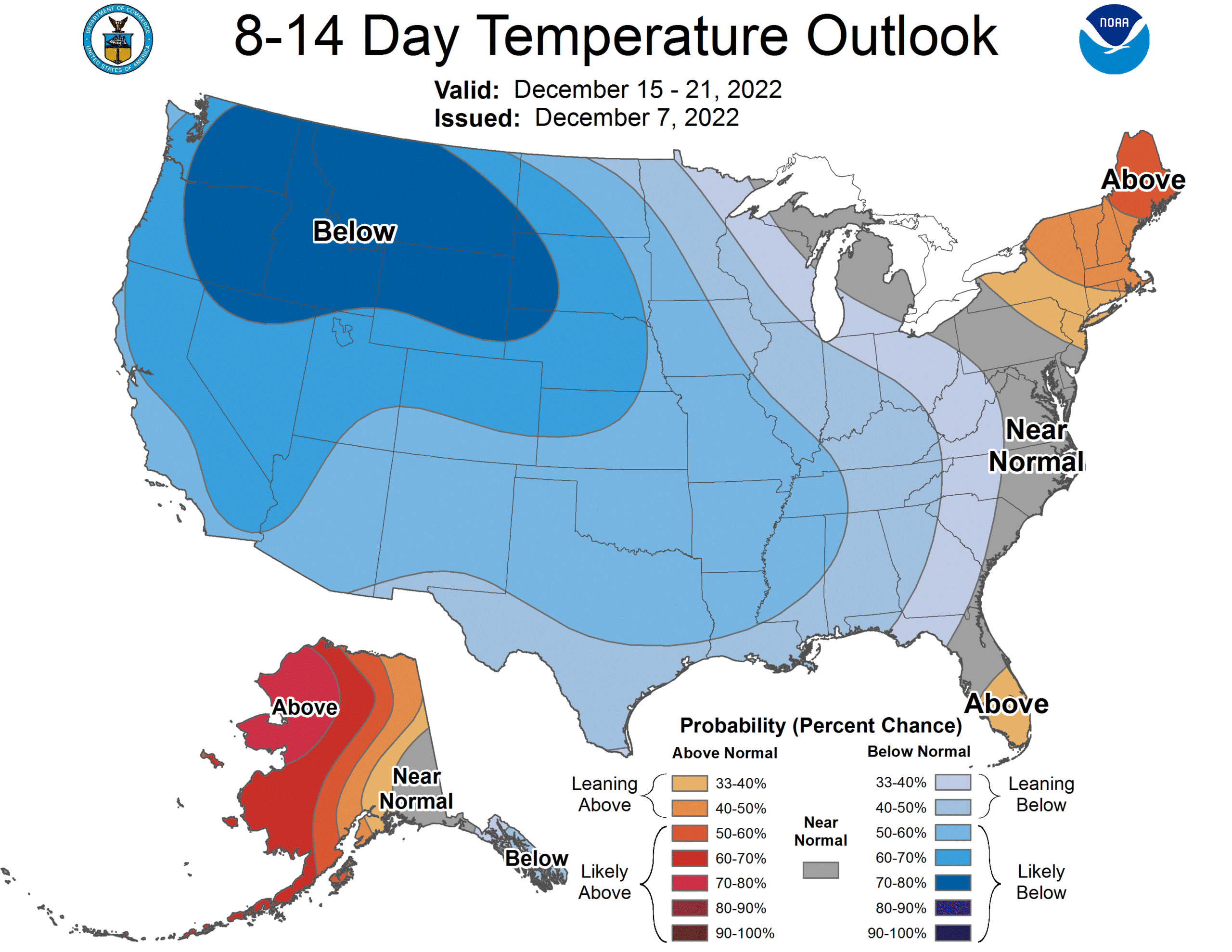
Global models continue to show signals for below-average temperatures across the Deep South (and much of the nation) as we approach Christmas.
 TROPICS: Showers and thunderstorms have increased since last evening near a large non-tropical area of low pressure over the central subtropical Atlantic, about 850 miles east-southeast of Bermuda. However, the system remains embedded within a frontal zone, which is expected to become more pronounced later today as the low begins to move east-northeastward at 20 to 25 mph toward colder waters and interact with a mid-latitude trough. Therefore, while the system could show some subtropical characteristics today, its chances to fully transition to a subtropical or tropical cyclone appear to be decreasing. Odds of this system getting a name have dropped to 30%, and it will remain far from land.
ON THIS DATE IN 2017: Significant snow fell across a large portion of central Alabama along a southwest-to-northeast axis. Within the main corridor of snow, totals of 4 to 8 inches were common, with a few swaths of 8 to 12 inches. A few reports exceeding 12 inches were received from Clay into Cleburne counties: one 15-inch report in Delta (Clay County), and two 13-inch reports (Cleburne County). While public reports are considered unofficial, values were fairly consistent and tend to indicate this event was a top-tier-ranking snowstorm for some locations in east Alabama. Birmingham officially recorded 4 inches of snow, making it the third-snowiest December on record.
BEACH FORECAST: Click here to see the AlabamaWx Beach Forecast Center page.
For more weather news and information from James Spann and his team, visit AlabamaWx.


