James Spann: Dry, mild Tuesday for Alabama; rain returns Wednesday night
James Spann forecasts more pleasant weather for Alabama from Alabama News Center on Vimeo.
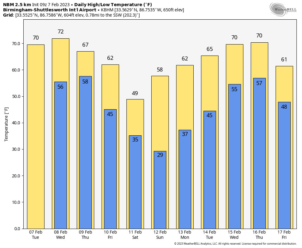
ANOTHER SPRING-LIKE AFTERNOON AHEAD: Temperatures are all over the board this morning due to variations in cloud cover and wind. We are seeing places in the 30s, 40s and 50s across Alabama just before sunrise, but everyone will enjoy a mild afternoon, with many communities reaching the 70-degree mark. The sky will be partly sunny, and dry weather continues tonight.
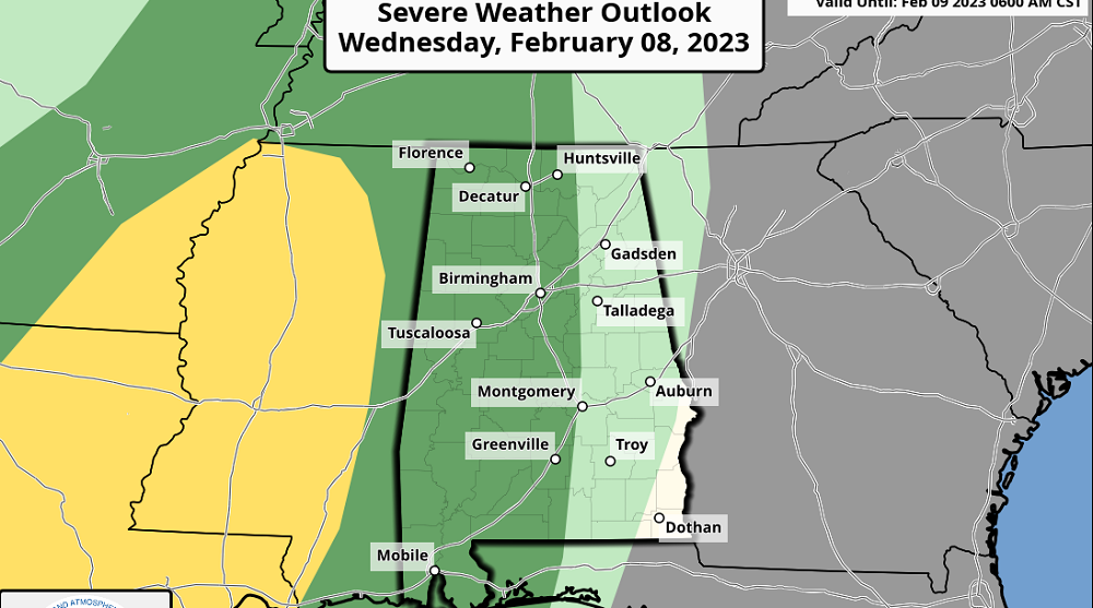
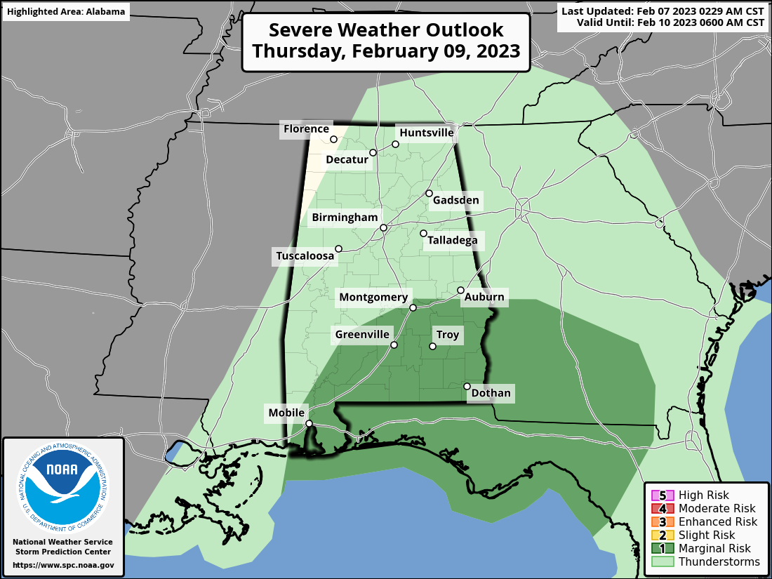
WEDNESDAY/THURSDAY: Clouds will increase Wednesday, and we can’t rule out a few widely scattered showers during the day. But the bulk of the rain and storms will arrive late Wednesday night, especially after midnight. The Storm Prediction Center maintains a low-end marginal risk (level 1 out of 5) of severe thunderstorms for the western half of the state in its outlook that is valid through 6 a.m. Thursday. After 6 a.m., much of southeast Alabama is in a marginal risk.
A line of strong thunderstorms will be near the Mississippi border Wednesday night around midnight; at that point they will be capable of producing strong, gusty winds, and an isolated tornado can’t be totally ruled out (but isn’t likely). The storms should weaken after midnight as they move into Alabama with no surface-based instability available.
During the day Thursday rain will slowly taper off for areas north and west of Birmingham, but wet weather will continue into the afternoon for the rest of the state. A few strong storms are possible Thursday afternoon across southeast Alabama, with gusty winds the main threat. Temperatures will likely hold in the 60s Thursday.
FRIDAY AND THE WEEKEND: Friday will feature a mix of sun and clouds with only a small risk of a shower during the day; highs will be mostly in the low to mid 60s. An upper trough will bring a chance of some light rain or drizzle to the state Friday night into Saturday morning, but precipitation will be very light. A few flurries are possible over the northern third of the state, but no accumulation or impact is expected. The sky becomes partly sunny Saturday afternoon with highs in the 40s and 50s. Sunday will feature sunshine in full supply with highs mostly in the 60s.
NEXT WEEK: Monday and Tuesday will be dry with a warming trend; then a batch of rain and possible thunderstorms will arrive Wednesday or Thursday. Temperatures will reach 70 degrees by midweek.
ON THIS DATE IN 1904: A small fire in the business district of Baltimore, Maryland, became wind-whipped into an uncontrollable conflagration that engulfed a large portion of the city by evening.
ON THIS DATE IN 2018: Six short-lived tornadoes touched down across central Alabama during the early morning. Fortunately, no injuries were reported.
BEACH FORECAST: Click here to see the AlabamaWx Beach Forecast Center page.
For more weather news and information from James Spann and his team, visit AlabamaWx.


