James Spann: Showers for Alabama this evening, strong to severe storms later this week
RADAR CHECK: We have a band of showers moving across the northern half of Alabama ahead of a surface boundary. The air is stable and the showers are generally light; they end tonight as drier air pushes into the state. It is very windy over the northern two-thirds of Alabama, with gusts to 30-35 mph in spots. The winds will diminish after dark.
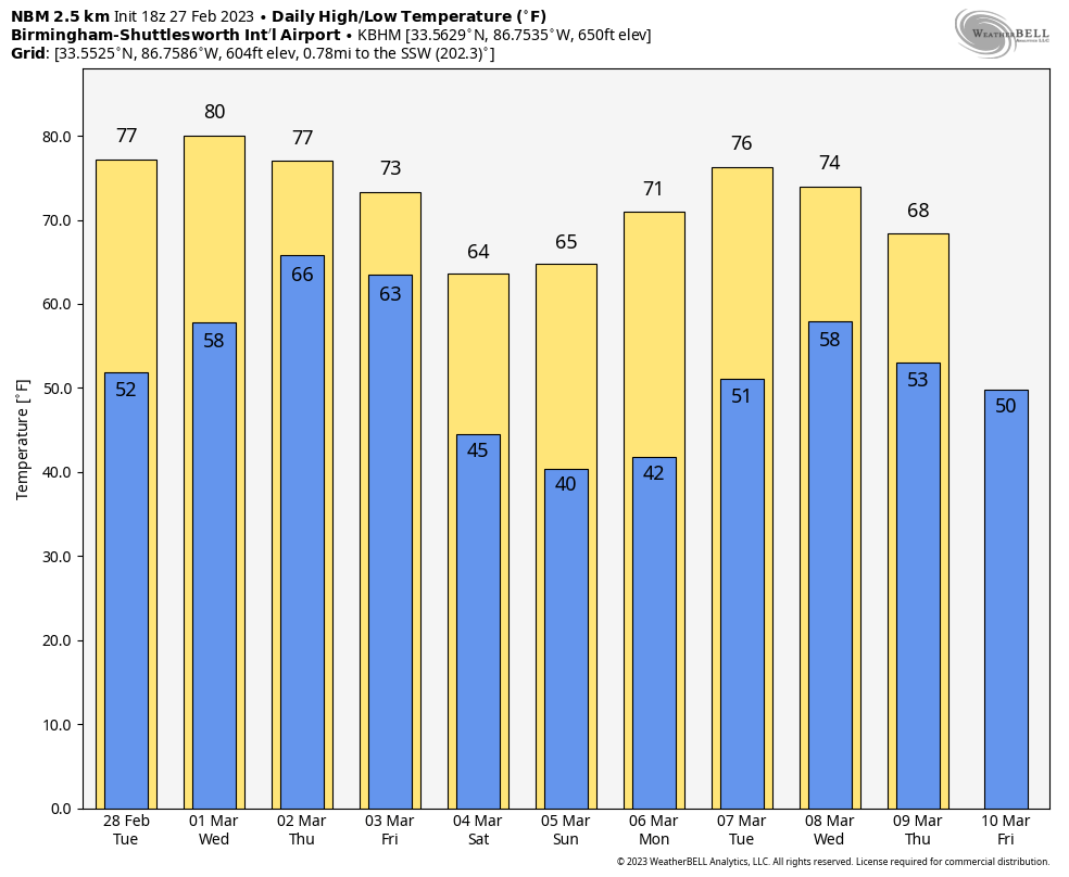
Tuesday will be the most pleasant day of the week. Expect a good supply of sunshine with highs well up in the 70s again.
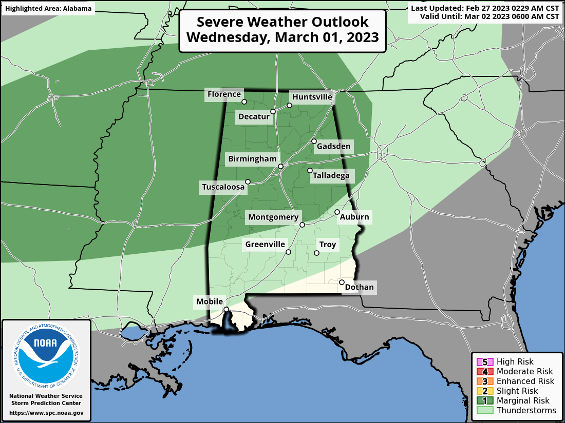
WEDNESDAY: The Storm Prediction Center has introduced a marginal risk (level 1 out of 5) of severe thunderstorms for the northern two-thirds of Alabama Wednesday. Scattered storms that form Wednesday afternoon and evening could produce small hail and strong, gusty winds. Otherwise, Wednesday will be warm with more clouds than sun; the high will be close to 80 degrees.
THURSDAY/FRIDAY: Thursday will be warm and breezy with developing showers and a high between 77 and 81 degrees. A more meaningful severe weather threat unfolds late Thursday night into Friday as a dynamic weather system will race through the state. The SPC has much of the state covered in a severe weather risk during the time frame.
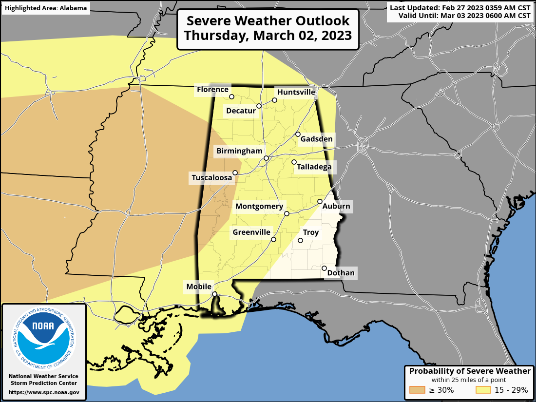
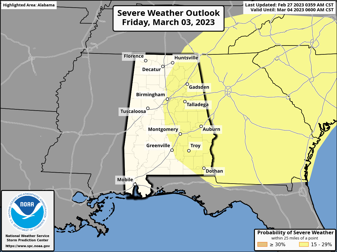
For now, it looks like the main window for severe storms will come from about midnight Thursday night until noon Friday, and the main threat will come from damaging straight-line winds. But a tornado or two can’t be ruled out based on the forecast wind profiles.
This will be similar to the system that moved through Oklahoma Sunday night — very strong dynamics (wind fields), but somewhat marginal thermodynamics (instability). We will be much more specific about the magnitude of the threat once we get within 60 hours of the event and can see high-resolution models.
THE ALABAMA WEEKEND: The weekend will be dry with sunny days and clear, cold nights. Lows drop into the 30s and 40s over the northern half of the state. Highs will be mostly in the 60s, with 70s close to the coast.
NEXT WEEK: The first half of the week looks dry and mild, with highs in the 70s; showers and storms will likely return by Thursday or Friday.
LATER IN MARCH: Winter isn’t over. From NOAA’s Climate Prediction Center: “There is higher than normal confidence in a pattern change by mid-March that will bring below-average temperatures into the eastern and southern U.S. This is a result of 1) robust circulation patterns in both the Tropics and the Arctic and 2) an ongoing sudden stratospheric warming event that can lead to cold air outbreaks. However, given the current forecast lead time, the eventual weather and potential impacts during this period remain uncertain at this time.”
ON THIS DATE IN 1999: At least six tornadoes touched down in Alabama, including an EF-2 that moved through Blount County at Locust Fork. Two or three large barns were demolished, a sturdy brick home lost a portion of its roof, and a small wood-frame house was completely deroofed. One minor injury occurred in the wood-frame house.
ON THIS DATE IN 2010: A magnitude 8.8 earthquake occurred off the coast of central Chile at 3:34 local time. The quake triggered a tsunami that devastated several coastal towns in south-central Chile. Tsunami warnings were issued in 53 countries. Waves caused minor damage in the San Diego area and the Tohoku region of Japan.
BEACH FORECAST: Click here to see the AlabamaWx Beach Forecast Center page.
For more weather news and information from James Spann and his team, visit AlabamaWx.


