James Spann: Cooler air, showers return to Alabama Wednesday
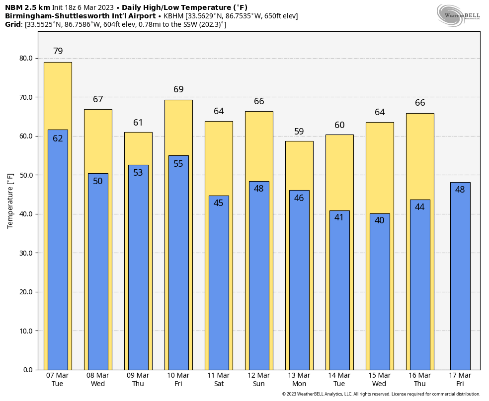
WARM MARCH DAY: Temperatures are hovering around 80 degrees across much of Alabama this afternoon with a partly to mostly sunny sky. Tonight will be mostly fair with a low between 55 and 65.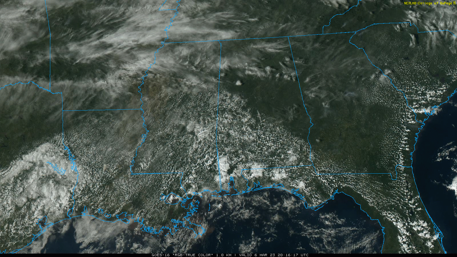 Most of Alabama will stay dry Tuesday, but we will bring in a chance of isolated showers over the southern two-thirds of the state by afternoon as moisture levels begin to rise. The high will be in the upper 70s in most places.
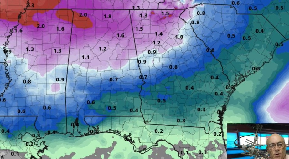
WEDNESDAY/THURSDAY/FRIDAY: Clouds will increase Wednesday as noticeably cooler air drops into the northern half of Alabama, and we will mention periods of rain beginning Wednesday afternoon, continuing Thursday and into at least the first half of the day Friday. Temperatures will hold in the 50s over the northern third of the state on these three days, with 60s to the south. We’re not expecting much thunder with the rain, and there is no risk of severe storms.
THE ALABAMA WEEKEND: We will continue to forecast a cool, dry Saturday, with a high in the 50s and 60s. Clouds increase Sunday, and rain is likely by Sunday afternoon and night. Models remain in poor agreement concerning the surface and upper-air features, and it remains to be seen whether strong storms will be an issue. We will have much higher confidence in the weekend situation by midweek.
NEXT WEEK: Much of the week looks dry with below-average temperatures. The latest global models suggest temperatures could reach the 30s over north Alabama by midweek. There’s no sign of a major freeze at this point, but we still expect several more mornings with freezing temperatures between now and mid-April.
ON THIS DATE IN 1962: The strongest nor’easter of the century struck the Mid-Atlantic region on March 5-9. Known as the “Ash Wednesday Storm,” it caused more than $200 million (1962 dollars) in property damage and significant coastal erosion from North Carolina to Long Island, New York. It was estimated to have destroyed or significantly damaged 45,000 homes in New Jersey alone. The Red Cross recorded that the storm killed 40 people. It hit during “Spring Tide.” When the sun and moon are in phase, they produce a higher-than-average astronomical tide. Water reached 9 feet at Norfolk (flooding begins around 5 feet). Houses were toppled into the ocean, and boardwalks were broken and twisted. The islands of Chincoteague and Assateague, Maryland, were completely underwater.
ON THIS DATE IN 1996: Six tornadoes touched down across Alabama before dawn, killing six people. An F3 moved through Selma, where four people were killed at a mobile home park on the northwest side of town. An F2 tore through southern Montgomery, with two fatalities there. It also brought down the WCOV-TV tower.
ON THIS DATE IN 2014: The Great Lakes saw some of their worst ice covers in nearly four decades because of a frigid winter with months of below-freezing temperatures in large sections of the northern United States, the National Ocean and Atmospheric Administration said. As of March 6, 2014, the federal agency said that 92.2% of the five lakes were under ice, breaking a record set in 1973 but still short of the 94.7% established in 1979.
BEACH FORECAST: Click here to see the AlabamaWx Beach Forecast Center page.
For more weather news and information from James Spann and his team, visit AlabamaWx.


