James Spann: Alabama stays dry through Thursday; storms return Friday night
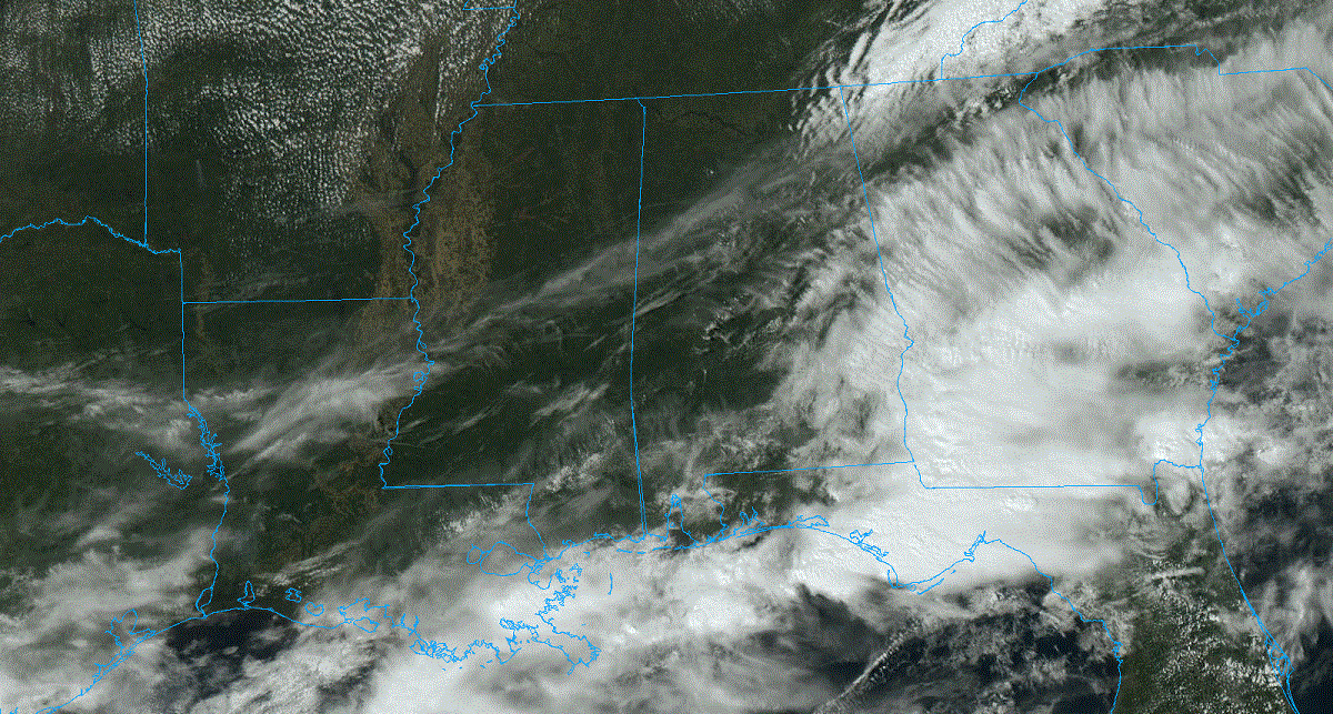
PLEASANT DAY: Most of Alabama is rain-free at midafternoon; the batch of rain and storms that was over the southern counties earlier in the day has moved into Georgia. Temperatures are between 65 and 75 degrees, and tonight will be mostly fair and colder, with a low between 36 and 44 degrees. Colder spots across north Alabama could dip into the mid 30s with a touch of light frost possible.
Wednesday and Thursday will feature a good supply of sunshine statewide with highs in the 60s and 70s. Colder spots will visit the 30s again early Thursday morning with some scattered light frost possible.
FRIDAY AND THE WEEKEND: The day Friday will be dry and mild, with a high in the 70s. A band of showers and thunderstorms will push into the state Friday night into Saturday morning ahead of a cold front; the Storm Prediction Center has defined a risk of severe thunderstorms for areas north and west of Birmingham in its outlook that runs through 7 a.m. Saturday.

Models are trending toward better dynamic support for strong thunderstorms. The air will be unstable, and severe storms certainly could become an issue. For now, it looks like the main window for strong to severe storms will come from 9 p.m. Friday through 7 a.m. Saturday, and all modes of severe weather will be possible including hail, strong straight-line winds and a few tornadoes.
By Saturday afternoon, the best chance of showers and storms will shift into the southern half of the state. Sunday looks dry with a partly to mostly sunny sky. Highs Saturday will be in the 70s, and on Sunday north Alabama will hold in the 60s as cooler air drops in.
NEXT WEEK: Moisture returns Monday with some risk of showers and storms, and the first half of the week looks generally unsettled, with multiple rounds of rain and thunderstorms likely through Wednesday. It’s too early to know the severe weather risk, but the first week of April usually brings some very active weather to the Deep South. Drier air will likely return by Thursday and Friday; highs will be in the 70s and 80s.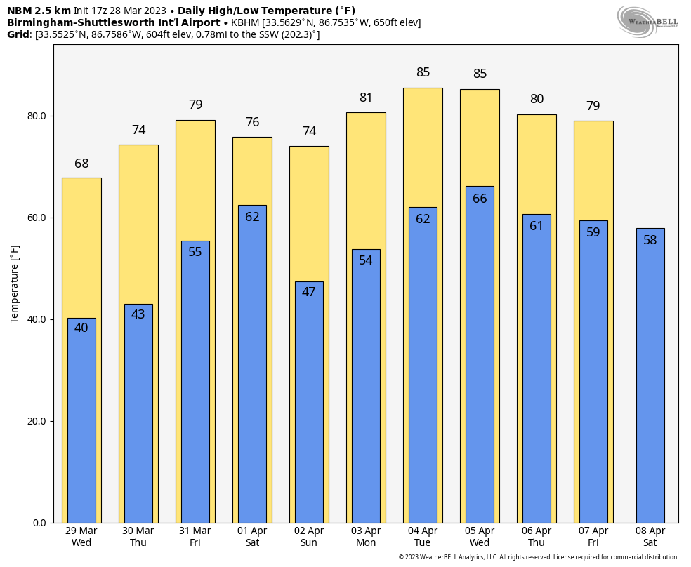 ON THIS DATE IN 1920: A long-track tornado moved from near Deatsville to West Point, Georgia, killing 17 people. Some of the greatest destruction was in Tallapoosa County in the vicinity of Susanna, Agricola and the Red Ridge settlement. This tornado was part of an outbreak that saw 38 tornadoes hit the Midwest and the Deep South states. More than 380 people died and at least 1,215 were injured during the Palm Sunday outbreak.
ON THIS DATE IN 1963: A decision was handed down in the case of Whitney Bartie vs. the United States of America. Bartie sued the U.S. Weather Bureau for negligence in failing to provide a warning about Hurricane Audrey in 1957. Bartie’s wife and five children were killed after the 12-foot storm surge struck Cameron Parish, Louisiana, on the morning of June 27, 1957. It was ruled that the evidence presented did not establish negligence on the part of the Weather Bureau.
BEACH FORECAST: Click here to see the AlabamaWx Beach Forecast Center page.
For more weather news and information from James Spann and his team, visit AlabamaWx.


