James Spann: Drier days ahead for Alabama
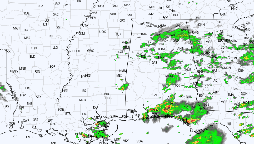
RADAR CHECK: Large areas of light rain persist this afternoon across parts of Alabama; the rain is most widespread over the eastern half of the state at midafternoon. Temperatures are only in the 65- to 72-degree range where rain is falling, almost 20 degrees below average for this time of the year. But Mobile has a mostly sunny sky and is in the mid 80s. Rain will continue to diminish tonight as the upper low drifts eastward.
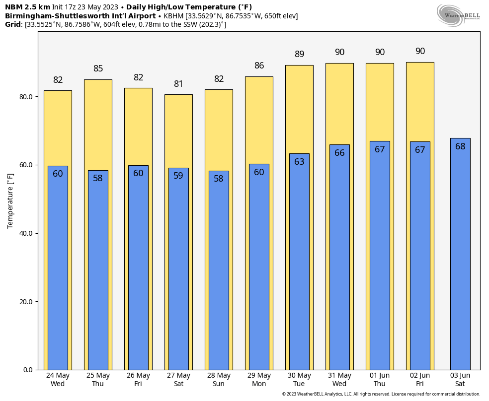
REST OF THE WEEK: Dry air returns to Alabama Wednesday, and the weather will be generally rain-free for most of the state through Friday, with just a few isolated showers. Expect mostly sunny days, fair nights and highs in the low to mid 80s.
MEMORIAL DAY WEEKEND: A quiet weather pattern will continue into the holiday weekend. We will maintain the chance of a few isolated showers Saturday through Monday, but the chance of any one spot getting wet each day is 15-25%. Otherwise, we are forecasting a good supply of sunshine daily with highs holding in the low to mid 80s.
REST OF NEXT WEEK: Look for only isolated showers daily with rising heat levels. Highs will be close to 90 by midweek.
 TROPICS: The Atlantic basin is quiet, and tropical storm formation is not expected for the next seven days. The season officially begins June 1.
However, in the Pacific, extremely dangerous Super Typhoon Mawar is now packing sustained winds of 155 mph and is only about 80 miles southeast of Guam. The typhoon will likely move over the island in 12-18 hours with potential for major, widespread damage from storm surge and wind.
ON THIS DATE IN 1968: One of the costliest hailstorms in Oklahoma City history pummeled the city. Hail the size of baseballs fell over much of the city, resulting in more than 40,000 insurance claims over the 90,000-square-mile path of the storm. The final cost was more than $20 million.
For more weather news and information from James Spann and his team, visit AlabamaWx.


