James Spann: Showers remain scarce across Alabama through the weekend
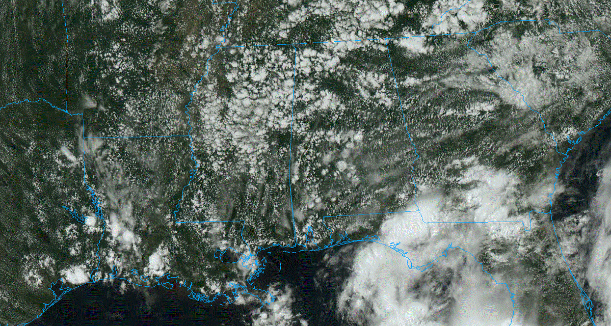
RADAR CHECK: We have a few small, isolated showers across Alabama this afternoon moving northwest; these won’t last long and will all dissipate after sunset. Otherwise, we have a partly sunny sky with temperatures mostly in the 80s. Tonight will be fair with a low in the 60s.
For the rest of the week, heat and humidity levels continue to slowly rise with just a few isolated afternoon showers; most places will be dry. Highs will be in the upper 80s for most places.
THE ALABAMA WEEKEND: Expect only isolated afternoon showers; otherwise, look for partly sunny days and fair nights with highs close to 90 degrees. The chance of any one place getting wet both days is 10-20%.
NEXT WEEK: We don’t see much reason for any major change in the weather. There’s no sign of any high-impact, widespread rain event, only isolated showers daily with highs between 87 and 91 degrees most days — pretty typical weather for early June in Alabama.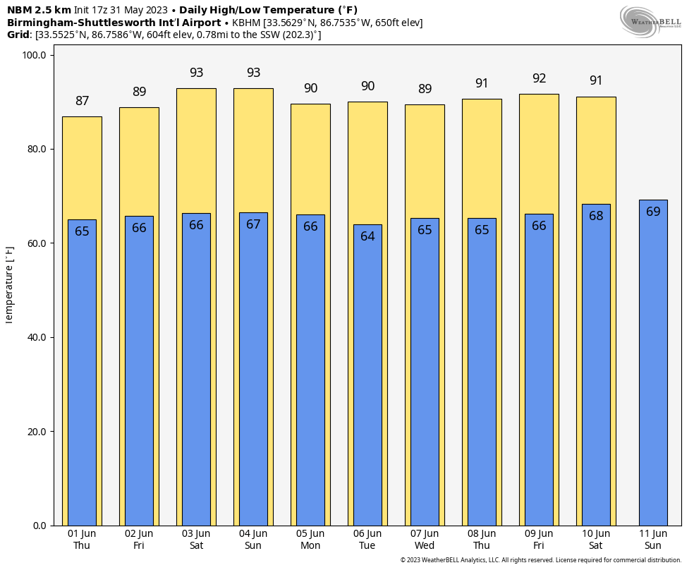
TROPICS: An area of low pressure has formed over the northeastern Gulf of Mexico in association with disorganized showers and thunderstorms displaced to its northeast. Environmental conditions appear marginally favorable for some slow development over the next day or two as the system meanders over the northeastern Gulf of Mexico. However, by this weekend, environmental conditions are forecast to become unfavorable for additional development as the system drifts southeastward toward the Florida Peninsula. Regardless of development, the system could produce heavy rainfall and gusty winds over portions of the Florida Peninsula through this weekend.
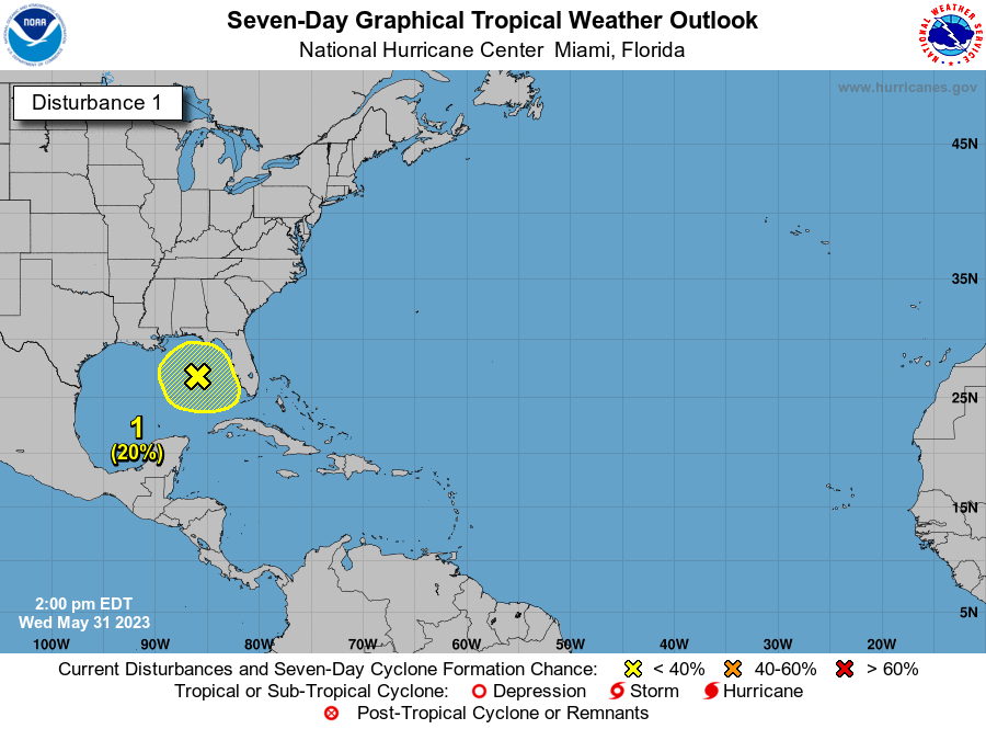
The National Hurricane Center gives it only a 20% chance of development through early next week, and any impact to the Central Gulf Coast (Gulf Shores to Panama City Beach) will be minimal. The rest of the Atlantic basin is quiet.
ON THIS DATE IN 1889: The Johnstown, Pennsylvania, disaster occurred, the worst flood tragedy in U.S. history. Heavy rains collapsed the South Fork Dam, sending a 30-foot wall of water rushing down the already flooded Conemaugh Valley. Traveling as fast as 22 feet per second, it swept away all structures, objects and people. The flood killed around 2,100 people.
ON THIS DATE IN 2013: An intense, long-track tornado formed southwest of El Reno, Oklahoma. This exceptionally wide tornado took a complex path, rapidly changing in both speed and direction. Radar data showed winds of at least 295 mph very close to the surface. The maximum tornado width was 2.6 miles.
Eight people were killed, all in vehicles. This included three severe storm researchers who were killed east of U.S. Highway 81 as the tornado overtook their position.
For more weather news and information from James Spann and his team, visit AlabamaWx.


