Scott Martin: Rain, storms dampen the first day of summer; Bret no threat to US
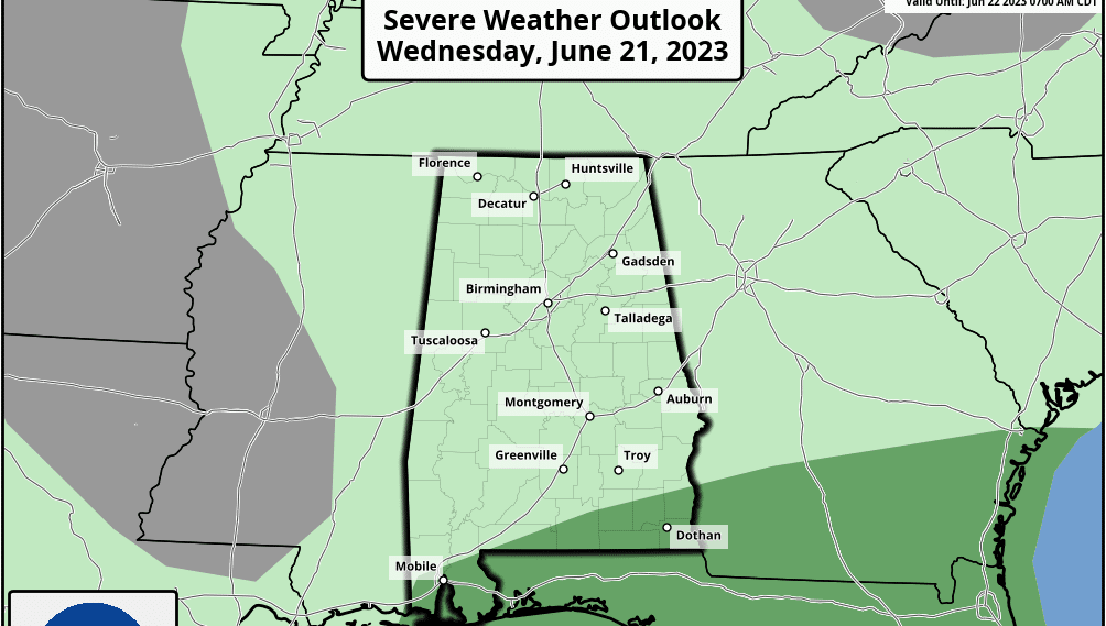
REST OF THE WORK WEEK: An upper-level low continues to hang out over the Southeast today, keeping scattered to numerous showers and storms likely. Rain chances will be highest during the afternoon and evening. While a strong storm may be possible, severe weather is not likely. Highs will be in the upper 70s to the mid 80s.
While the low begins to lose a little of its strength, it remains nearly stationary on Thursday. That will keep elevated chances of scattered showers and thunderstorms in the forecast. Highs will be in the mid 70s to the mid 80s.
The low moves out on Friday, and we finally start to see a good bit of dry weather for a change. There is a small chance of an isolated shower or storm, but much of the state will be dry. Highs will be in the 80s.
THE WEEKEND: Saturday looks to be the best day of the forecast period as it will feature plenty of sunshine, but the heat begins its return as highs top out in the upper 80s to the lower 90s.
A small chance of scattered afternoon showers and storms returns Sunday, but much of the day will be sunny. Highs will be in the upper 80s to the lower 90s.
NEXT WEEK: A familiar weather pattern returns Monday, which brings a northwesterly flow into the state. This will increase rain chances as a few waves move through. We’ll have scattered showers and storms, with highs in the upper 80s to the lower 90s.
On Tuesday, that flow looks to push most of the moisture to our south, reducing our rain chances. However, a few scattered showers and storms will remain possible. Highs will be in the upper 80s to the lower 90s.
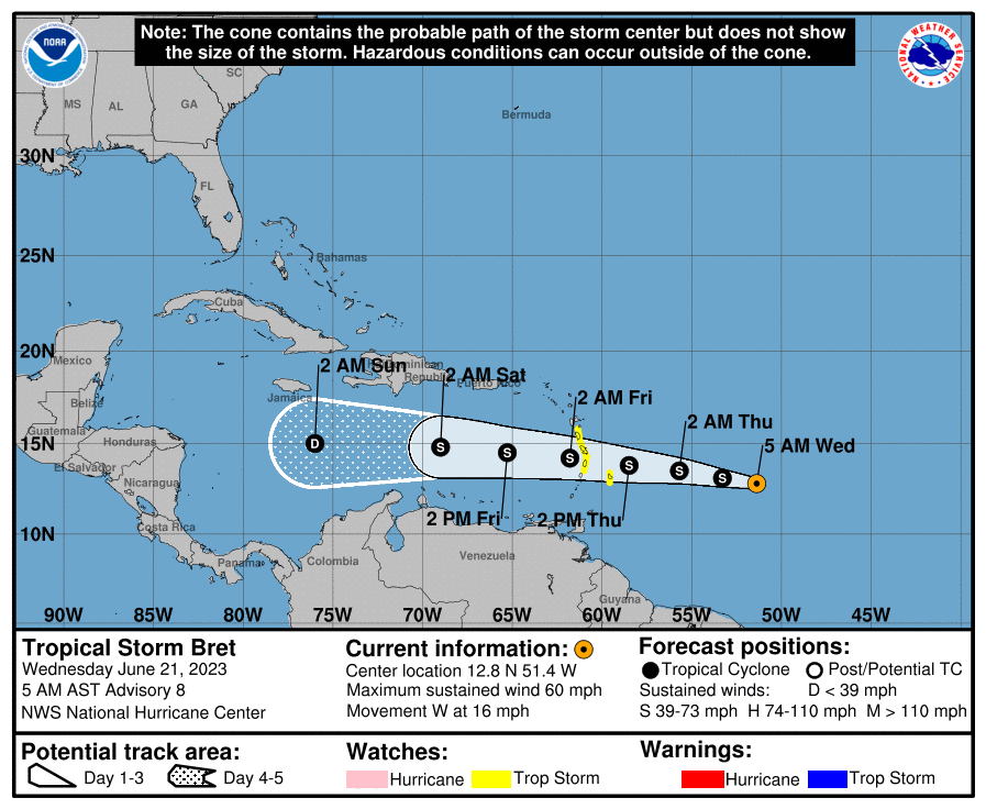
TROPICS: We have Tropical Storm Bret over the tropical Atlantic Ocean with maximum sustained winds at 60 mph and a minimum central pressure of 1,001 millibars. It may strengthen a little more today before moving into an atmosphere with higher wind shear that will cause Bret to weaken. The National Hurricane Center is forecasting Bret to dissipate by Monday. Unless major changes occur, this will not be a threat to the U.S. mainland.
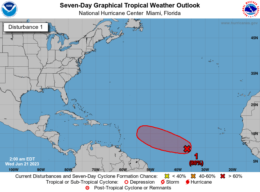
Another tropical depression could form in a few days just behind Bret. Invest 93L has a 70% chance of developing into a depression or storm within the next two days and 80% within the next seven days as it follows in Bret’s wake. For now, the models have this one curving more to the northeast and out into the open Atlantic Ocean, but we’ll keep an eye on it for any changes.
BEACH FORECAST CENTER: Get the latest weather and rip current forecasts for the beaches from Dauphin Island to Panama City Beach, Florida, on our Beach Forecast Center page. There, you can select the forecast of the region you are interested in.
ON THIS DATE IN 1886: A destructive hurricane hit the Apalachicola-Tallahassee area of Florida on the summer solstice. Extensive damage was done in Florida and throughout the Southeast by this storm. Damage was due mainly to extremely high tides.
For more weather news and information from James Spann, Scott Martin and other members of the James Spann team, visit AlabamaWx.


