James Spann: Alabama storms thin out Sunday, next week
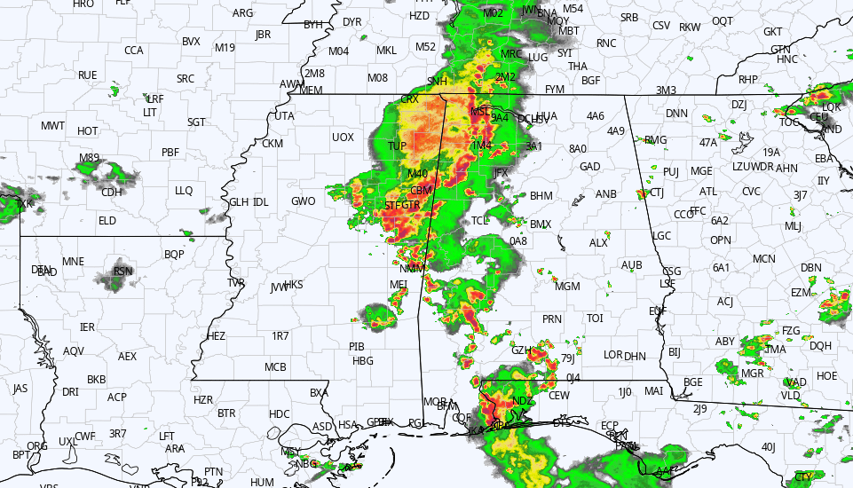
RADAR CHECK: Showers and thunderstorms are most active over the western half of Alabama this afternoon. Some spots are seeing heavy rain and gusty winds, but all storms are below severe limits as of 3 p.m. The storms will continue to work eastward through the evening and fade late tonight. Away from the storms, temperatures are between 88 and 93 degrees in most places this afternoon, near or slightly below average for mid-July.
The weather won’t change much Saturday. It will be partly sunny, hot and humid, with scattered storms mainly from noon to midnight. The high will be close to 90 for most communities. On Sunday, storms become fewer as the upper ridge begins to strengthen and the air becomes more stable; the high will be in the low to mid 90s.
NEXT WEEK: The upper ridge will continue to grow stronger and, accordingly, heat levels will rise and coverage of scattered storms will be low through much of the week. Highs will be in the mid to upper 90s, with lows in the 70s. Heat advisories will be needed through the week with heat index values exceeding 100 degrees daily. Afternoon storms are possible, but they should be widely spaced most days.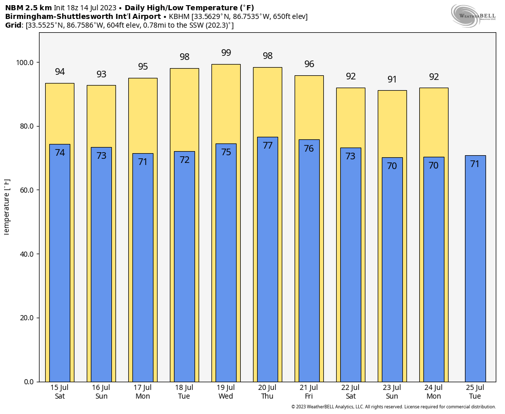
TROPICS: Subtropical Storm Don is in the middle of the Atlantic with winds of 45 mph. Don is a junk system that will remain far from land, and the rest of the Atlantic basin, including the Gulf of Mexico, remains very quiet.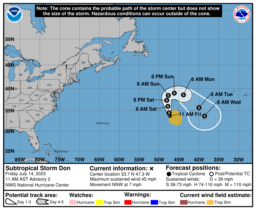 ON THIS DATE IN 1995: Thunderstorms producing severe weather occurred over upper Michigan and adjacent portions of Ontario near Sault Saint Marie. By late evening the storms had evolved into a bowing line just northwest of the Mackinac Bridge. At 10:17 p.m. EDT, the thunderstorm gust front hit the bridge and a gust to 90 mph was measured. Sustained winds of 80 mph continued on the bridge for 10 more minutes. Thus began the intense “Ontario-Adirondacks Derecho” that would cause hundreds of millions of dollars’ damage, several deaths and many injuries as it raced southeast from the northern Great Lakes to the Atlantic coast.
ON THIS DATE IN 2006: Tropical Storm Bilis tracked across northern Taiwan before making landfall in southeastern China’s Fujian province with maximum sustained winds near 65 mph. The storm caused at least 575 deaths in Fujian, Guangdong and Hunan provinces and direct economic losses near $3.3 billion.
For more weather news and information from James Spann and his team, visit AlabamaWx.


