James Spann: Strong storms for north Alabama this evening
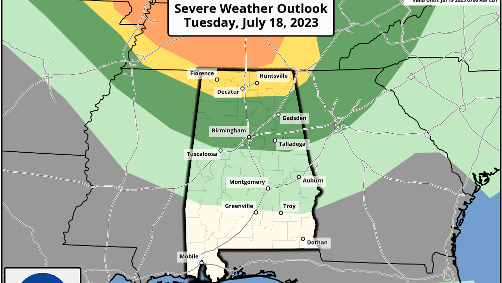
HOT SUMMER DAY: The sky is partly to mostly sunny across Alabama this afternoon with temperatures generally in the low to mid 90s. To the north, we are watching an organized batch of severe thunderstorms over Tennessee. These will move into Alabama this evening, and the Storm Prediction Center has defined a slight risk (level 2 out of 5) of severe storms for the Tennessee Valley of north Alabama, with a marginal risk (level 1) as far south as Tuscaloosa, Pelham and Wedowee.
The main concern with the storms over north Alabama early tonight is strong straight-line winds. The storms could make it as far south as I-20, but they will be weakening by then. Most of the storms will come from 6 until 10 p.m.
REST OF THE WEEK: Some high-res models suggest potential for another batch of showers or storms Wednesday morning across the northeast counties of Alabama, but otherwise the weather will be generally hot and dry Wednesday and Thursday, with highs in the mid to upper 90s. The day Friday looks generally dry with temperatures in the 90s again by afternoon, but an approaching surface boundary will bring showers and storms into the state late in the day and into Friday night.
THE ALABAMA WEEKEND: Models are a bit slower with the progression of the front, and showers and storms remain possible Saturday over the southern two-thirds of the state. Then, on Sunday, unusually dry air for summer will cover much of Alabama with a mostly sunny sky and lower humidity. Heat levels will come down, with highs between 85 and 90 degrees for the northern counties; low 90s are likely to the south. Any storms on Sunday should be confined to areas near the coast, and even there they should be pretty widely spaced.
NEXT WEEK: For now, the week looks fairly quiet, with mostly sunny days and only isolated afternoon showers or storms. Highs will be between 91 and 95 degrees, which is pretty much what we expect in late July in Alabama.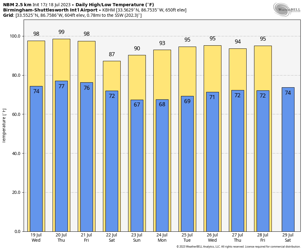
TROPICS: Tropical Storm Don is in the middle of the Atlantic, far from land, with winds of only 40 mph. It will loop around in the same area for the next five to seven days and is no threat to land. The rest of the Atlantic basin, including the Gulf of Mexico, is very quiet.
Over in the Pacific, Tropical Storm Calvin is forecast to move over the Big Island of Hawaii late tonight; it a weak system with winds of 45 mph but will bring the threat of heavy rain.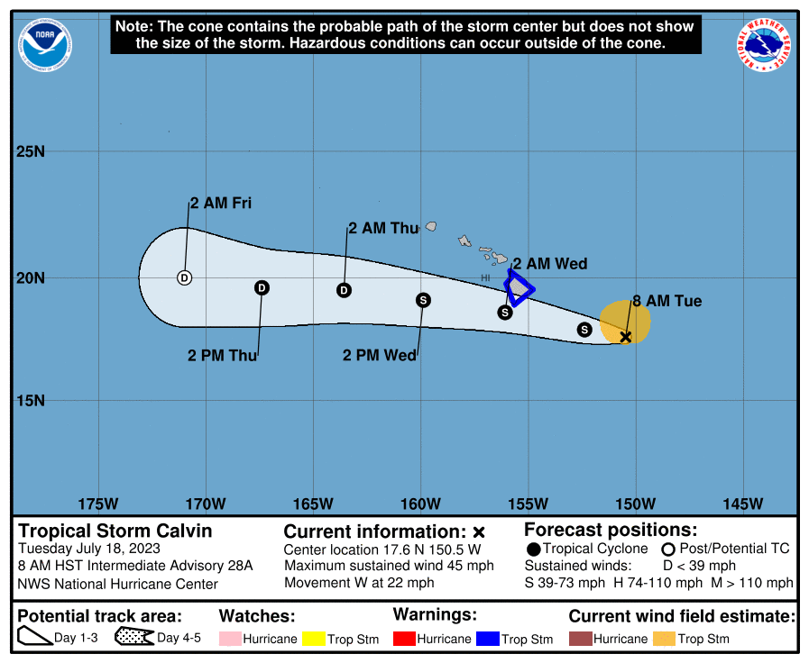 ON THIS DATE IN 1996: A massive rainstorm in north central and northeast Illinois led to widespread flooding. Aurora reported 16.94 inches, establishing a state record for the most rain in a single day. Other heavy totals included 13.6 inches at Joliet, 9.24 inches in Wheaton, 8.09 inches in DeKalb and 7.82 inches at Elgin. This event is often called the second-most-damaging weather disaster in Illinois history.
ON THIS DATE IN 1997: Hurricane Danny was looming over the Gulf just south of the Mississippi coast after first making landfall in Louisiana. Due to weak steering currents, Danny moved very slowly as it approached the Alabama coast from the southwest.
For more weather news and information from James Spann and his team, visit AlabamaWx.


