James Spann: Strong storms for far north Alabama this evening
RADAR CHECK: Strong to severe thunderstorms are just north of Alabama, in southern Middle Tennessee at mid-afternoon. Over the next few hours some of these will likely creep into the Tennessee Valley, where a severe thunderstorm watch is in effect until 9 p.m.
The main threat with the storms this evening will come from strong winds. The rest of Alabama is hot and dry with temperatures in the low to mid 90s.
Most of the state will be dry during the day Friday, but a band of thunderstorms will likely push into the state late Friday afternoon and Friday night ahead of a surface front. Those could be severe with potential for strong winds; the Storm Prediction Center has defined a slight risk (level 2 of 5) for about the northern half of the state, with a marginal risk (level 1) as far south as Butler, Chapman and Dothan.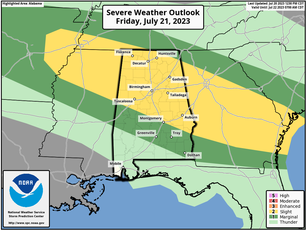 THE ALABAMA WEEKEND: The surface front will continue to sag southward Saturday, and the best chance of showers and storms will be over the southern two-thirds of the state. This won’t be an all-day kind of rain, but a passing shower or storm is a fairly decent possibility, mainly south of I-20. Heat levels drop considerably; the high will be in the 80s over the northern half of the state, with low 90s for the southern counties.
Dry air will cover the northern half of Alabama Sunday with lower humidity levels. Early-morning lows will drop well down into the 60s over the northern counties, with potential for upper 50s in a few cooler spots for a brief preview of fall. A few scattered storms will remain possible over south Alabama, but even there it certainly won’t rain all day. The high will be close to 90.
NEXT WEEK: For now, the week looks quiet with seasonal temperatures. Afternoon storms will be isolated, and highs will be in the low to mid 90s.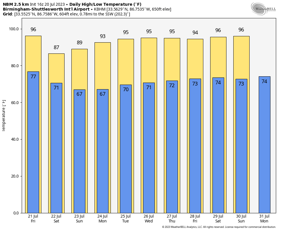 TROPICS: Tropical Storm Don, with winds of 50 mph, remains far from land in the Atlantic. It will become post-tropical in four to five days over the North Atlantic.
Elsewhere, a tropical wave a few hundred miles southwest of the Cabo Verde Islands is interacting with the Intertropical Convergence Zone. The combination of these features is producing an elongated area of showers and thunderstorms over the eastern and central tropical Atlantic. While dry air to the north may prevent significant organization during the next day or two, environmental conditions could become more conducive for some development later this weekend as the system moves westward across the central tropical Atlantic.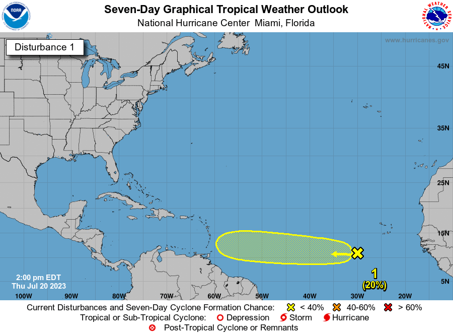 There are no tropical systems near the U.S. or the Gulf of Mexico.
ON THIS DATE IN 1977: A flash flood hit Johnstown, Pennsylvania, killing 84 people and causing millions of dollars in damages. This flood came 88 years after the infamous Great Flood of 1889 that killed more than 2,000 people in Johnstown.
ON THIS DATE IN 2005: Hurricane Emily made landfall in northern Mexico. When its sustained winds reached 160 mph on July 16, Emily became the strongest hurricane ever to form before August, breaking a record set by Hurricane Dennis just six days before. It was also the earliest Category 5 hurricane ever recorded in the Atlantic basin, beating Hurricane Allen’s old record by nearly three weeks.
For more weather news and information from James Spann and his team, visit AlabamaWx.


