James Spann: Dry days ahead for Alabama; heat levels rise by the weekend
James Spann forecasts an unusually pleasant day for August in Alabama from Alabama News Center on Vimeo.
REFRESHING MORNING: Here are some temperatures across the northern half of Alabama just before sunrise:
- Oneonta — 58
- Fort Payne — 60
- Chelsea — 62
- Gadsden — 63
- Jasper — 63
- Hueytown — 63
- Bessemer — 63
- Pell City — 64
- Anniston — 64
- Cullman — 64
- Decatur — 64
- Jemison — 64
- Birmingham — 67
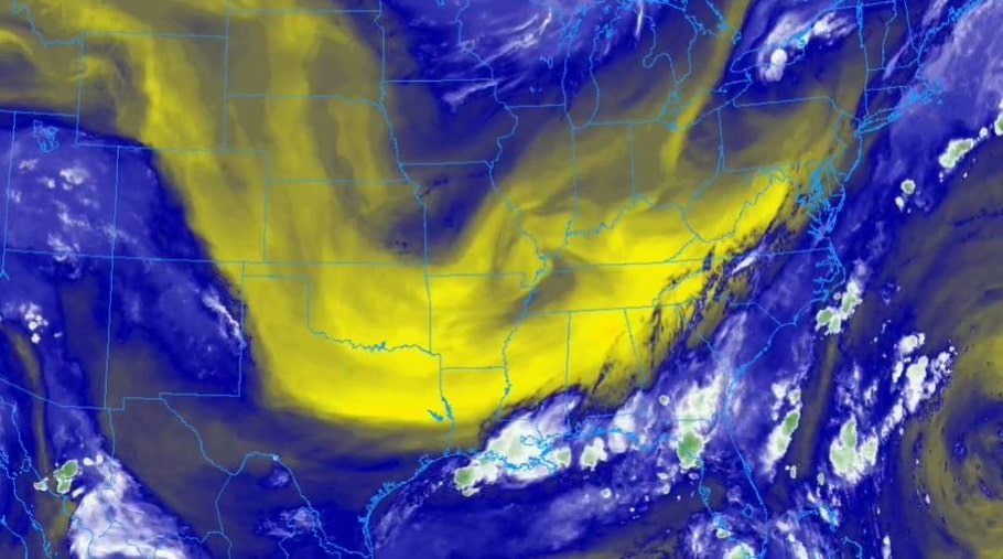
A dry, continental air mass has dropped in here, and that will set up an amazingly pleasant day for mid-August — sunny, with lower humidity and highs only in the 80s over the northern half of the state. South Alabama will see low 90s this afternoon.
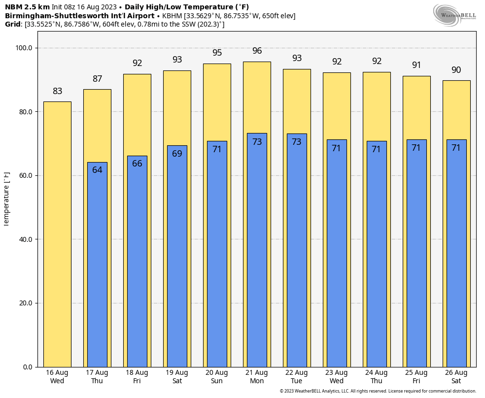
THURSDAY THROUGH THE WEEKEND: We drop into the 60s again early Thursday morning, followed by a high between 87 and 92 degrees with a sunny sky. The weather will be dry for most of the state Friday through the weekend with rising heat levels; highs will be in the mid 90s with mostly sunny days and fair nights. A few isolated storms could show up Saturday and Sunday over the southern quarter of Alabama, but even there most places will stay dry.
NEXT WEEK: Quiet weather continues with mostly sunny days; afternoon storms will be very hard to find. Highs will be generally in the 90s.
 TROPICS: A broad area of low pressure could form in the central or western Gulf of Mexico by the beginning of next week. Some slow development of this system is possible thereafter as it moves westward and approaches the western Gulf of Mexico coastline by the middle of next week. For now, the National Hurricane Center (NHC) gives this feature only a 20% chance of development; if anything by chance gets organized here it will be well to the south of Alabama. Hopefully this will bring some rain to parched cities like Houston at some point next week.
The NHC is also monitoring two tropical waves in the central and eastern Atlantic. The lead wave has a 40% chance of development over the next seven days; the one just coming off the coast of Africa has a 20% chance. These are not close to the U.S.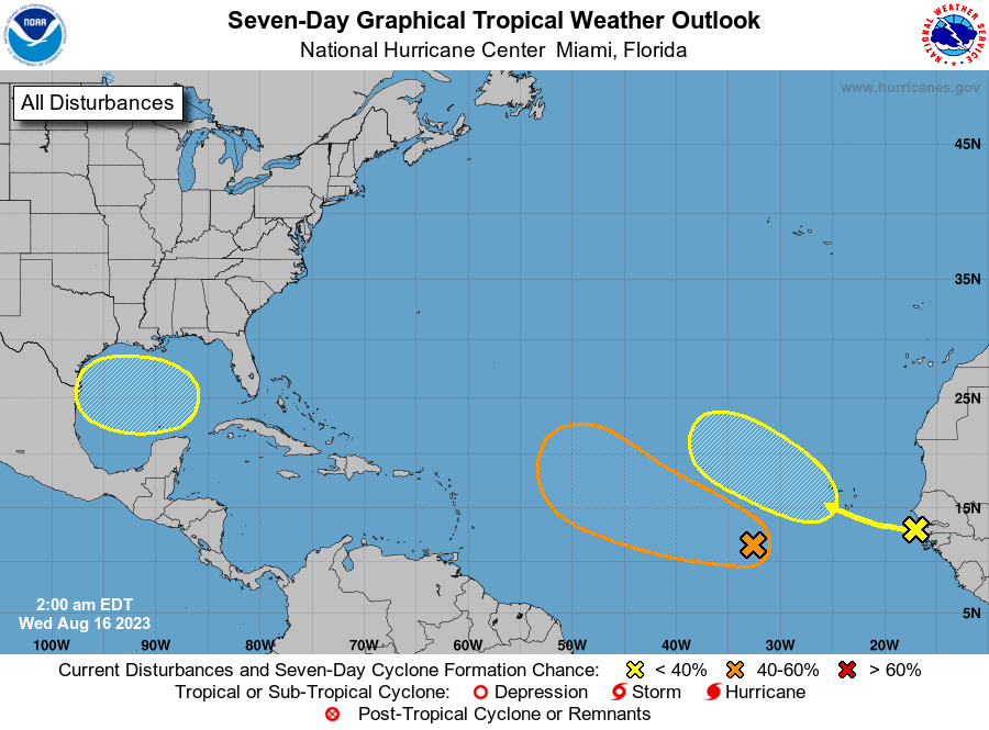 ON THIS DATE IN 1992: One of the most destructive United States hurricanes of record started modestly as a tropical wave that emerged from the west coast of Africa on Aug. 14. The wave spawned a tropical depression on Aug. 16, which became Tropical Storm Andrew the next day.
For more weather news and information from James Spann and his team, visit AlabamaWx.


