James Spann: Showers few, far between this afternoon across Alabama
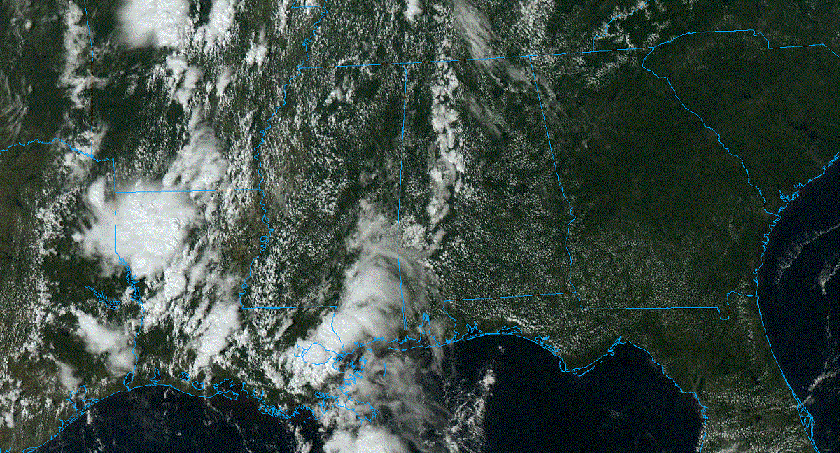
RADAR CHECK: We have a few small, isolated showers over the western half of the state this afternoon; otherwise, the sky is partly to mostly sunny with temperatures between 87 and 91 degrees for most communities. Those showers will end this evening, and tonight will be mostly fair with a low between 68 and 73 degrees.
REST OF THE WEEK: Dry weather is expected Tuesday with a good supply of sunshine, but we will bring in some risk of widely scattered showers and thunderstorms Wednesday and Thursday as moisture levels rise ahead of a surface front. The chance of any one given spot seeing rain both days is 20-30%, and showers will be most active during the afternoons and evenings. On Friday, drier air pushes into the state, and the chance of showers will be generally confined to the counties south of Montgomery.
Highs will be in the low 90s for most places Tuesday and Wednesday, near 90 Thursday and in the mid to upper 80s Friday.
THE ALABAMA WEEKEND: For now, it looks dry for most of the state with mostly sunny days, fair nights and highs between 84 and 88 degrees. A few scattered showers will be possible near the Gulf Coast, but even there probably not much rain.
NEXT WEEK: Global models are suggesting the return of showers and storms toward the middle of the week with an upper trough approaching; highs will be mostly in the 80s.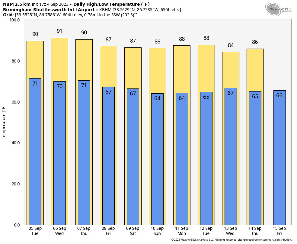
TROPICS: Tropical Storm Gert has dissipated, and Tropical Depression Katia will dissipate tonight far from land over the open Atlantic. The system to watch is Invest 95L, which is about 700 miles west/southwest of the Cabo Verde Islands.
 It is expected to become a powerful hurricane named Lee over the next few days as it moves west/northwest across the Atlantic. Global models continue to suggest the system will turn to the north before reaching the U.S. East Coast.
No tropical systems will threaten the U.S. or the Gulf of Mexico for the next seven days.
ON THIS DATE IN 1933: A Category 3 hurricane made landfall on South Padre Island, Texas, during the late evening on Labor Day. The storm caused 40 fatalities.
ON THIS DATE IN 1950: Hurricane Easy was an erratic and unpredictable hurricane that lingered over the Tampa Bay area for days, dropping torrential rains and causing damage, especially in Cedar Key, Florida, where the storm eventually made landfall. This hurricane dumped 38.7 inches of rain in 24 hours in Yankeetown, a record for the U.S. at the time.
ON THIS DATE IN 1996: Hurricane Fran made landfall near the tip of Cape Fear, North Carolina, with maximum sustained winds near 115 mph on the evening of Sept. 5. Fran was responsible for 26 deaths and was at the time the most expensive natural disaster in North Carolina’s history.
For more weather news and information from James Spann and his team, visit AlabamaWx.


