James Spann: Scattered showers for Alabama through Saturday
James Spann forecasts scattered showers but no major rain events for Alabama from Alabama News Center on Vimeo.
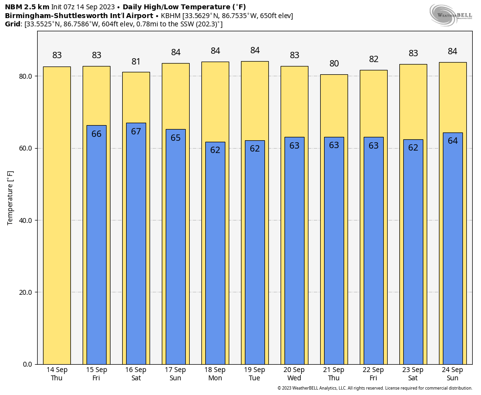
RADAR CHECK: A few scattered showers are moving into the western half of Alabama early this morning with temperatures at daybreak ranging from the low 60s over the Tennessee Valley to the mid 70s near the coast. Look for a mix of sun and clouds today with potential for a few scattered showers; highs will be in the mid 80s in most locations. The average high for Birmingham on Sept. 14 is 87.
FRIDAY AND THE WEEKEND: The sky will be occasionally cloudy Friday and Saturday with a chance of showers both days statewide. A thunderstorm or two is possible as well, but the rain won’t be especially heavy or widespread. The chance of any one location seeing rain is 30-40% Friday and 40-50% Saturday. On Sunday, we have just an outside risk of a stray shower with a partly sunny sky. Highs all three days will be in the low to mid 80s.
NEXT WEEK: At this point it looks like much of Alabama will be dry through the week. We will mention just the risk of a few scattered showers over the southern counties Tuesday and Wednesday. Highs will remain in the 80s, with lows in the 60s.
FOOTBALL WEATHER: For the high school games Friday night, we have a risk of scattered showers, but nothing especially widespread or heavy. Temperatures will fall through the 70s.
Saturday, Alabama travels to Tampa to take on South Florida (2:30 p.m. CT kickoff). The day will be hot and humid, with a kickoff temperature around 90 degrees. A passing shower or thunderstorm is likely during the game, which, of course, means potential for a lightning delay.
Auburn hosts Samford Saturday at Jordan-Hare Stadium (6 p.m. kickoff). The sky will be mostly cloudy with a passing shower possible. Temperatures will be in the mid to upper 70s.
UAB will host Louisiana Saturday at Protective Stadium in downtown Birmingham (6 p.m. kickoff). A shower can’t be ruled out during the game. Conditions will be mostly cloudy with temperatures falling from near 80 at kickoff to mid 70s by the fourth quarter.
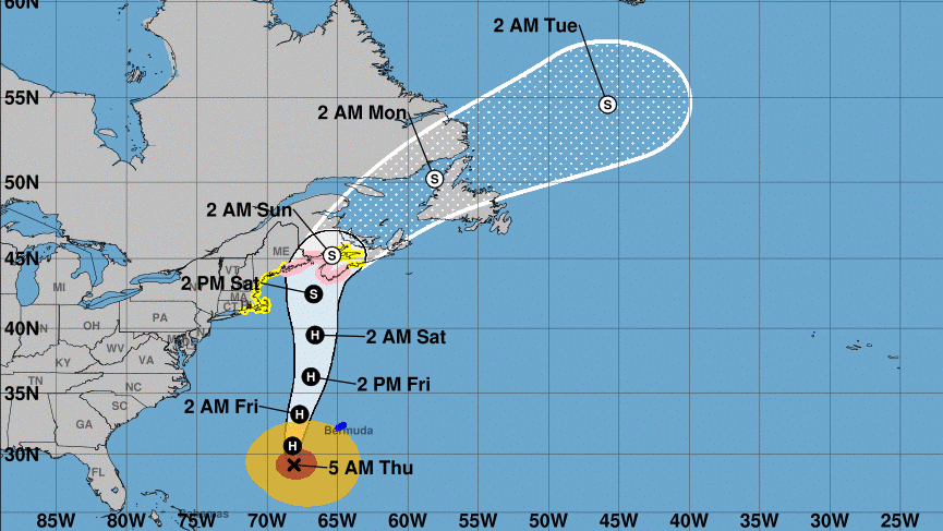
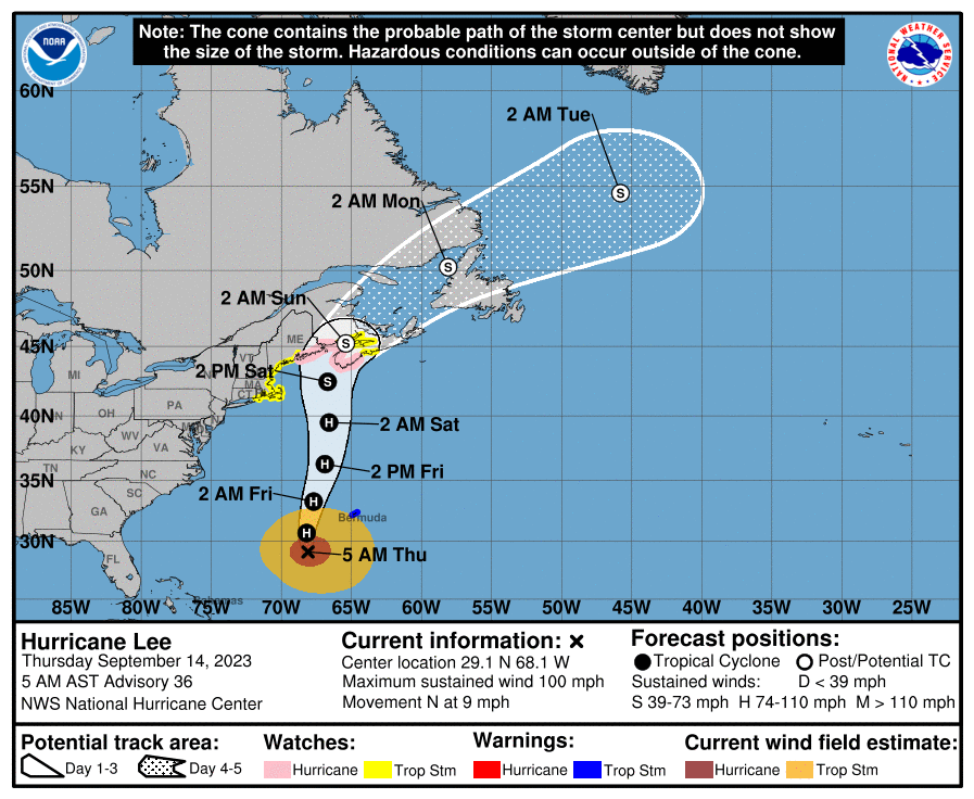
TROPICS: Hurricane Lee, with winds of 100 mph, is about 840 miles south of Nantucket early this morning. The latest shear analyses suggest that moderate southwesterly shear has begun to affect Lee, and this is confirmed by the offset of the aircraft fixes relative to the satellite eye feature. The shear is forecast to increase further in 24-36 hours, which will cause Lee to ingest drier and more stable air into its circulation. In addition, sea surface temperatures along Lee’s future path drop off significantly after 36 hours. Therefore, continued gradual weakening is forecast.
Extratropical transition is likely to begin Friday as Lee interacts with a frontal boundary moving off the east coast of the United States, and a good chunk of the guidance suggests the transition could be complete by 60 hours. In order to maintain continuity with the previous forecast, Lee is now shown to be a fully post-tropical cyclone by 72 hours. Regardless of its designation, Lee will remain a large and dangerous cyclone while it approaches eastern New England and Atlantic Canada into the weekend. Landfall is expected over western Nova Scotia late Saturday.
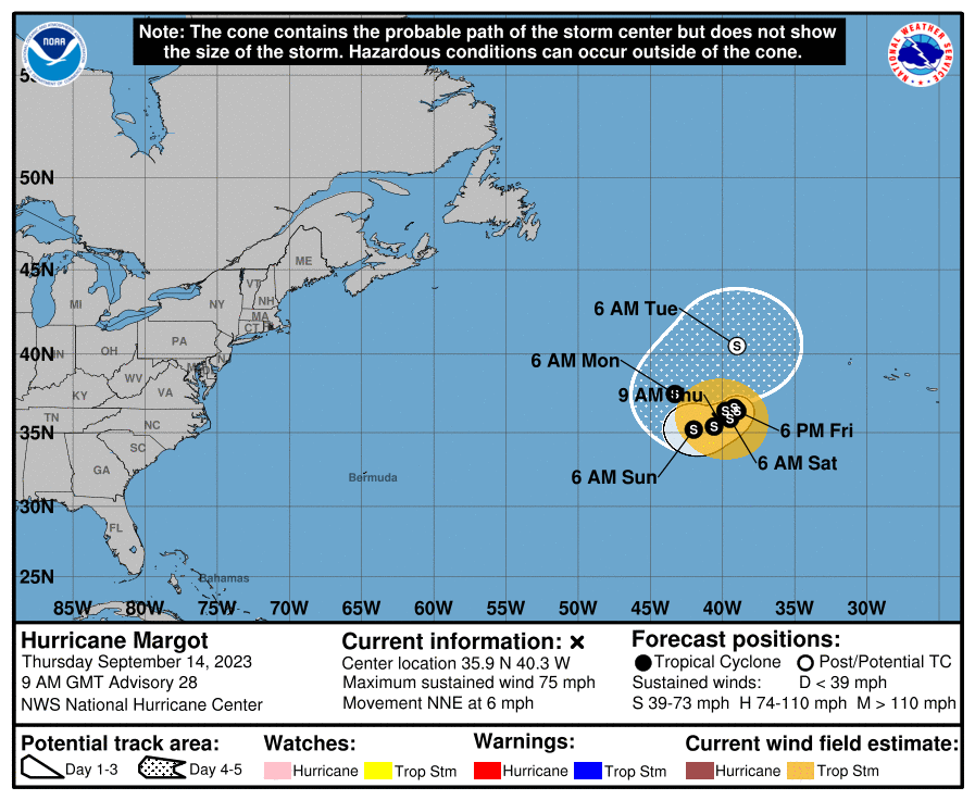
Hurricane Margot is weakening with sustained winds of 75 mph in the Atlantic far from land. It will move little over the next five days and should become post-tropical by early next week.
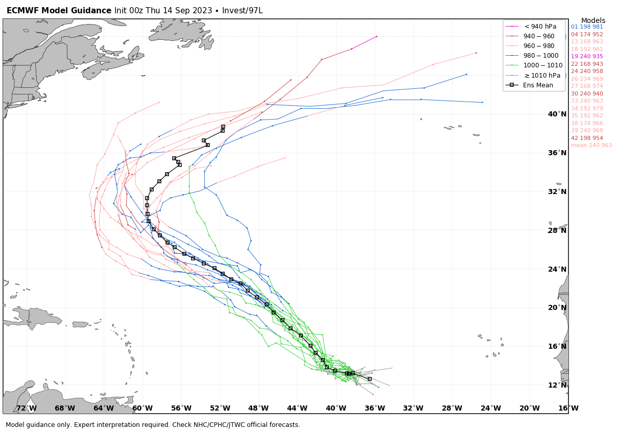
 Invest 97L in the Central Atlantic is expected to become Tropical Storm Nigel over the next few days. It will be turning northward and will likely remain far from land.
 No tropical systems will threaten the Gulf of Mexico for at least the next seven days.
ON THIS DATE IN 1928: A violent, estimated F4 tornado, with winds of 200 mph, tore across Rockford, Illinois. It first touched down 8 miles south-southwest of Rockford and moved across the southeast part of the city. The tornado was on the ground for 25 miles with a width varying from 200 to 500 feet. Fourteen people were killed.
ON THIS DATE IN 2005: Hurricane Ophelia caused some damage and beach erosion along the United States coastline from Florida to North Carolina. The closest approach occurred Sept. 14-15 with its western eyewall crossing land and the eye remaining just offshore in the Carolinas.
ON THIS DATE IN 2018: Hurricane Florence, a large, slow-moving Category 1 hurricane, made landfall during the morning. After the eye crossed Wrightsville Beach, North Carolina, at 7:15 a.m., the storm spent the next two days producing record-breaking rainfall across eastern North Carolina and a portion of northeastern South Carolina. More than 30 inches of rain was measured in a few North Carolina locations, exceeding the highest single-storm rainfall amounts ever seen in this portion of the state. A station in Loris, South Carolina, recorded 23.63 inches of rain, setting a new tropical cyclone rainfall record for that state.
For more weather news and information from James Spann and his team, visit AlabamaWx.


