Scott Martin: Light rain possible in Alabama this morning; cooler on Sunday
THE ALABAMA WEEKEND: A surface front that will move through Alabama today will bring much drier, cooler air, but the northern half of the state may have to deal with some light rain during the morning. Once we reach the afternoon, clouds will be on the decrease and all rain will have ended. Highs will be in the lower 70s to the lower 80s.
Sunday will be much cooler as a trough settles in. Clouds will make a return along with northwesterly winds. There is a small chance of a few sprinkles, but almost everyone in Alabama will stay dry. Highs will be in the upper 50s to the upper 60s.
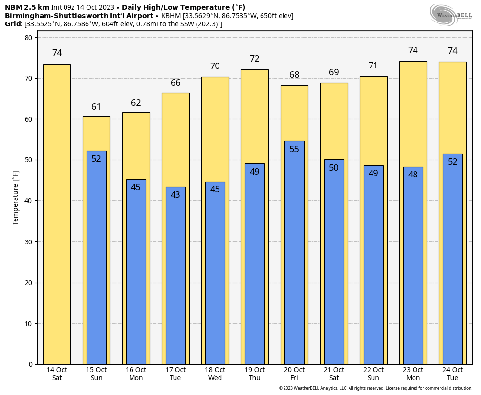
THE WORK WEEK AHEAD: The trough will continue to hang around on Monday, keeping clouds in the state during the first half of the day. It will also keep temperatures on the cool side, with highs in the upper 50s to the mid 60s. We’ll begin to have a shift in our pattern on Tuesday as the trough pushes off the East Coast and makes its way out over the Atlantic. The flow will become more zonal and allow the temperatures to start to moderate. Highs will be in the 60s. We’ll go a little warmer on Wednesday with the zonal flow, but our weather will remain very quiet. Highs will be in the upper 60s to the lower 70s. A system will be trying to get organized to our west on Thursday, but for now it looks like none of that activity will make it into Alabama. Highs will be in the upper 60s to the mid 70s.
On Friday, plenty of moisture will be pulled up from the Gulf of Mexico and a cold front will be approaching from the west. Rain will be possible at times throughout the day. Some thunder may be possible, as minor instability will be present during the late night and overnight. For now, severe weather is not expected. Highs will be in the upper 60s to the mid 70s.
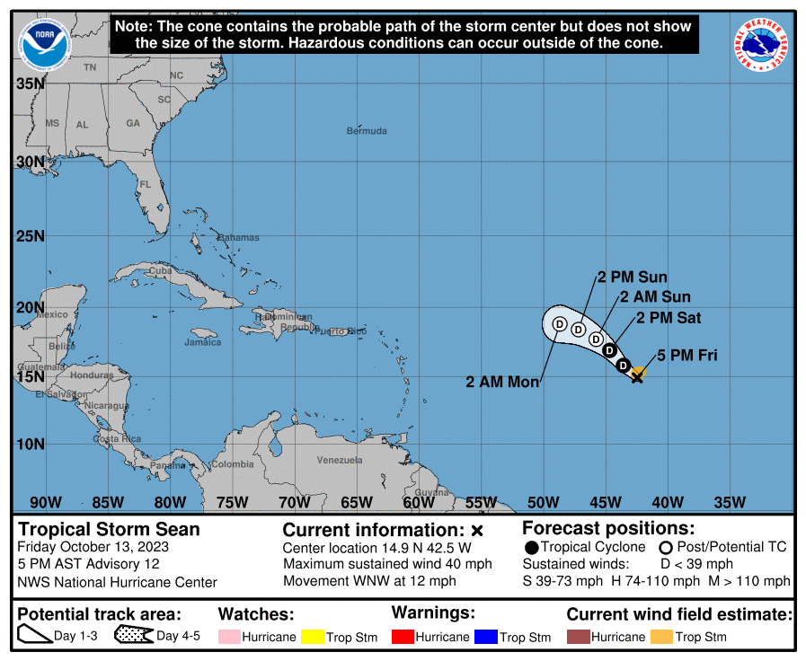
TROPICS: Sean is struggling to stay a tropical storm and is expected to weaken into a depression today and eventually become post-tropical by Sunday morning. It’s no threat to any land.
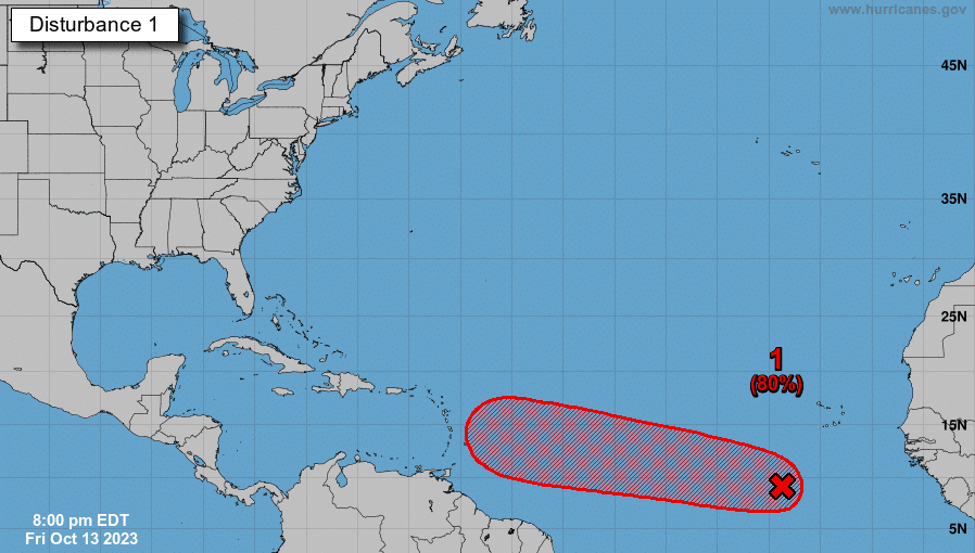
An area of low pressure over the eastern tropical Atlantic has been getting better organized, and conditions will become favorable for a depression to form by the middle of next week. Projections have this system heading west-northwestward and approaching the Windward Islands by Thursday evening. The ensembles agree on the direction, but do not go out far enough to see what happens by next weekend. Whatever happens, we’ll keep our eye on it.
For more weather news and information from James Spann, Scott Martin and other members of the James Spann team, visit AlabamaWx.


