James Spann: Freeze warning for Alabama tonight; warming trend to follow
SUNNY, COLD NOVEMBER DAY: Temperatures are between 48 and 53 degrees across the northern half of Alabama this afternoon, with mid to upper 50s over the southern counties under a cloudless sky. The average high for Birmingham on Nov. 1 is 70. A freeze warning is in effect tonight for all of Alabama, with the exception of areas south of I-10 in Baldwin and Mobile counties. Lows will be between 24 and 32 degrees early Thursday with a clear sky and near-calm wind. Mid to upper 30s are likely along the Gulf Coast.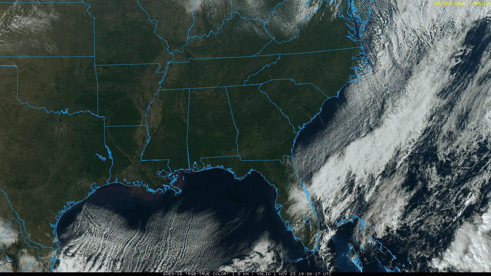
A warming trend begins Thursday afternoon. With sunshine in full supply, the high will be close to 60 over north Alabama, with mid 60s for the southern half of the state.
FRIDAY AND THE WEEKEND: Dry weather continues with mostly sunny days, fair nights and a warming trend. Highs will be in the 60s and low 70s Friday, followed by low to mid 70s statewide over the weekend. Clouds will increase Sunday night.
NEXT WEEK: New global model guidance certainly doesn’t look encouraging for a state that needs rain badly. There might be a day or two with a drop of rain in spots, but meaningful rain at this point seems unlikely.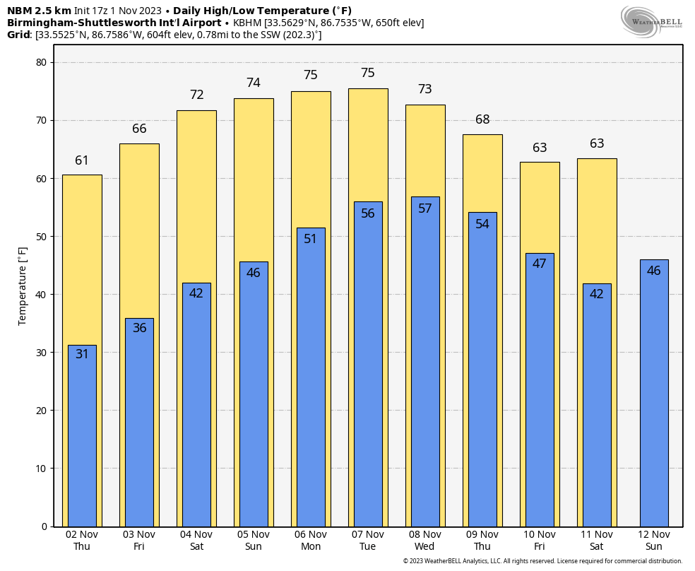 FOOTBALL WEATHER: Expect a clear sky for the high school games across Alabama Friday night with temperatures falling through the 50s.
Saturday, UAB hosts Florida Atlantic at Protective Stadium in downtown Birmingham (2 p.m. kickoff). The sky will be sunny with temperatures in the low 70s.
Auburn travels to Nashville to take on Vanderbilt (3 p.m. CT kickoff). The sky will be clear with upper 60s at kickoff, dropping into the low 60s by the final whistle.
Alabama will host LSU at Bryant-Denny Stadium (6:45 p.m. kickoff). The sky will be clear with temperatures falling through the 60s. It will be a perfect night for football in Tuscaloosa.
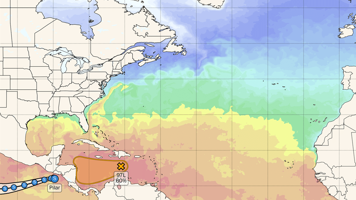
TROPICS: Disorganized showers and thunderstorms over the central Caribbean Sea are associated with a trough of low pressure. Environmental conditions could become a little more conducive for development in a day or two, and a tropical depression could form when the system moves over the southwestern Caribbean Sea during the latter part of this week. Regardless of development, this system has the potential to produce heavy rains over portions of Central America late this week and into the weekend. The National Hurricane Center has dropped the chance of development to 40%.
The rest of the Atlantic basin is quiet.
ON THIS DATE IN 1925: A late-season hurricane began to affect the west coast of Florida as it strengthened during the day. The storm made landfall early in the day south of Tampa Bay, weakened to a tropical storm as it crossed central Florida and exited around St. Augustine. It regained hurricane strength off Jacksonville late in the day. Heavy rain continued over northeast Florida Nov. 2. Gale-force winds were reported from the Keys to Jacksonville and more than 50 people lost their lives, mostly on ships at sea. Damage along the coast south of Jacksonville was heavy and excessive rain and wind seriously damaged citrus and truck crops.
For more weather news and information from James Spann and his team, visit AlabamaWx.


