James Spann: Another freeze for Alabama tonight
James Spann forecasts more cold, dry weather for Alabama before rain returns from Alabama News Center on Vimeo.
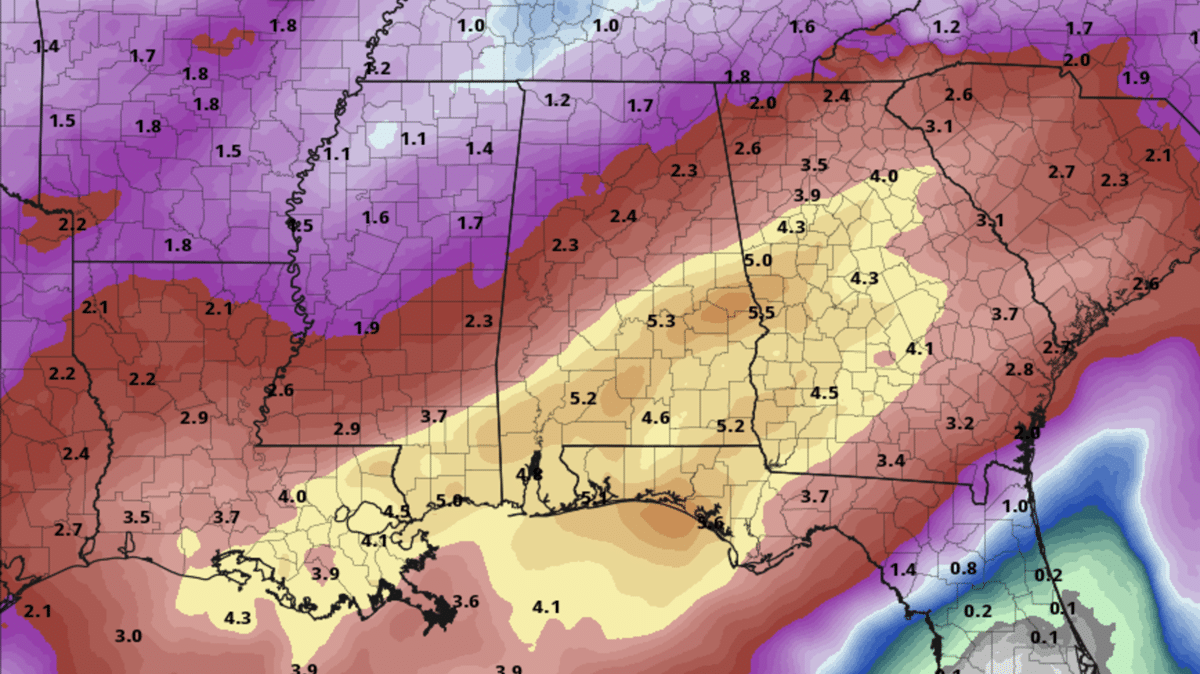
COLD START: Here are some temperatures across Alabama just before daybreak:
- Tuckers Chapel (Cherokee County) — 23
- Fort Payne — 24
- Meridianville — 24
- Gadsden — 26
- Remlap — 27
- Margaret — 27
- Haleyville — 27
- Decatur — 27
- Jasper — 27
- Cullman — 28
- Huntsville — 28
- Hueytown — 29
- Muscle Shoals — 29
- Trussville — 31
- Anniston — 31
- Talladega — 31
- Tuscaloosa — 33
- Birmingham — 34
- Montgomery — 41
- Dothan — 42
- Mobile — 44
Today will be another sunny day with highs mostly in the 50s, but the Tennessee Valley will hold in the 40s this afternoon. Tonight will feature a freeze all the way down to I-10; look for 20s over north and central Alabama early Wednesday, with low 30s for the southern counties. It will be the coldest morning of the week.
Wednesday will be sunny with highs in the 50s and 60s, and the day Thursday will be dry with most of the state reaching the 60s by afternoon. Clouds will increase late in the day, and rain is likely across Alabama late Thursday night into Friday morning. For now, it looks like the main window for rain will come from about midnight Thursday night through noon Friday. Clouds linger Friday afternoon with highs in the 60s.
THE WEEKEND: We will deal with more rounds of rain over the weekend. It won’t be a total washout, but occasional rain is likely, and the rain could be heavy at times, especially over south Alabama. A few thunderstorms are possible, but for now severe storms look unlikely. Highs will be in the mid to upper 60s both days.
South Alabama has potential for 3-5 inches of rain through Sunday night, with 1-3 inches over the northern half of the state — very beneficial considering the ongoing drought.
NEXT WEEK: Models are in poor agreement concerning Monday; we will maintain the chance of some lingering rain, but the rest of the week looks dry with seasonal temperatures.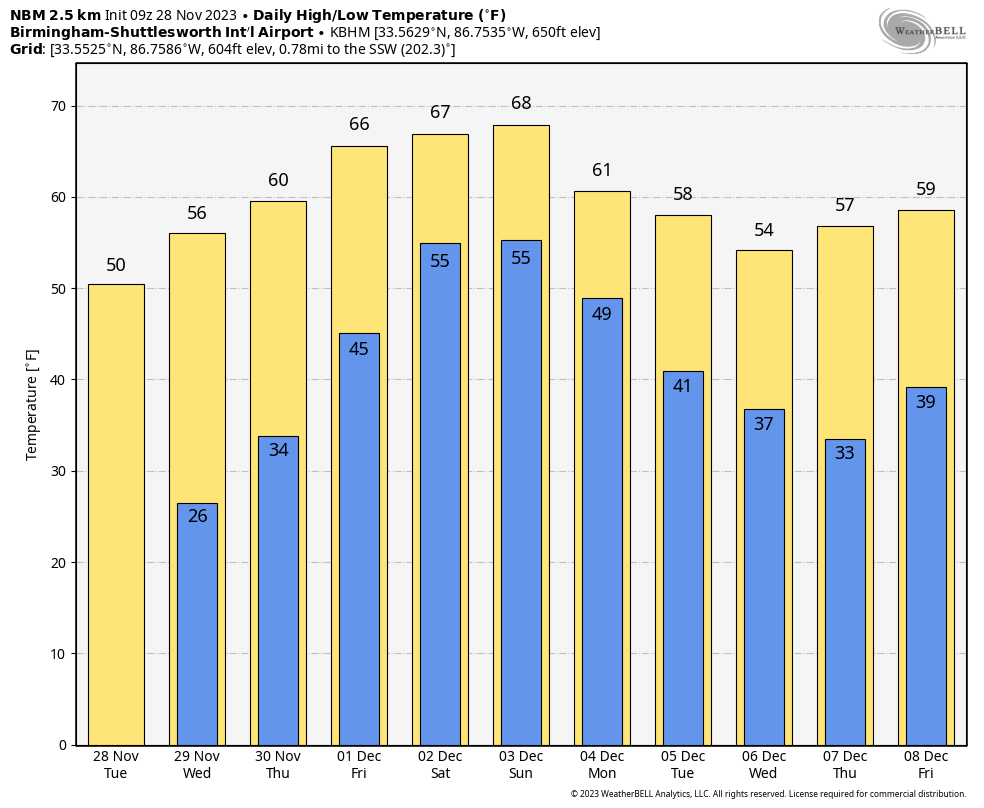 TROPICS: The Atlantic basin is quiet, and hurricane season ends Thursday.
ON THIS DATE IN 1921: New England was in the midst of a four-day ice storm, its worst of record. Ice was more than 3 inches thick in many places following the storm, and property damage was in the millions of dollars. Northern New England received heavy snow, with more than 2 feet reported in some areas. Overnight freezing rains continued through the day at Worcester, Massachusetts, while the wind increased to a gale. Streets became impassable even on foot, and whole towns were plunged into darkness without communication.
ON THIS DATE IN 1988: An F4 tornado moved across five North Carolina counties with an 83-mile track. Four people were killed and 154 were injured.
ON THIS DATE IN 2005: Six tornadoes touched down across Alabama; all were rated either EF0 or EF1. In Jefferson County, short-lived tornadoes touched down near Corner, Bagley and Concord.
For more weather news and information from James Spann and his team, visit AlabamaWx.


