James Spann: A few strong storms for south Alabama tonight; rain ends early Saturday
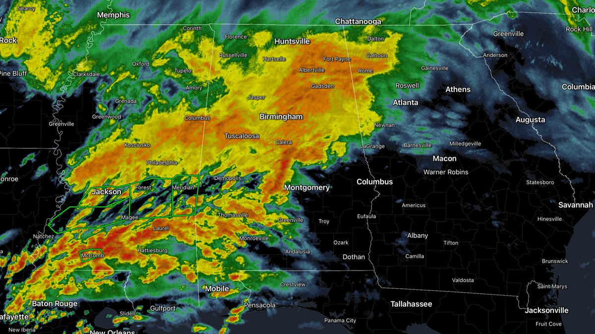
RADAR CHECK: Rain is widespread across Alabama this afternoon with the exception of the southeast part of the state. A flash flood watch will remain in effect tonight for the central and southern counties.
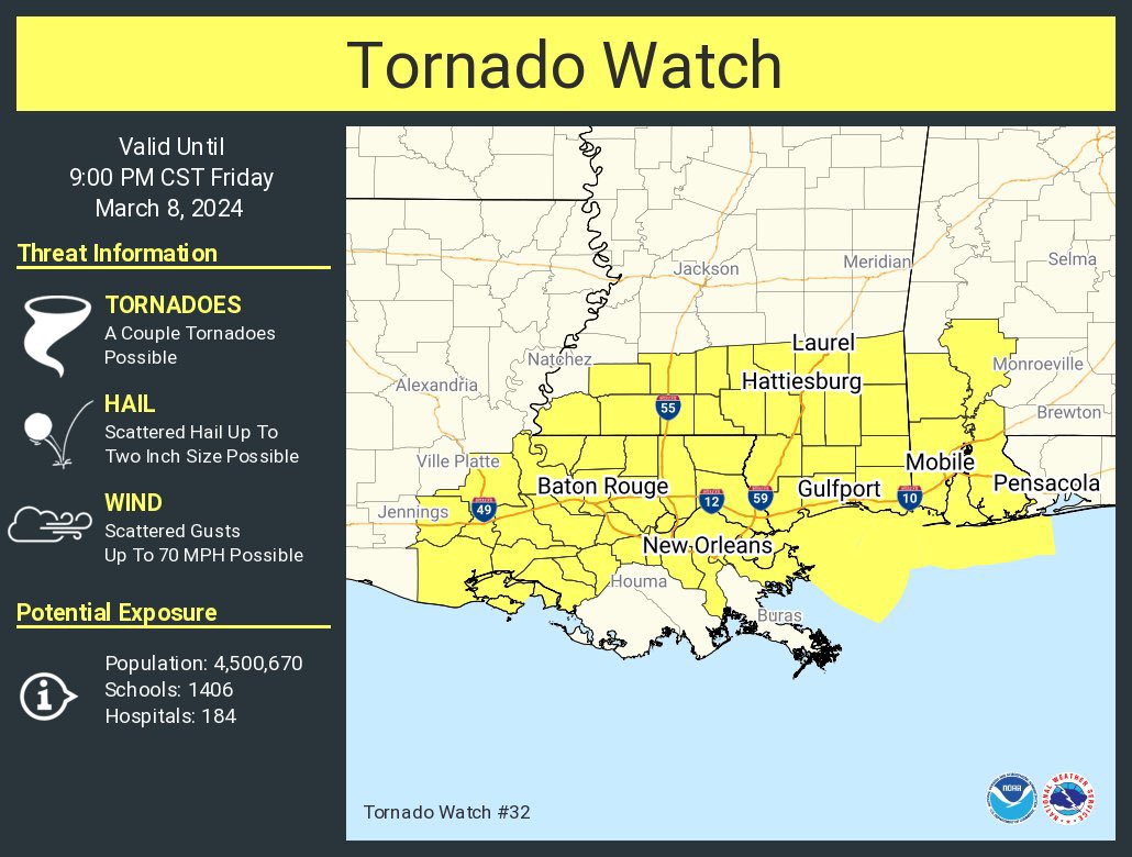
A tornado watch has been issued for Mobile, Baldwin, Washington and Clarke counties in southwest Alabama until 9 tonight. A few strong to severe thunderstorms are possible tonight over far southern Alabama, where the air is somewhat unstable. Heavier storms over south Alabama could also produce strong, gusty winds. The risk of severe storms is mainly along and south of U.S. 84.
Severe storms are not expected to the north with a rain-cooled, stable air mass in place.
While showers and storms could linger across southeast Alabama through mid-morning Saturday, the rest of the state will be dry with some afternoon clearing possible. The high will be between 65 and 70 degrees for most places. Sunday will be sunny and cool, with a high between 55 and 65.
NEXT WEEK: Temperatures will drop into the 30s over the northern two-thirds of Alabama both Monday and Tuesday mornings, and colder spots could see a light freeze. But we warm into the 70s over the latter half of the week as cold snaps this late in the season don’t last long. Much of the week looks dry, although some rain could return by Friday. Global models continue to suggest some risk of rain lingering into Saturday, March 16.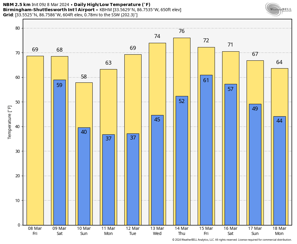 ON THIS DATE IN 1909: The town of Brinkley, Arkansas, was struck by an estimated F4 tornado, which killed 49 people. The tornado, which was two-thirds of a mile wide, destroyed 860 buildings. Entire families were killed as houses were completely swept away by the storm.
ON THIS DATE IN 2000: An F1 tornado traveled a short distance across Milwaukee, Wisconsin, during the evening, injuring 16 people.
For more weather news and information from James Spann and his team, visit AlabamaWx.


