James Spann: Drier air arrives in Alabama Saturday; sun in full force Sunday

RADAR CHECK: Large areas of mostly light rain continue over the northern half of Alabama this afternoon. South Alabama is mostly dry; in fact, the sun is out across the southwest counties, where temperatures have reached the low 70s. Occasional rain will continue tonight, mostly across north and central Alabama.
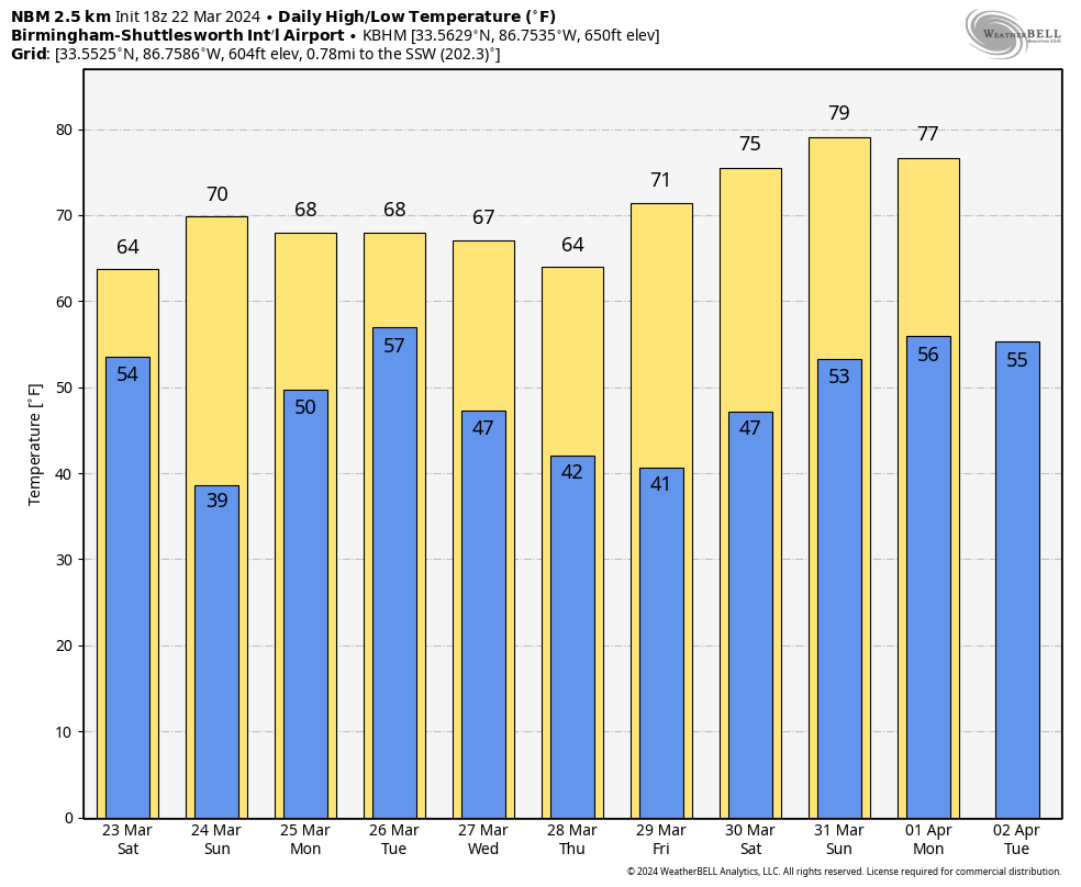
THE ALABAMA WEEKEND: Any lingering showers will end Saturday morning, and some clearing is possible by afternoon as dry air returns to the state. Temperatures will remain below average, with highs in the mid 60s. On Sunday, the sky will be sunny with a high not too far from 70 degrees. There will be some risk of scattered frost early Sunday morning with temperatures dropping into the mid to upper 30s over the northern two-thirds of Alabama.
NEXT WEEK: The weather stays dry Monday, but showers and storms return Tuesday ahead of a surface front. Instability will be very limited; the main dynamic support will pass well to the north, and we are not expecting severe thunderstorms. Rain amounts of one-half to 1 inch are likely Tuesday; then drier air returns Wednesday with a partly sunny sky. The latest global model data suggests Thursday and Friday will be dry as well. Highs will be between 65 and 72 degrees through the week.
ON THIS DATE IN 1893: The first tornado was recorded in Oklahoma City. It destroyed 14 buildings and injured four people as it passed through the center of town. There was minor damage to the Weather Bureau office, which was at Grand and Robinson in south Oklahoma City.
ON THIS DATE IN 2022: Nine tornadoes touched down across Alabama, including an EF-2 in Choctaw County that was down for more than four miles.
For more weather news and information from James Spann and his team, visit AlabamaWx.


