James Spann: Improving weather for Alabama today; dry weekend ahead
James Spann forecasts dry weekend for Alabama, followed by a wet week from Alabama News Center on Vimeo.
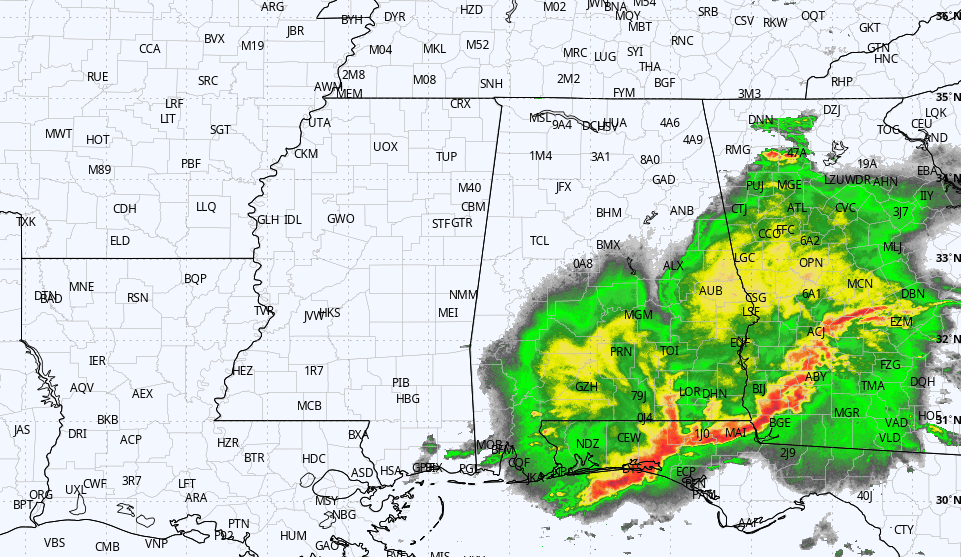
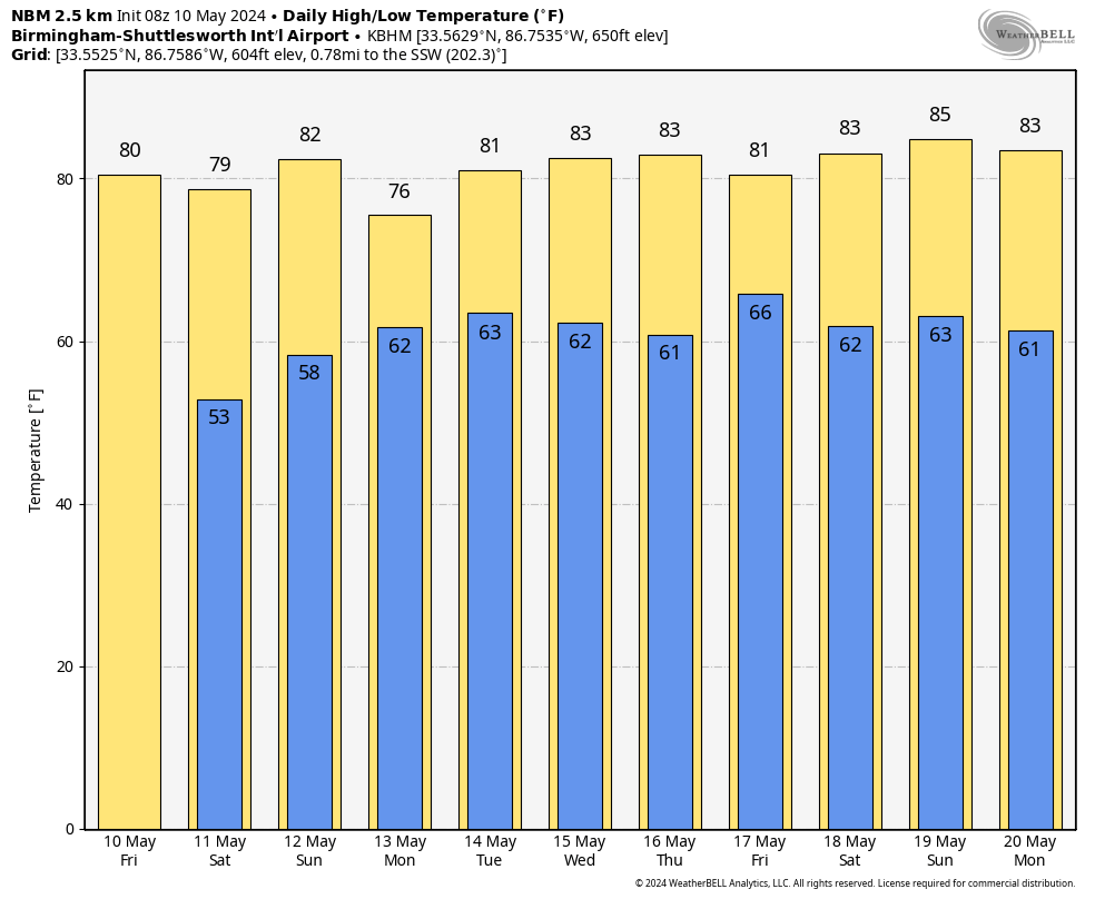
RADAR CHECK: A large mass of rain covers southeast Alabama just before daybreak; the rain there will end later this morning. The sky becomes partly to mostly sunny, and today’s high will be close to 80 degrees. The average high for Birmingham on May 10 is 81. Tonight will be clear and cooler, with a low in the 50s. Some of the colder spots over north Alabama could reach the upper 40s early Saturday morning.
The weekend will be dry and pleasant; the sky will be partly to mostly sunny Saturday and Sunday with highs between 77 and 83 degrees.
NEXT WEEK: The week looks generally wet and unsettled. We will have periods of rain and possibly a thunderstorm daily, with the likely exception of Wednesday. Rain amounts through the week could exceed 4 inches over south Alabama, with more than 2 inches possible for the northern counties of the state. For now, we don’t see any major signal of severe thunderstorm potential, and highs will be mostly in the low 80s.
 ON THIS DATE IN 1905: The Oklahoma Territory was struck by one of the worst natural disasters in early American history. Tornadoes pounded the southwest part of the Territory, one of which flattened the town of Snyder. The “official” death toll is listed today as 97, but the actual number of victims may never be known.
ON THIS DATE IN 2010: Oklahoma experienced its largest tornado outbreak since May 3, 1999. Fifty-five twisters tore through the state, including two rated EF4. The EF4 storms took three lives and injured 81 people. Both EF4 tornadoes struck Norman, Oklahoma, home of the Storm Prediction Center and the National Severe Storms Laboratory.
For more weather news and information from James Spann and his team, visit AlabamaWx.


