James Spann: Occasional rain, storms in Alabama through Tuesday night
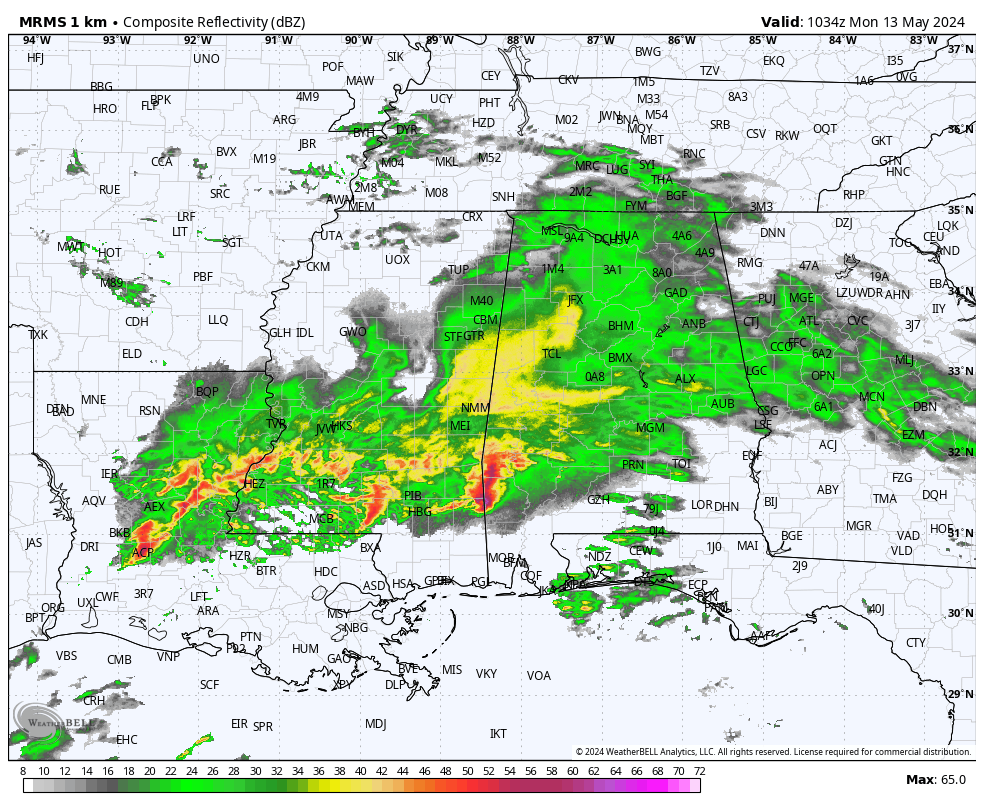
RADAR CHECK: A large mass of rain covers much of Alabama early this morning; heavier thunderstorms are pushing into the southwest corner of the state. Much of the rain for north and central Alabama will come this morning; most of the afternoon and nighttime will be dry. But, for the southern third of the state, periods of rain and storms are likely through tonight, and the rain will be heavy at times.
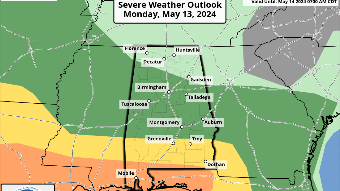
A flash flood watch is in effect south of a line from Butler to Camden to Greenville to Abbeville. Rain amounts of 3-4 inches are likely. Also, storms over this area could be strong to severe. The Storm Prediction Center has defined an enhanced risk (level 3 of 5) for Mobile and Baldwin counties, with a slight risk (level 2) as far north as Thomasville, Greenville and Eufaula. The main threat will come from strong straight-line winds, but an isolated tornado or two is possible as well.
The weather stays unsettled Tuesday with a good chance of showers and storms by afternoon into the evening — not an all-day rain, but where the storms form, they could be strong, with potential for some small hail and gusty winds. A marginal risk (level 1) covers all of Alabama.
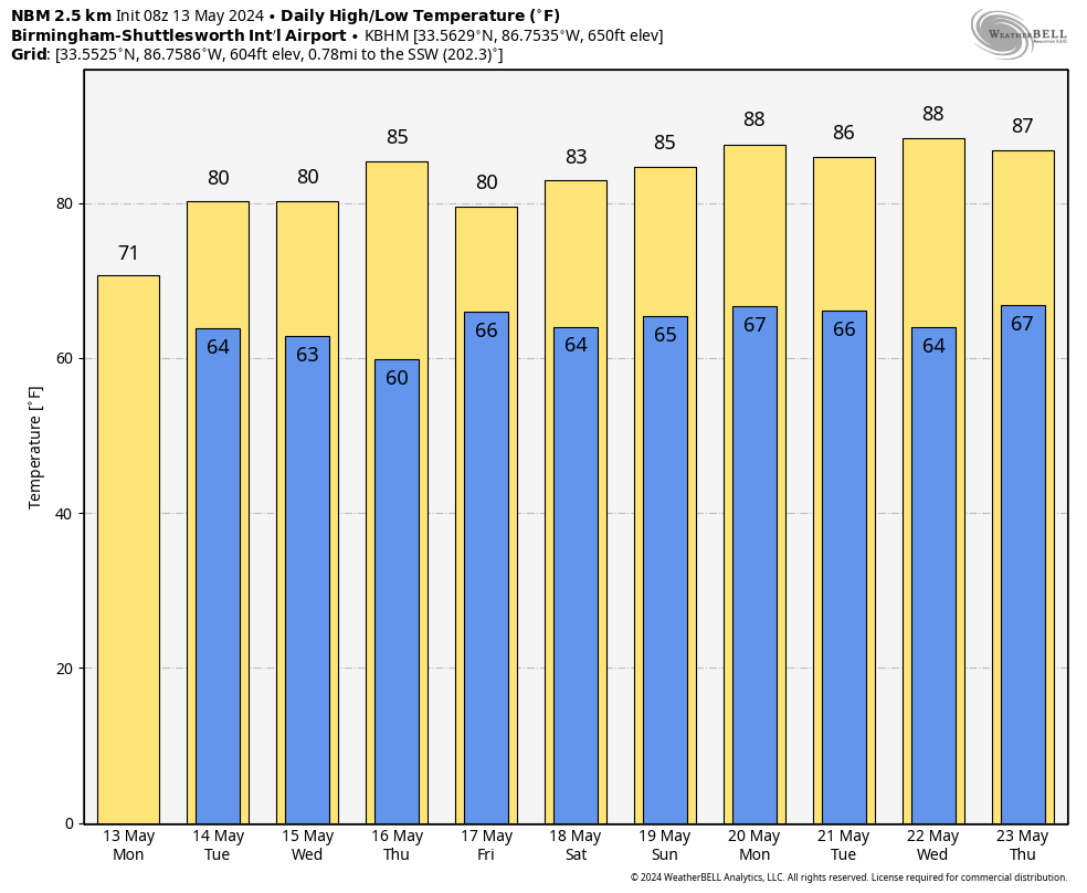
Drier air moves into Alabama Wednesday. Other than the chance of a few isolated showers over the Tennessee Valley, the rest of the state will be dry with a high in the low 80s. Thursday will be dry statewide with a good supply of sunshine and a high in the mid 80s.
FRIDAY AND THE WEEKEND: Rain returns to Alabama Friday as a surface low approaches; the rain could be heavy at times through Friday night. For now, it looks like any risk of severe storms will be confined to areas close to the Gulf Coast. Confidence in the weekend forecast is not very high as global models don’t agree well at all, so this will most likely change. But, for now, we will mention a chance of lingering showers Saturday, followed by a trend toward drier weather Sunday. Highs will be in the low to mid 80s.
NEXT WEEK: An upper ridge will build over the region, and for now a decent part of next week looks dry with highs in the mid to upper 80s.
 ON THIS DATE IN 1980: An F3 tornado ripped directly through the center of Kalamazoo, Michigan, killing five people, injuring 79, leaving 1,200 homeless and causing $50 million in damage.
ON THIS DATE IN 1995: An outbreak produced tornadoes extending from the Mississippi River near Burlington, Iowa, to the west of Bloomington, Illinois. Two violent tornadoes, each ranked at F4 intensity, were reported.
For more weather news and information from James Spann and his team, visit AlabamaWx.


