James Spann: Unsettled weather for Alabama through Saturday
James Spann forecasts some wet weather, possible storms for Alabama from Alabama News Center on Vimeo.
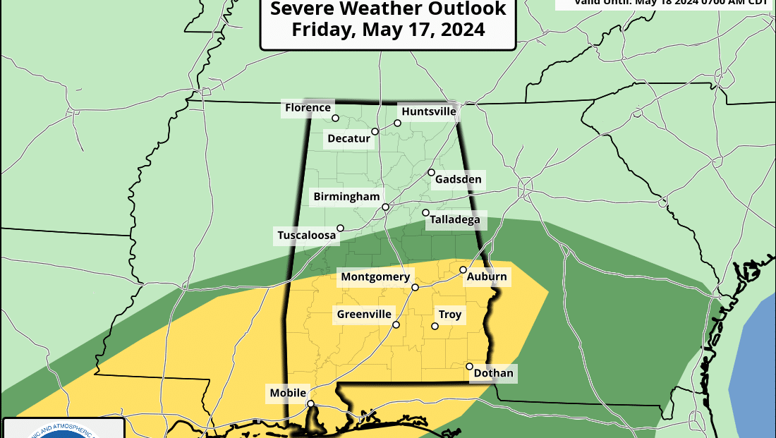
RADAR CHECK: Large areas of rain are moving through Alabama early this morning, including a few stronger thunderstorms near the Gulf Coast. We will forecast periods of rain and a few thunderstorms through tonight. The Storm Prediction Center maintains a slight risk (level 2 out of 5) of severe storms for the southern half of the state, with a marginal risk (level 1) as far north as Moundville, Calera and Wedowee.
Instability will be very limited today over the northern half of the state, but storms that form this afternoon and tonight over south Alabama could produce some hail and strong, gusty winds. An isolated tornado or two is possible.
THE WEEKEND: Unsettled weather continues Saturday with occasional showers and a few thunderstorms. The overall severe risk is low, but a few heavier storms could form across southeast Alabama with gusty winds and small hail.
Despite the wet pattern, there will be some good breaks in the rain through Saturday night. There are many outdoor events (graduations, baseball and softball tournaments, the Hangout Music Festival at Gulf Shores, etc.) going on. A shower or storm is possible at any hour of the day or night during the next 48 hours. When you hear thunder, get inside or in a vehicle.
Forecast rain amounts have come down; most places will see 1-2 inches through Saturday night. A flash flood watch is in effect for the southwest part of the state.
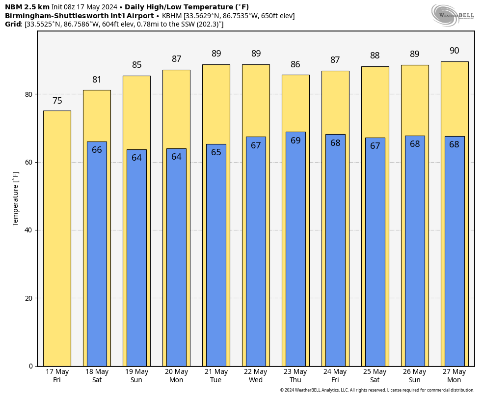
Most of the day Sunday will be dry with a partly sunny sky — just a small risk of a morning shower as an upper trough passes overhead. The high will be in the mid 80s.
NEXT WEEK: The weather looks warm and generally dry, with highs between 85 and 90 degrees. A few scattered showers will be possible over north Alabama Thursday and Friday as a weak front drifts into the state from the north.
 ON THIS DATE IN 1896: An estimated F5 tornado tracked 100 miles through northeastern Kansas and extreme southeastern Nebraska. Seneca, Oneida, Sabetha and Reserve, Kansas, sustained severe damage. While passing through Reserve, the tornado was 2 miles wide. Twenty-five people were killed and 200 were injured.
For more weather news and information from James Spann and his team, visit AlabamaWx.


