James Spann: Sun, heat, storms for Alabama over the weekend
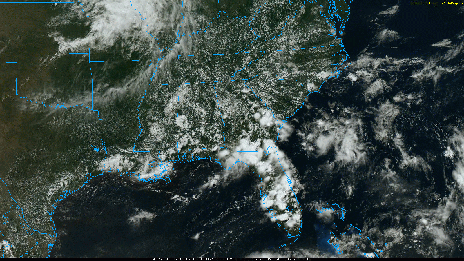
RADAR CHECK: We have the classic case of widely scattered, random showers and thunderstorms across Alabama. They are most active over the southern two-thirds of the state and are moving northward. Away from the showers the sky is partly sunny with temperatures generally between 90 and 94 degrees. Showers will end after dark, and tonight’s low will be in the 70s.
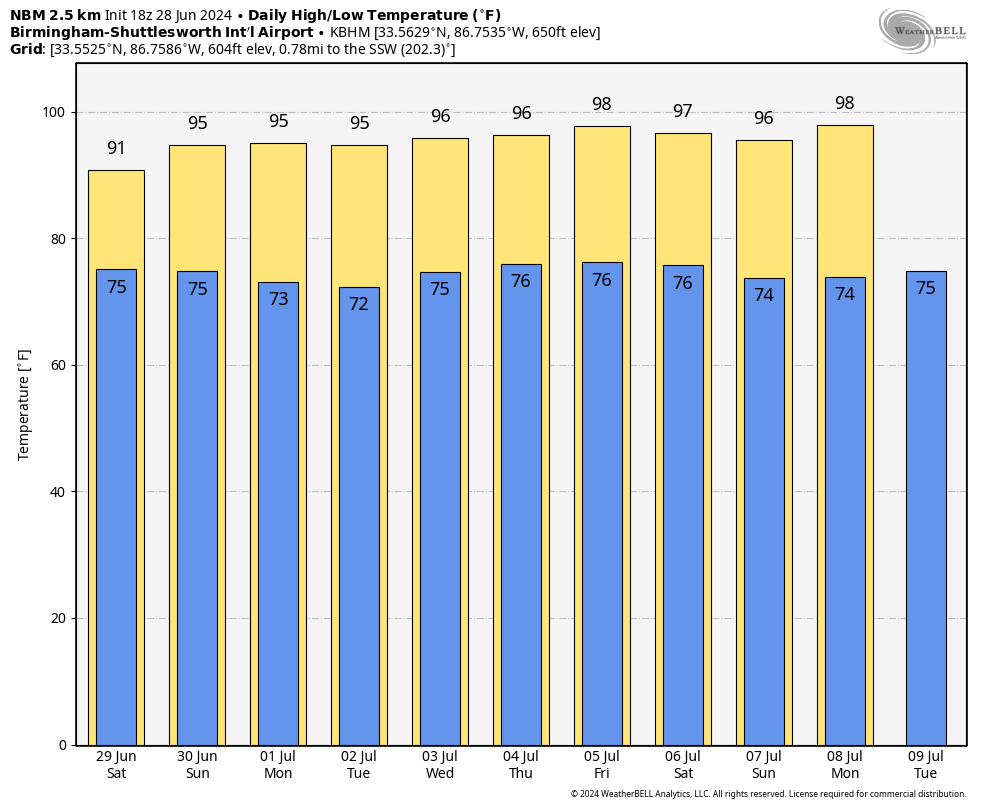
Scattered showers and storms should be more numerous over the weekend; the chance of rain for your front yard will be 50-60% both days. Most, but not necessarily all, of the showers and storms will come from about 1 until 10 p.m. Otherwise, expect a mix of sun and clouds both days with highs remaining in the low to mid 90s.
NEXT WEEK: The air will be drier Monday and Tuesday; most of the state will be hot and dry, with only a few isolated showers for the southern third of the state. Then, scattered, mostly afternoon and evening showers and storms are possible statewide over the latter half of the week. Highs will be in the 90s, lows in the 70s.
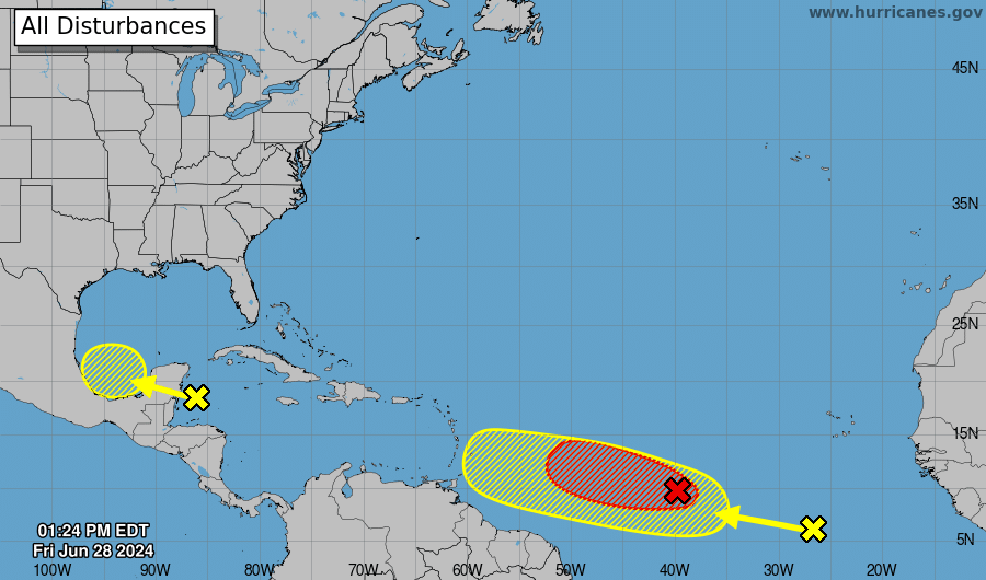
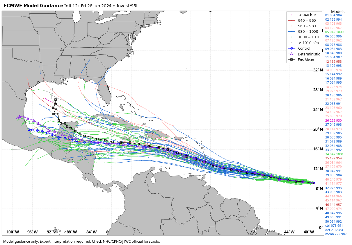
TROPICS: The National Hurricane Center is monitoring three tropical features across the Atlantic basin. One in the western Caribbean and one in the far eastern Atlantic have 20-30% probabilities of development. Invest 95L in the Central Atlantic is now upgraded to Tropical Depression Two, and advisories will be initiated shortly.
TD2 will continue moving toward the west/northwest and should become Tropical Storm Beryl over the weekend. The system could reach hurricane strength by Sunday night.
Beryl will be in the Caribbean next week, but it remains too early to know the final destination. There is considerable model spread in the seven- to 10-day range with different possibilities in the upper air pattern near the system.
We expect no tropical storms or hurricanes for the central Gulf Coast (Gulf Shores to Panama City Beach) through the end of next week.
ON THIS DATE IN 1924: An estimated F4 tornado struck the towns of Sandusky and Lorain, Ohio, killing 85 people and injuring more than 300. This tornado is the deadliest ever in Ohio history.
ON THIS DATE IN 1975: Lightning struck Lee Trevino and two other golfers at the Western Open golf tournament in Oak Brook, Illinois.
For more weather news and information from James Spann and his team, visit AlabamaWx.


