Scott Martin: Scattered storms for Alabama through the weekend; Tropical Storm Beryl forms
THE WEEKEND: It’s no surprise we’ll be hot and muggy across Alabama today. However, there will be scattered to numerous showers and storms, mainly during the afternoon and evening, across the southeastern three-quarters of the state, with smaller chances over the northwestern quarter. Heat indices will be in the upper 90s to around 105 degrees, with highs in the upper 80s to the mid 90s.
Unsettled weather continues Sunday. Scattered to numerous showers and storms will be likely, mainly during the afternoon and evening. It will also continue to be hot and muggy, with highs reaching the upper 80s to the mid 90s.
THE WORK WEEK AND HOLIDAY: Believe it or not, a cold front will work through much of the state on Monday that will bring us a little relief from the mugginess. Skies will be partly to mostly sunny as the front makes it to around the I-85 corridor. Highs will still be hot, upper 80s to upper 90s, even though the heat index should stay out of the 100s for much of Alabama.
Ridging begins to build back in on Tuesday, allowing the mugginess to start returning. A few isolated to scattered showers may be possible over east and southeast Alabama, while the rest of the state looks rain-free. Highs will be throughout the 90s.
The rest of the week looks like your typical summer forecast for Alabama. Skies will be partly sunny with a chance of widely scattered showers and storms Wednesday through Friday, with highs well up into the 90s and heat advisories possible each day.
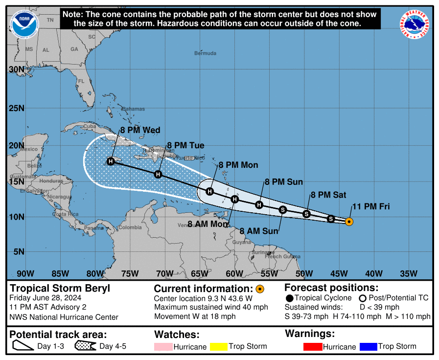
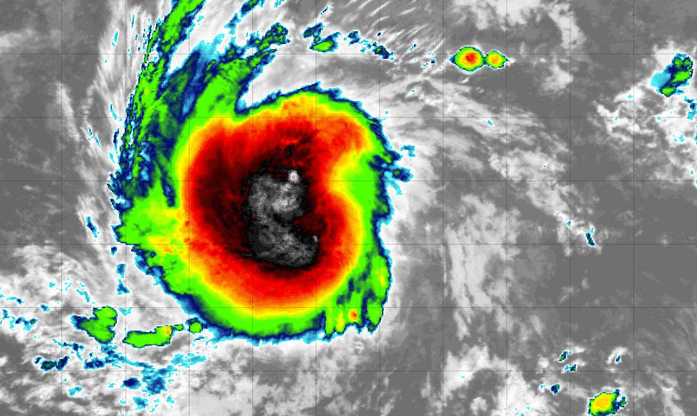
TROPICS: Tropical Storm Beryl has formed and is on its way to becoming a hurricane. Beryl is expected to strengthen as it moves toward the Windward Islands, possibly reaching hurricane status by late Sunday night or Monday. Beryl is moving west at about 18 mph. It’s expected to keep this westward to west-northwestward track for the next few days, bringing it across the Windward Islands late Sunday night into Monday. The maximum sustained winds are around 40 mph, with stronger gusts. Tropical-storm-force winds extend up to 45 miles from the center of the storm. The minimum central pressure is estimated to be 1,006 millibars.
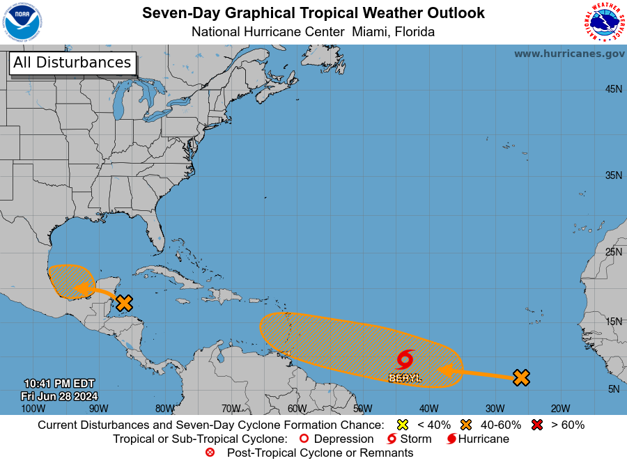
In the northwestern Caribbean and southwestern Gulf of Mexico, a broad area of low pressure is producing widespread but disorganized showers and thunderstorms. Development isn’t expected before it moves over the Yucatán Peninsula on Saturday. However, conditions could become favorable for development when it reaches the Bay of Campeche on Saturday night or early Sunday. A tropical depression might form before it moves inland over Mexico early next week. Regardless, heavy rain will affect parts of Central America and Mexico through early next week, with a 40% chance of development.
Meanwhile, in the eastern tropical Atlantic, a tropical wave is several hundred miles south-southwest of the Cabo Verde Islands. This wave is creating disorganized showers and thunderstorms, with conditions possibly allowing for further development. A tropical depression could form by midweek as it moves westward at 15 to 20 mph. There’s a 40% chance over the next seven days.
For more weather news and information from James Spann, Scott Martin and other members of the James Spann team, visit AlabamaWx.


