James Spann: Showers, storms a little fewer in number for Alabama Friday
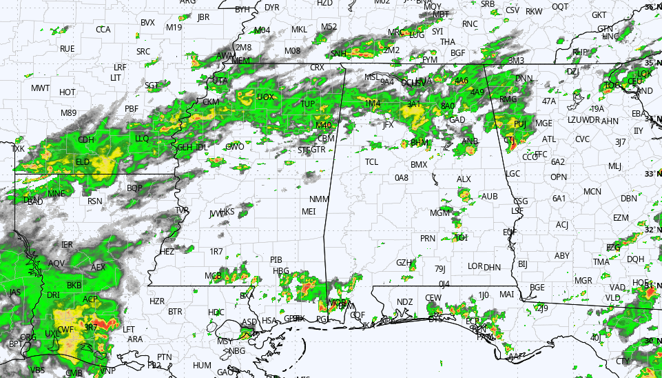
RADAR CHECK: Rain is relatively widespread over the northern third of Alabama this afternoon, where temperatures are only in the 70s and low 80s. South Alabama has seen some sun today, but showers and storms are beginning to increase there at midafternoon. Showers and storms remain possible through the evening, slowly fading late tonight.
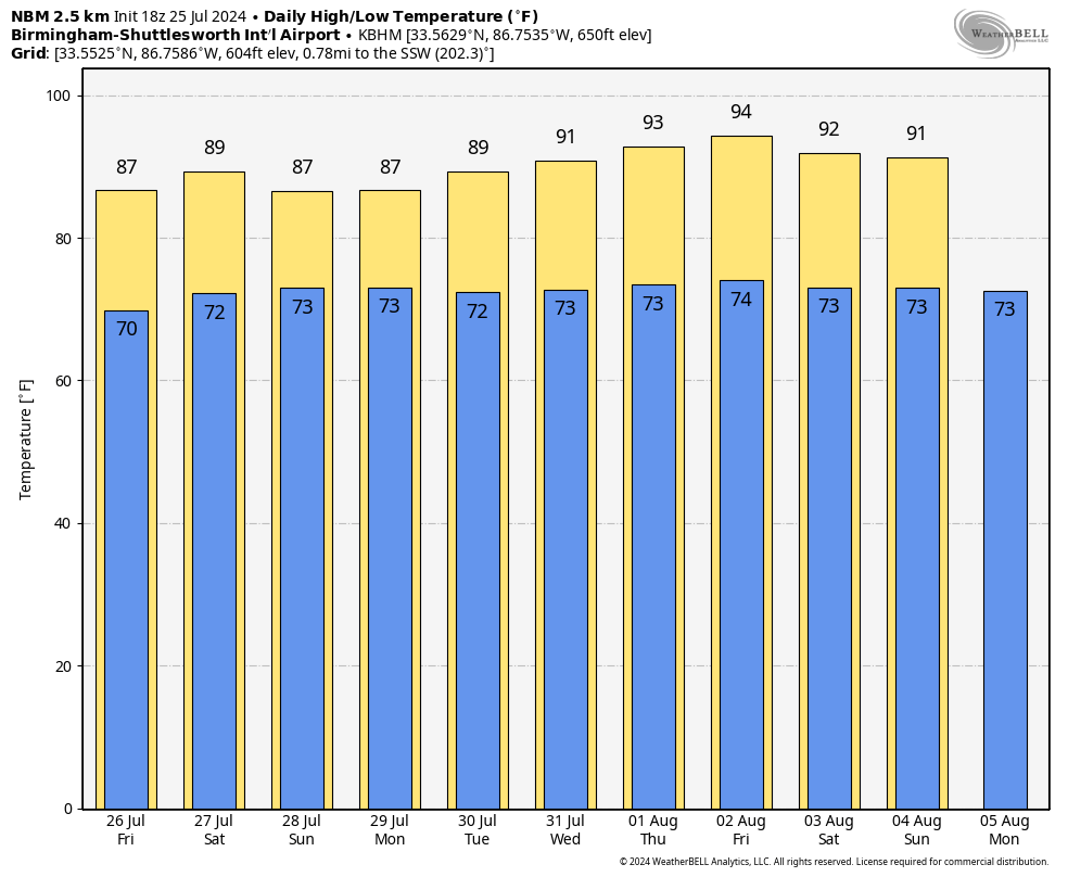
FRIDAY THROUGH SUNDAY: Showers and storms remain possible daily, but they should thin out a bit as the upper ridge tries to slowly rebuild across the Deep South. Most, but not all, of the showers will come from noon to midnight, and with a mix of sun and clouds, highs will be in the mid to upper 80s. The chance of any one location seeing rain each day is 50-60%.
NEXT WEEK: Heat levels continue to creep up, with low 90s likely over the latter half of the week. Expect partly sunny days with scattered, mostly afternoon and evening showers and thunderstorms, which is what we expect in midsummer. The rain next week won’t be as widespread as what we have experienced this week.
 TROPICS: The Atlantic basin remains very calm, and tropical storm formation is not expected through at least the next seven days.
ON THIS DATE IN 1936: Lincoln, Nebraska, saw an all-time high temperature of 115 degrees. The low only dropped to 91 degrees and the average temperature was 103. Many people spent the night outside to escape the heat.
ON THIS DATE IN 2005: The residents of Sand Point, Alaska, saw a rare tornado touchdown on two uninhabited islands. Sand Point is part of the Aleutian Chain and is about 570 miles southwest of Anchorage.
ON THIS DATE IN 2020: Hurricane Hanna made landfall on Padre Island, Texas, with winds of 90 mph. It dumped up to 18 inches of rain in isolated areas in southern Texas and Mexico. The storm also resulted in 50,000-plus people losing power.
For more weather news and information from James Spann and his team, visit AlabamaWx.


