James Spann: Only spotty showers for Alabama through the weekend
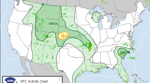
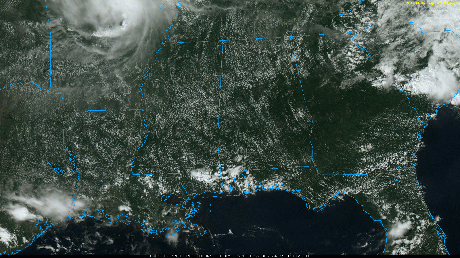
RADAR CHECK: We note a few isolated showers and storms over Mobile and Baldwin counties in far southwest Alabama this afternoon; the rest of the state is dry with a mostly sunny sky. Temperatures are in the 90s in most places. Tonight will be fair with a low in the 70s.
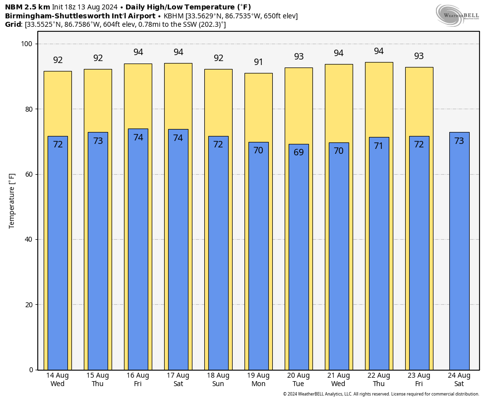
The weather won’t change much through midweek, with only isolated showers Wednesday and Thursday. We will mention a slightly higher coverage of scattered showers and storms on Friday with the approach of a surface front, but even then, the chance of any one spot seeing a shower will be 20-25%. Afternoon highs will stay between 91 and 95 degrees for most communities.
Global models now suggest the front will stall over Tennessee and dissipate over the weekend, meaning a few spotty showers are possible across Alabama Saturday and Sunday, but nothing widespread. With a partly sunny sky, highs will remain between 90 and 95 degrees.
NEXT WEEK: There’s still no sign of any major, widespread rain for the Deep South through the week. We could certainly see a few isolated showers or storms on a few days, but many places will stay dry. Temperatures remain near average for mid-August, with highs mostly between 90 and 94 degrees.
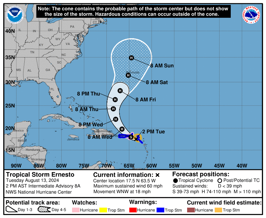
 ERNESTO: Tropical Storm Ernesto this afternoon has winds of 50 mph and is centered about 175 miles east/southeast of San Juan, Puerto Rico. The system is moving to the west/northwest at 18 mph.
Ernesto will be near Puerto Rico late tonight; a tropical storm warning is in effect there. A sharp turn to the north is expected Wednesday in response to an upper trough to the west, keeping Ernesto well east of the U.S. However, it is forecast to be very close to Bermuda Saturday as a Category 2 hurricane.
The rest of the Atlantic basin is very quiet.
ON THIS DATE IN 1987: A succession of thunderstorms produced rainfall that was unprecedented in 116 years of precipitation records at Chicago during an 18-hour period from the evening of Aug. 13 to the early afternoon of Aug. 14. The resulting flash flood was the worst ever to strike the Chicago metropolitan area, causing three deaths and water damage that amounted to $221 million.
ON THIS DATE IN 2004: Hurricane Charley made landfall near the island of Cayo Costa, Florida, as a 150 mph Category 4 hurricane. An hour later, it struck Punta Gorda as a 145-mph storm and then passed up through Port Charlotte and the Charlotte Harbor. However, the eye had shrunk before landfall, limiting the most powerful winds to an area within 7 miles of the center. Charley was initially expected to hit farther north in Tampa and caught many Floridians off-guard due to a sudden change in the storm’s track as it approached the state. Along its path, Charley caused 10 deaths and $16.9 billion in damage to insured residential property, making it the second-costliest hurricane in United States history at the time.
For more weather news and information from James Spann and his team, visit AlabamaWx.


