James Spann: Shower, storm coverage a bit higher in Alabama by Friday, Saturday
James Spann forecasts low rain chances for Alabama until the weekend from Alabama News Center on Vimeo.
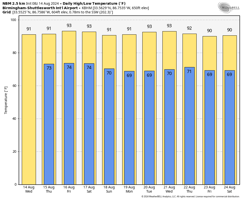
RADAR CHECK: We have a few isolated showers early this morning on radar over northwest Alabama and northeast Mississippi moving southward; these will most likely dissipate over the next few hours. Additional scattered showers could form later today or tonight, but odds of any one spot seeing rain remain around 20%. Otherwise, today will be partly sunny with a high in the low 90s for most spots. Southwest Alabama will see higher heat levels again, with upper 90s.
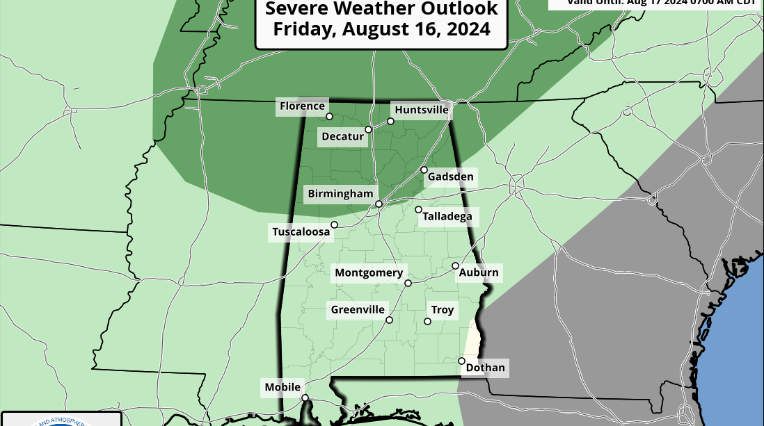
The weather won’t change much Thursday, but by Friday afternoon and evening an approaching front could increase thunderstorms over the northern third of the state. The Storm Prediction Center has defined a marginal risk of severe storms there due to the potential for strong, gusty winds.
THE ALABAMA WEEKEND: The front will sag southward Saturday, and the European global model suggests this will be the day with the highest coverage of showers and storms. Still, it won’t rain everywhere; any one spot stands a 40-50% chance of seeing some rain. A drier air mass works into the state Sunday with a mostly sunny sky and only a small risk of a shower. Highs will be in the low 90s both days.
NEXT WEEK: A dry air mass will mean rain-free weather for most of the state during the first half of the week with lows in the 60s over the northern counties. A few isolated showers or storms could show up by Thursday and Friday, but there’s still no sign of any widespread rain. Highs will remain generally in the low 90s.
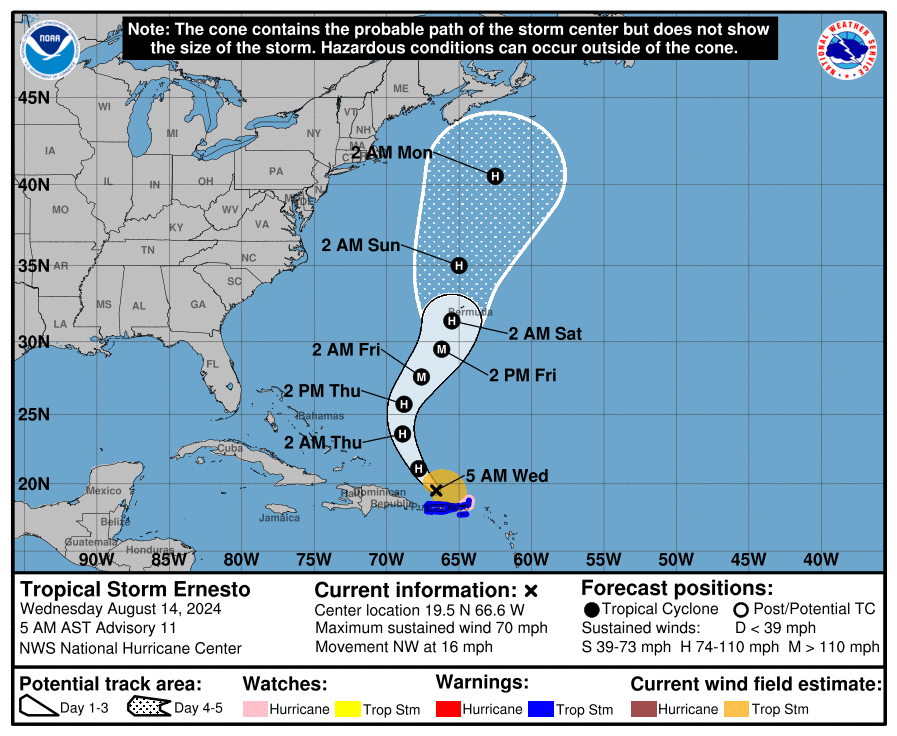
 TROPICS: Ernesto is just under hurricane strength early this morning with sustained winds of 70 mph; the center is about 85 miles north/northwest of San Juan, Puerto Rico. The system is moving northwest at 16 mph, and the turn to the north will continue today. The latest National Hurricane Center track has Ernesto near Bermuda late Friday night and early Saturday morning at Category 2 strength.
 Ernesto is no threat to the U.S., and the rest of the Atlantic basin is very quiet.
ON THIS DATE IN 1953: Hurricane Barbara hit North Carolina as a Category 2 hurricane. Damage from the storm was relatively minor, totaling around $1.3 million (in 1953 U.S. dollars). Most of it occurred in North Carolina and Virginia from crop damage. The hurricane left several injuries, some traffic accidents and seven fatalities in the eastern United States; at least two were due to electrocution from downed power lines. Offshore Atlantic Canada, a small boat sank, killing its crew of two.
ON THIS DATE IN 1969: Hurricane Camille, a powerful, deadly and destructive hurricane formed just west of the Cayman Islands. It rapidly intensified, and by the time it reached western Cuba the next day, it was a Category 3 hurricane. Camille was spawned on Aug. 5 by a tropical wave off the coast of Africa. The storm became a tropical disturbance on Aug. 9 and a tropical storm Aug. 14.
For more weather news and information from James Spann and his team, visit AlabamaWx.


