James Spann: Generally dry pattern, warm afternoons for Alabama through the weekend

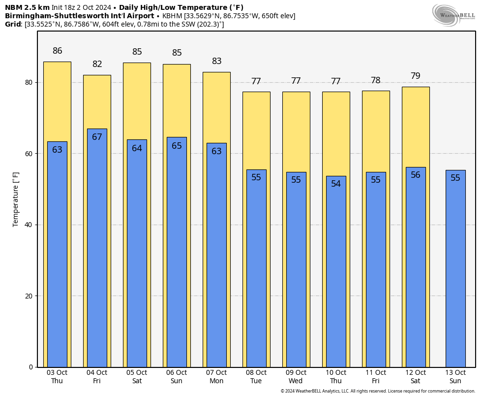
WARM OCTOBER AFTERNOON: Temperatures are mostly in the mid 80s across Alabama this afternoon with a partly to mostly sunny sky. There’s nothing on radar, and tonight will be fair and pleasant with a low in the 60s.
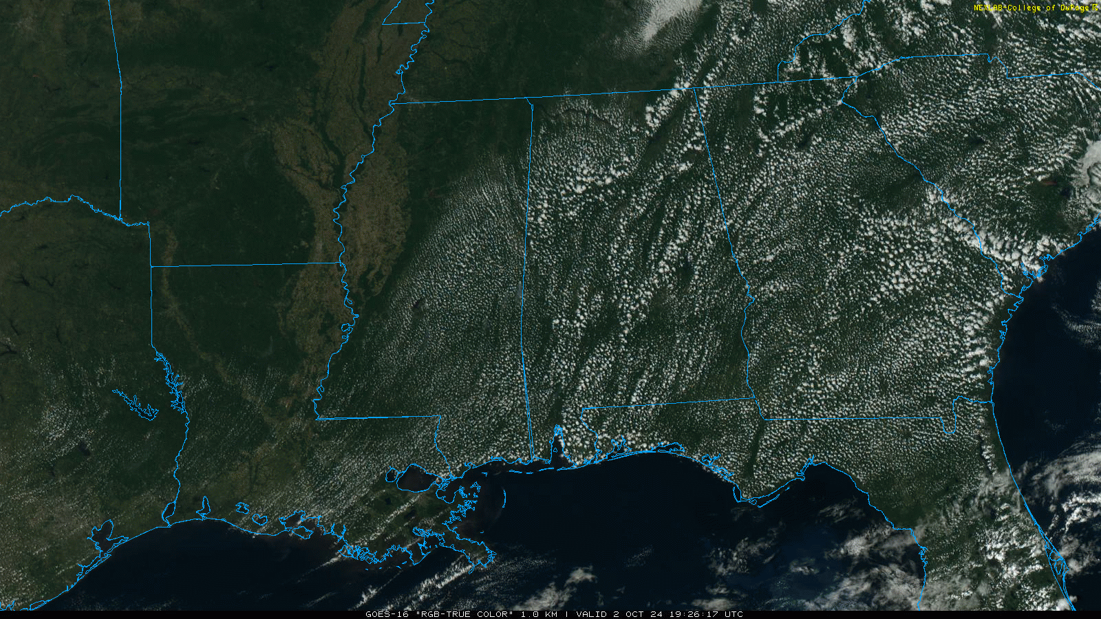
Thursday will be another warm, dry day for most of the state, although a few scattered showers could show up near the Gulf Coast.
FRIDAY AND THE WEEKEND: We will bring in a risk of scattered showers statewide on Friday, but nothing really widespread or heavy. The weekend will be mostly rain-free with only a few showers near the coast. The weather stays warm, with highs in the mid 80s in most places. Days will be partly sunny and nights fair, with morning lows in the 60s.
NEXT WEEK: The quiet October weather pattern continues. Most of the week will be rain-free; cooler air arrives Tuesday following the passage of a dry cold front. After Monday, highs will be in the mid to upper 70s over the northern half of the state, with lows in the 50s. The highs will be close to 80 over south Alabama.
 TROPICS: Hurricane Kirk is in the eastern Atlantic with winds of 80 mph; it becomes a major hurricane Thursday. Kirk will turn north and then northeast over the open Atlantic; it is no threat to land.
Tropical Depression 13, east of Kirk, is forecast to become Hurricane Leslie by the weekend. It will follow the same path and stay far from land.
Closer to home, a broad trough of low pressure is producing disorganized showers and thunderstorms over the northwestern Caribbean Sea and the southwestern Gulf of Mexico. Environmental conditions could support some gradual development of this system, and a tropical depression could form over the weekend as the broader disturbance moves fully into the Gulf of Mexico. Interests along the U.S. Gulf Coast should continue to monitor the progress of this system. Regardless of development, locally heavy rains could occur over portions of Mexico during the next several days and over portions of the Florida Peninsula by the weekend.
The National Hurricane Center continues to give it a 40% chance of development over the next seven days. Global models continue to suggest this will be a disorganized, broad tropical low that will mainly bring rain to the Florida Peninsula (not the panhandle).
RACE WEEKEND: A few spotty showers are possible Friday at Talladega, but the weather will be dry Saturday and Sunday with a good supply of sunshine both days. Highs will be in the low to mid 80s, lows in the 60s.
FOOTBALL WEATHER: It will be dry and pleasant for the high school games Friday night; temperatures will fall through the 70s.
Saturday, UAB will host Tulane at Protective Stadium in downtown Birmingham (noon kickoff). The sky will be mostly sunny with temperatures in the low to mid 80s.
Auburn will be on the road at Georgia (2:30 p.m. CT kickoff). The sky will be sunny with temperatures in the low 80s through most of the game.
Alabama travels to Nashville to take on Vanderbilt (3:15 p.m. CT kickoff). Expect a sunny sky with temperatures falling from near 85 degrees at kickoff to near 80 by the final whistle.
ON THIS DATE IN 1898: A Category 4 hurricane made landfall in Georgia, the most recent major (Category 3 or stronger) hurricane to make landfall in Georgia.
For more weather news and information from James Spann and his team, visit AlabamaWx.


