James Spann: Rain, a few thunderstorms for Alabama Tuesday
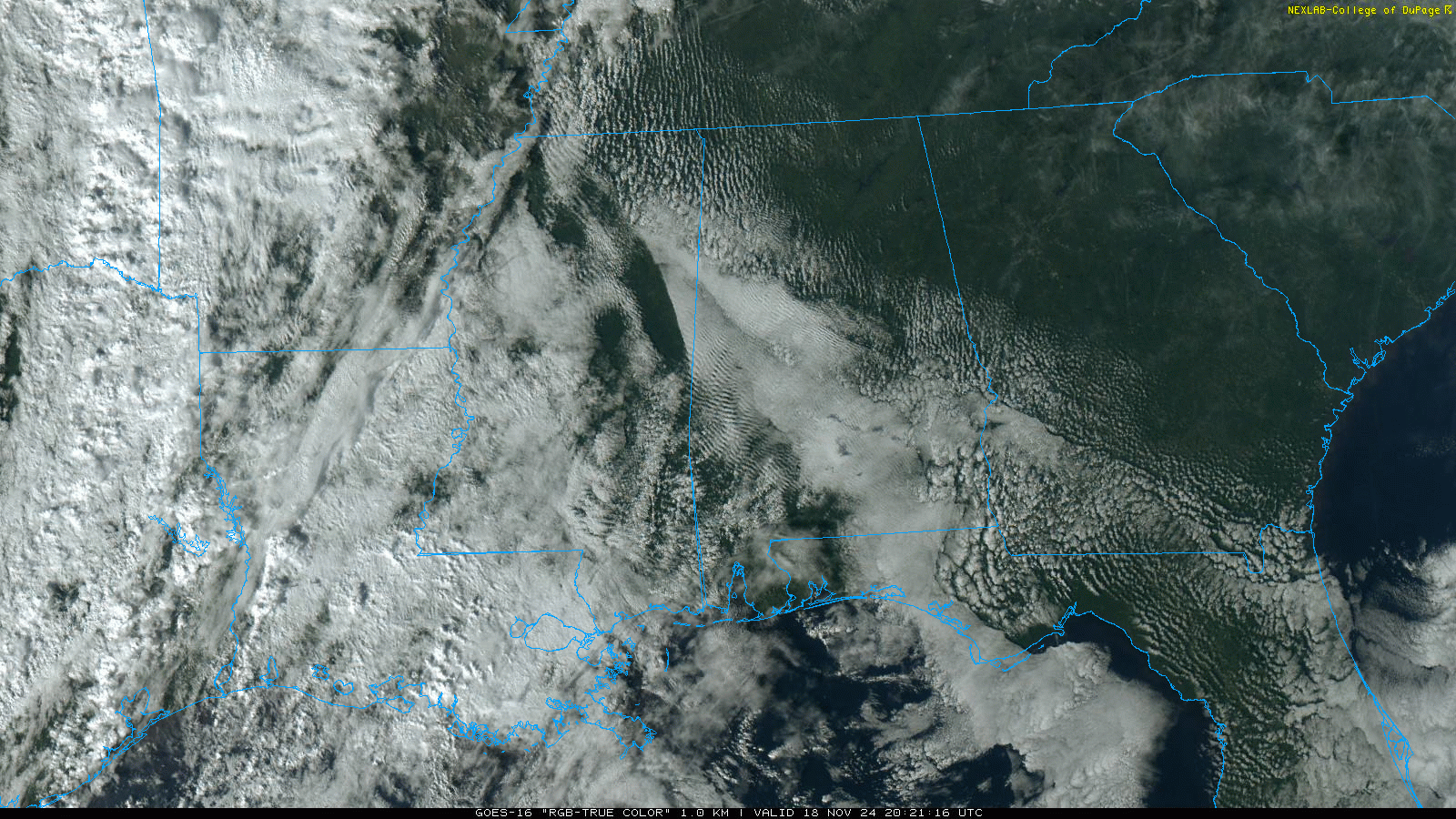
BIG CHANGES AHEAD: Temperatures are mostly in the 70s across Alabama this afternoon with a partly sunny sky. Clouds will increase tonight ahead of an approaching storm system, and rain could reach the western counties after midnight.
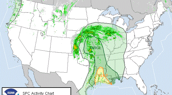
Rain becomes widespread across Alabama Tuesday, and with tropical moisture involved we expect amounts of 2-3 inches for the southern half of the state. Amounts will be close to 1 inch for the northern counties. The Storm Prediction Center has a decent part of the state in a marginal risk (level 1 out of 5) of severe thunderstorms.
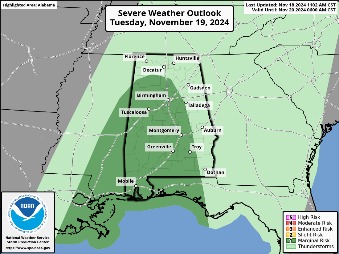
The air will be fairly stable, but where thunderstorms do form, they will be capable of producing gusty winds. A brief, isolated tornado can’t be ruled out across the southwest corner of the state.
The sky becomes partly sunny Wednesday, and showers will be confined to the southeast corner of the state around Dothan.
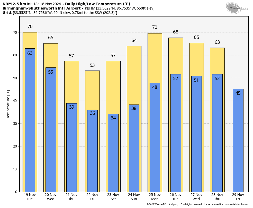
COLDER: The coldest air so far this season arrives Thursday; highs drop into the 50s over the northern half of the state with a brisk north wind. Lows will be in the 30s over much of the state by Friday morning. The coldest morning will likely come early Saturday, when a freeze is likely for much of north and central Alabama; mid 30s are likely down into the southern counties, along with widespread frost.
Highs remain in the 50s across the northern half of the state Saturday, rising into the 60s Sunday. The weather will be dry Thursday through Sunday with sunny days and fair nights.
THANKSGIVING WEEK: At this point global models suggest the weather will be dry Monday and Tuesday, followed by a few waves of rain and possible thunderstorms over the latter half of the week. Highs will be generally in the 60s.
TROPICS: The Atlantic basin is now very quiet. Tropical storm formation is not expected over the next seven days. Hurricane season ends Nov. 30.
ON THIS DATE IN 1957: Alabama was bracing for another round of severe weather in the wake of tornadoes the day before that had killed three in Walker County. The first signs of trouble in Alabama came around 2:30 p.m. as what was likely an F2 tornado skipped along a 28-mile path from Forkland to near Sawyerville and Havana Junction in Greene and Hale counties.
A few minutes later, farther north, a tornado traveled along Alabama Highway 69 for three miles north of Tuscaloosa. This same storm may have been the one that produced a tornado in the Birmingham area less than an hour later. The tornado first touched down at 3:30 p.m. in Ensley and moved northeast, affecting North Birmingham around ACIPCO, Tarrant City and Huffman. Pratt City, Dolomite and Pleasant Grove also reported damage. One person was killed in Ensley.
The deadliest tornado on that November Monday afternoon was one that touched down in Blount County east of Cleveland, passed east of Snead and ended in Marshall County northwest of Albertville after a 27-mile rampage. The four deaths from this tornado occurred in Blount County, where 40 homes were destroyed.
A reminder that November is a big part of Alabama’s tornado season, which runs from November through May.
For more weather news and information from James Spann and his team, visit AlabamaWx.


