James Spann: Alabama stays dry through Friday; showers, storms return over the weekend

FOGGY START: A dense fog advisory is in effect for the southern half of Alabama early this morning; the fog will dissipate by 9 a.m. in most places.
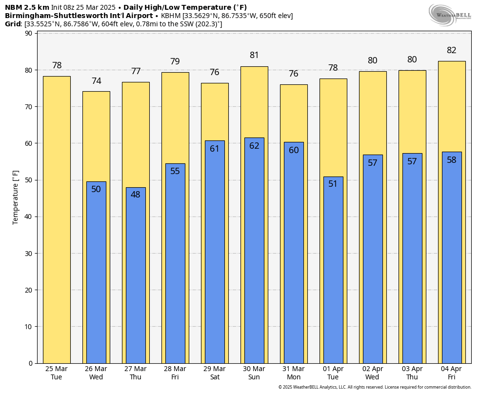
Alabama’s weather will be rain-free through Friday with partly to mostly sunny, mild days and fair, cool nights. Highs will be mostly in the mid to upper 70s, but a few spots will reach the low 80s today and again on Friday.
STORMS RETURN: Moisture surges northward, and we will bring in a chance of showers and thunderstorms Saturday. For now, we aren’t expecting severe storms, and it won’t be an all-day kind of rain, but occasional showers are likely along with some thunder; the high will be in the mid to upper 70s.
A dynamic weather system with strong wind fields will bring an organized batch of storms into the Deep South Sunday night into Monday morning. The Storm Prediction Center has defined a risk of severe storms Sunday night for roughly the northern two-thirds of the state in its outlook valid through 7 a.m. Monday.
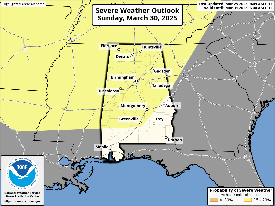
The risk of severe storms will likely persist through midday Monday across east and southeast Alabama. While the synoptic (large) scale pattern favors severe storms, we won’t know the mesoscale details for a few more days. It is still too early to know the magnitude of the event, the timing and the primary threats and hazards. Rain amounts over the weekend will be around 1 inch for north Alabama, with one-half inch for the southern counties. Highs Saturday and Sunday will be between 77 and 82 degrees.
ON THIS DATE IN 2021: Eleven tornadoes touched down across Alabama, some of them long-track. One EF-3 tornado carved a path of damage spanning 80.38 miles over its 98-minute lifespan from Hale to Shelby counties. This was a single tornado, putting it at No. 7 for the longest single tornado track in Alabama.
Six people were killed by an EF-3 tornado that was down for 38 miles through parts of Calhoun and Cherokee counties. Another EF-3 tornado touched down near West Blocton and then moved through some highly populated neighborhoods in north Shelby County. Damage was severe in neighborhoods like Eagle Point, Greystone Farms and Shoal Creek. This tornado was down for 50 miles, and there were five injuries.
For more weather news and information from James Spann and his team, visit AlabamaWx.


