Scott Martin: Nice weekend for Alabama; no severe weather threats through the next 7 days

A quiet, stable weather pattern is expected across Alabama for the next seven days, with no threat of severe weather anticipated during this period.
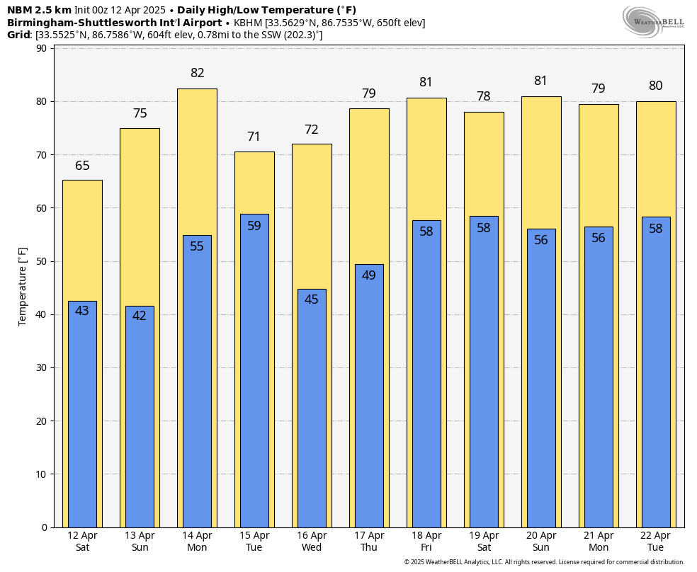
THIS WEEKEND: Today will be a textbook example of spring weather across Alabama. Under the influence of a strong surface high-pressure system, skies will remain clear throughout the day. High temperatures will range from the lower 60s across northern Alabama to the mid 70s in southern areas. Winds will be breezy at times, with gusts up to 20 mph possible. Dry, sunny conditions continue into Sunday. Morning lows will be on the cooler side, especially in northern counties, but temperatures will rebound nicely during the afternoon, with highs ranging from the upper 60s to upper 70s. The persistent upper-level ridge will continue to suppress cloud development and maintain calm weather conditions.
THE WORK WEEK AHEAD: Temperatures begin to trend warmer on Monday as the upper ridge gradually shifts southeastward and a southwest flow sets up. Highs are expected to climb into the upper 70s and may approach the low 80s in some southern locations. Sunshine will prevail through much of the day before cloud cover increases late in the afternoon ahead of an approaching cold front. An isolated shower cannot be ruled out, though the probability of measurable precipitation remains low.
On Tuesday, slightly cooler air arrives in the wake of Monday’s front, though conditions will remain pleasant. High temperatures will range from the upper 60s to upper 70s, and skies will gradually clear as surface high pressure reestablishes itself across the region. Another dry and seasonable day is expected on Wednesday. Abundant sunshine and light winds will accompany highs in the upper 60s to upper 70s across most areas.
On Thursday, cloud coverage may increase slightly during the day, though sunshine should still dominate. Temperatures will reach into the mid 70s to near 80 degrees. By late Thursday night, the ridge begins to weaken, and there is a low-end chance for isolated showers to develop after midnight. No significant rainfall is expected at this time. On Friday, partly cloudy skies and warm temperatures are on tap. Highs will range from the mid 70s to mid 80s. While a few isolated showers may develop, the majority of the state is expected to remain dry.
THE BOTTOM LINE: A generally dry, mild stretch of spring weather is ahead, with ample sunshine and above-average temperatures. While isolated showers may develop late in the week, the overall risk of impactful weather remains low, and no severe weather is forecast. Enjoy the beautiful weather ahead.
For more weather news and information from James Spann, Scott Martin and other members of the James Spann team, visit AlabamaWx.


