Bill Murray: More widespread rain, storms for Alabama today
Bill Murray has the forecast for a wet Tuesday in Alabama from Alabama NewsCenter on Vimeo.
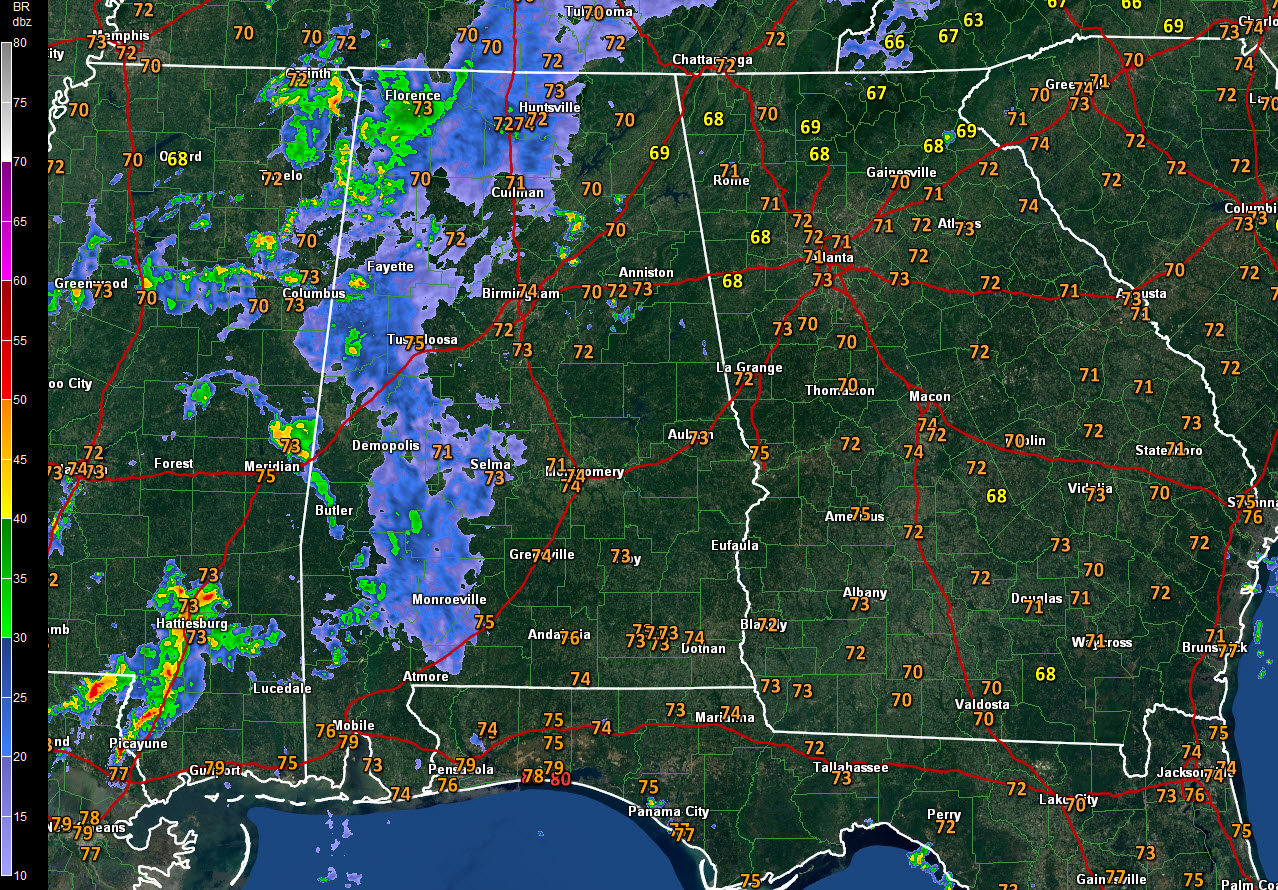
Showers and storms were hard to come by on Monday, but that should change today as an upper-level disturbance and wave of moisture combine to create a better chance of rain and thunderstorms.
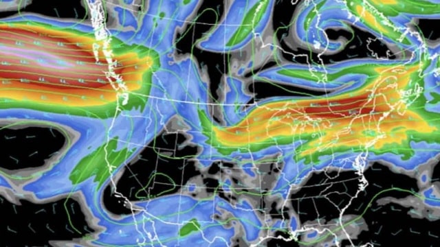
ON THE WEATHER MAPS: An upper-level disturbance is swinging through the southeastern United States, part of a broad trough that covers much of the country. At the surface, low pressure extends from the Great Lakes to Texas. A huge ridge of high pressure is centered east of Bermuda, putting Alabama in a southerly flow of moisture off the Gulf of Mexico.
HIGHER RAIN CHANCES TODAY: Rain and thunder should become widespread across much of Alabama today thanks to the upper-level energy and moisture over the state. We can’t rule out a strong storm, but wind shear is light, so storms will have a hard time organizing. They still will produce heavy rain, dangerous lightning and some gusty winds. Highs today will be in the lower and middle 80s. With lingering clouds and high humidity, overnight lows will drop only to around 70.
LESSER CHANCES WEDNESDAY: As the energy from the trough moves off to the northeast, our rain chances should decrease. But with a warm, moist air mass in place across the state, scattered showers and storms will break out again with the heating of the day. Temperatures will be a few degrees warmer than those of today.
STRONG STORMS ON THURSDAY? We will have to watch out for a better chance of organized storms on Thursday as the main trough approaches with its stronger wind fields and colder air aloft. Hail and damaging winds will be the primary threats, although we can’t rule out a tornado threat as well. Stay tuned concerning this developing situation.
HIGH PRESSURE TO RETURN: High pressure will gradually take back control of our weather by the end of the week, with diminishing rain chances into the weekend. The mercury will respond, returning to highs in the 90-degree range with lows in the lower 70s for the weekend.
RAINFALL TOTALS: We’re still expecting rainfall amounts to average between 1 and 1.5 inches across central Alabama over the next seven days — not a tremendous amount, but probably enough to at least help us hold our own in the rainfall department.
GULF COAST WEATHER: It will be another beautiful, fairly typical June day along the beaches of Alabama and northwest Florida, with eight or so hours of sunshine; widely scattered, mainly afternoon and evening thunderstorms; highs near 90 and lows in the middle 70s. Rain and storms will increase starting Wednesday and lasting into Friday. Things will return to fairly typical summerlike conditions by the weekend. Water temperatures are running around 83 degrees. Click here to see the Beach Forecast Center page.
WEATHERBRAINS: This week, the panel talked to Bryan Busby, chief meteorologist from KMBC in Kansas City. Check out the weekly netcast that’s all about the weather at WeatherBrains.com.
ON THIS DATE IN 2015: San Antonio picked up 2.43 inches of rain in one hour between 6 and 7 p.m. as powerful thunderstorms exploded over the northeast part of Bexar County. They quickly shot through the equilibrium level of 50,000 feet. By 7 p.m., the daily total stood at 2.64 inches, which established a new record for the date. Numerous roads were closed in San Antonio. Follow my weather history tweets on Twitter. I am @wxhistorian at Twitter.com.
For more weather news and information from James Spann, Bill Murray and other members of the James Spann team, visit AlabamaWx.


