James Spann: Cold rain continues tonight in Alabama
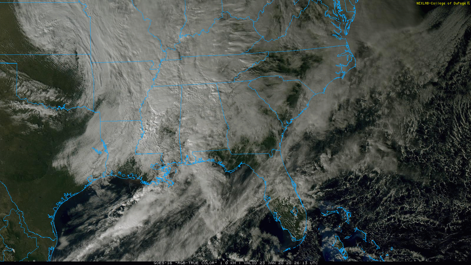
RADAR CHECK: Rain covers much of Alabama this afternoon. It is a cold rain, with temperatures generally in the 40s over the northern half of the state; we are seeing 50s over south Alabama. Occasional rain will continue tonight; the rain will end from west to east early Friday morning.
Clouds will linger much of the day Friday, although we could see a few intervals of afternoon sunshine. An upper trough will be swinging through, so a few showers could pop up during the afternoon, but most of the day should be dry with a high in the low to mid 50s.
THE ALABAMA WEEKEND: Saturday will be dry; with a partly sunny sky we expect a high in the mid 50s. Then, on Sunday, clouds will increase, and some light rain is possible Sunday night with a wave passing through the northern Gulf of Mexico. The high Sunday will be in the 52- to 55-degree range, not far from average for late January in Alabama.
NEXT WEEK: A fast flow pattern will keep the weather very active across the state. Patchy light rain is still possible Monday morning, but Monday afternoon and Tuesday should be dry. The next wave brings a chance of rain Tuesday night into Wednesday, followed by another rain event Friday. For now we see no risk of severe storms with a fairly stable air mass in place; highs through the week will be mostly in the 50s. 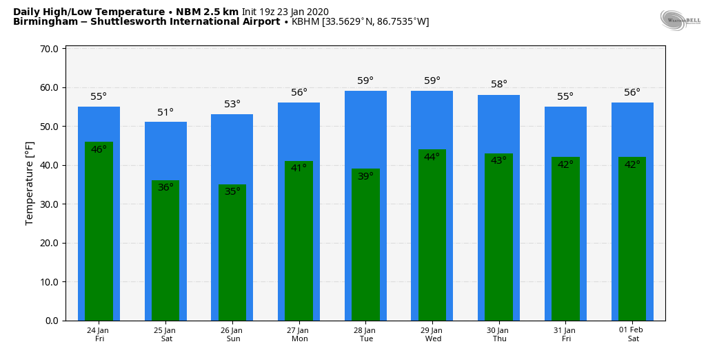
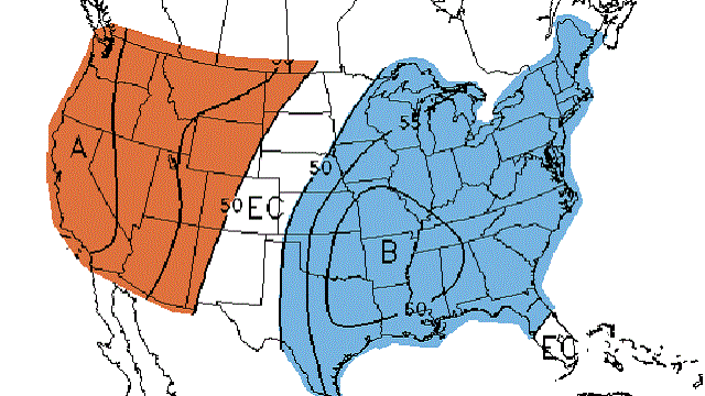
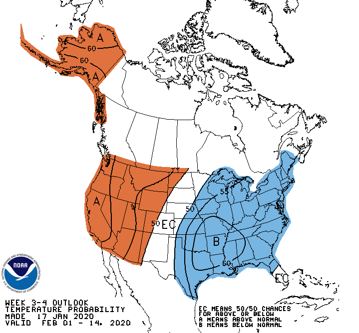
The new Climate Prediction Center outlooks suggest near-average temperatures in early February, dropping to below average by mid-month. Winter is far from over.
ON THIS DATE IN 2012: An EF-3 tornado tore through Center Point and Clay before dawn, killing one person and injuring many others. A total of 231 homes and businesses were damaged or destroyed. The tornado damage path was approximately 15.5 miles long and was 880 yards wide at its widest point. Earlier that morning, an EF-2 moved through western Jefferson County, killing one person near Oak Grove.
ON THIS DATE IN 1969: An F4 tornado cut a 120-mile-long path from Jefferson through Copiah, Simpson, Smith, Scott and Newton counties in Mississippi, killing 32 and injuring 241 others. Property damage was estimated at $2 million. An inbound Delta Airlines aircraft reported a hook echo on its scope with this storm.
ON THIS DATE IN 1940: A total of 9.5 inches of snow fell at Birmingham in the midst of the city’s longest cold wave. It is the second-largest daily snow total on record, surpassed only by the “Blizzard of 93,” when 13 inches fell.
BEACH FORECAST: Click here to see the AlabamaWx Beach Forecast Center page.
WEATHER BRAINS: You can listen to our weekly 90-minute show any time on your favorite podcast app. This is the show all about weather featuring many familiar voices, including the meteorologists at ABC 33/40.
CONNECT: You can find me on the major social networks:
Facebook
Twitter
Instagram
Pinterest
Snapchat: spannwx
For more weather news and information from James Spann and his team, visit AlabamaWx.


