James Spann: Alabama stays dry on Thursday
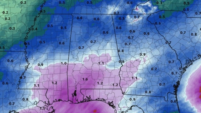
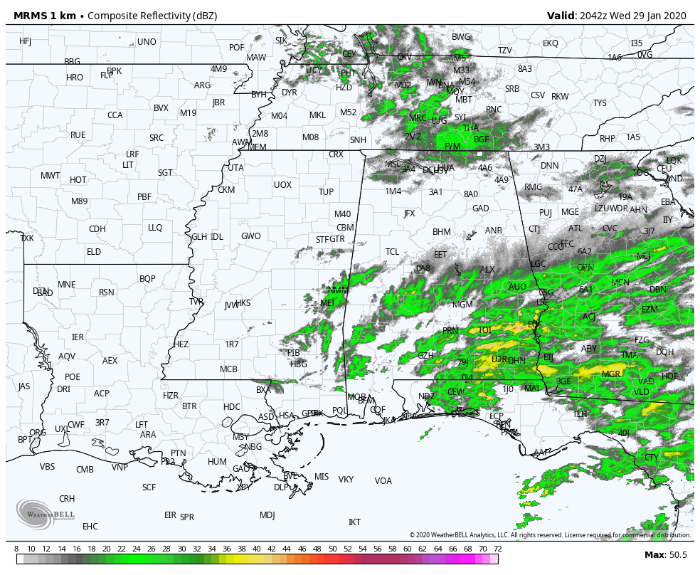
RADAR CHECK: Most of the rain across Alabama this afternoon is over the southern half of the state, south of a line from Eutaw to Clanton to Alexander City. There are a few sprinkles over the Tennessee Valley of far north Alabama; otherwise the sky is cloudy with temperatures mostly in the 50s. Rain ends this evening and we expect gradual clearing tonight. Some fog is possible after midnight.
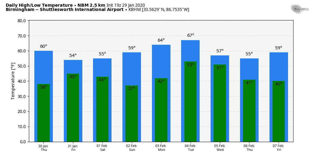
Thursday will be a dry day; the sky will be partly to mostly sunny with a high in the low 60s. Clouds return Thursday night and the next wave brings a few periods of light rain Friday. Friday will be cooler, with a high in the low 50s.
THE ALABAMA WEEKEND: A deep upper trough will swing through Saturday, and it could squeeze out a few widely scattered showers, especially during the morning. Otherwise Saturday will feature more clouds than sun with a high in the mid 50s. Sunday should be a wonderful winter day with lots of sunshine and a high around 60 degrees.
NEXT WEEK: Monday will be dry and mild, with a high in the 60s; then the next wave brings a good chance of rain and thunderstorms Tuesday and Tuesday night. If some surface-based instability develops, we could see a few strong thunderstorms with this feature. The rest of the week looks dry and cooler.
There’s still no sign of any bitterly cold, Arctic air for the Deep South in the next seven to 10 days.
ON THIS DATE IN 2016: Eleven tornadoes touched down across Alabama. Damage occurred in Pickens, Lamar, Marion, Fayette, Winston, Marengo, Hale, Lee and Chambers counties. This storm system produced damage from Texas to the Carolinas. Two EF-2 tornadoes touched down in Winston County, one near Ashridge and another near Helicon. An EF-1 produced damage near Guin and Brilliant in Marion County.
ON THIS DATE IN 2002: A major three-day winter storm blasted parts of Kansas and Missouri. A catastrophic ice storm occurred south of the snow area, with 2 inches of ice and snow accumulating in the Kansas City, Missouri area. Thousands of trees were felled by the storm, blocking roads, felling utility lines and causing fires. Two “bicentennial trees” that were estimated at being more than 200 years old were badly damaged. After Jan. 31, 325,000 people were reportedly without power in Kansas City alone.
STORM SPOTTER TRAINING: Our annual storm spotter training is Saturday, Feb. 8 at the Hoover Met. It begins at 9:30 and there is no cost. We will offer both the basic and advanced training sessions; we expect to wrap up by 2:30. No need to register; just show up with a curious mind. We need more trained storm spotters. Help us make the warning process better.
BEACH FORECAST: Click here to see the AlabamaWx Beach Forecast Center page.
WEATHER BRAINS: You can listen to our weekly 90-minute show any time on your favorite podcast app. This is the show all about weather featuring many familiar voices, including the meteorologists at ABC 33/40.
CONNECT: You can find me on the major social networks:
Facebook
Twitter
Instagram
Pinterest
Snapchat: spannwx
For more weather news and information from James Spann and his team, visit AlabamaWx.


