James Spann: Significant flooding risk for northern half of Alabama
James Spann forecasts a wet start to the work week for Alabama from Alabama NewsCenter on Vimeo.
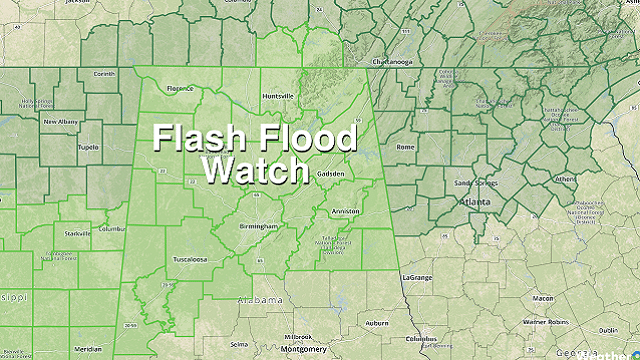
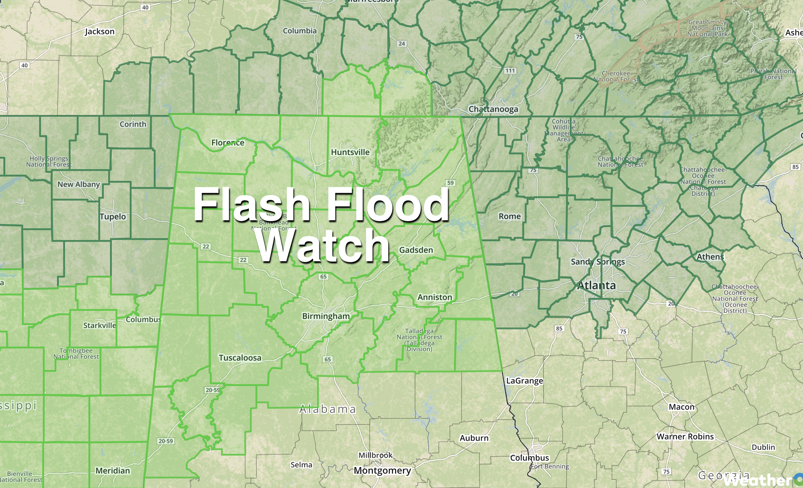
TOO MUCH RAIN: Rain is increasing across Alabama early this morning; we note a few thunderstorms embedded in the large-area mass over the western counties of the state. Soaking rains are likely through tonight, and a flash flood watch is in effect for about the northern half of the state, where 24-hour rain totals could exceed 3 inches.
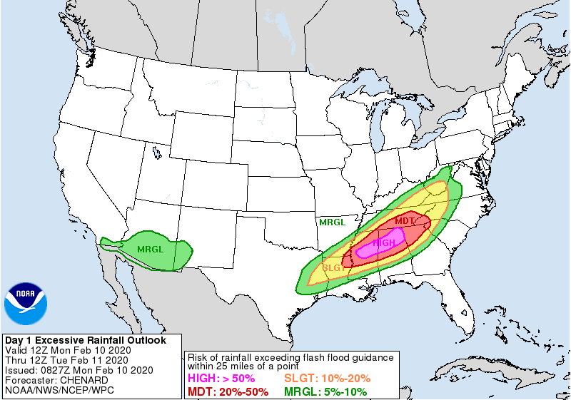
NOAA’s Weather Prediction Center has defined a high risk of flooding across north and central Alabama through tonight. Because of the recent rains and saturated soil, flooding is a very real concern — not only flash flooding, but longer-term river flooding. If you live in a flood-prone area or along a creek or river, pay close attention to flood warnings and statements.
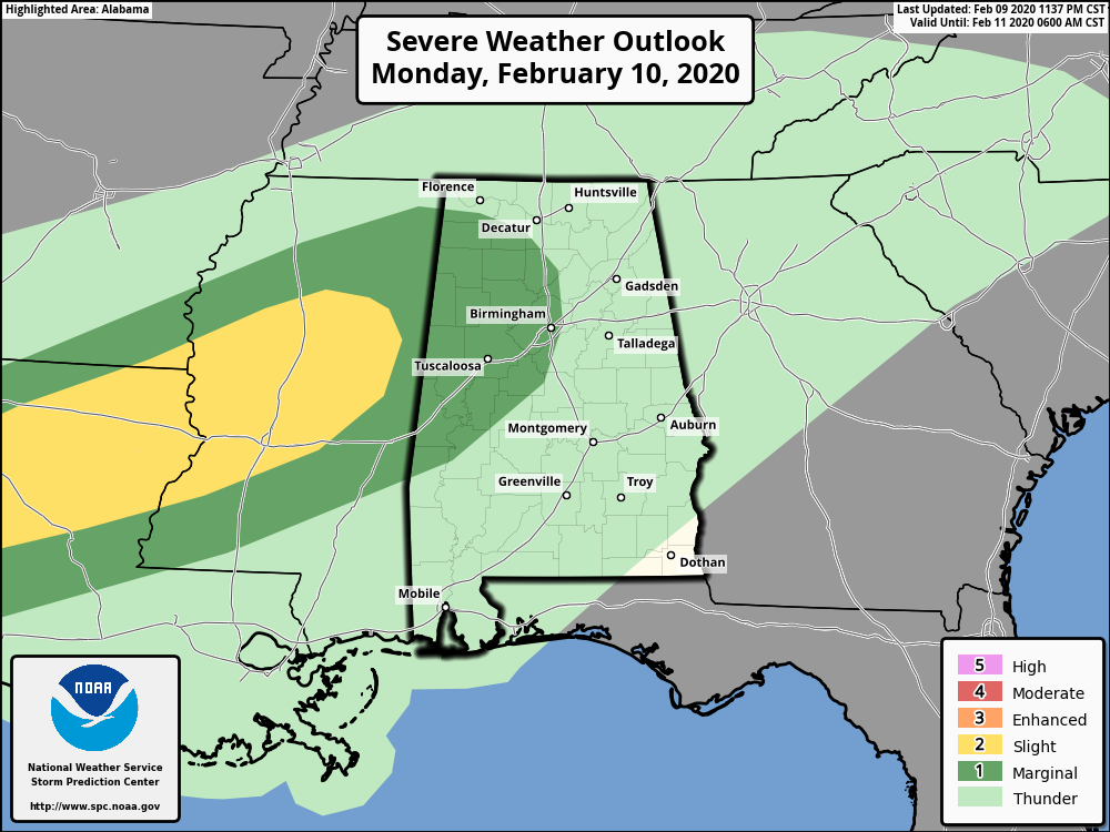
The Storm Prediction Center has a marginal risk (level 1 out of 5) of severe thunderstorms defined for parts of west Alabama though tonight; a few storms could produce small hail and gusty winds, but we are not expecting a major issue with severe thunderstorms through tonight.
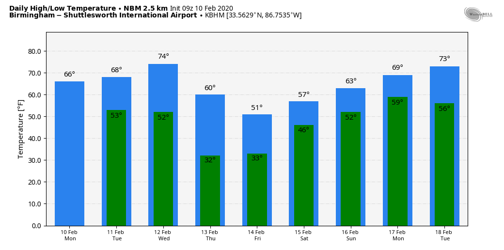
Temperatures will be mild today, with a high generally in the mid 60s.
TUESDAY: The weather stays wet with occasional rain — perhaps not as heavy as what we will experience today, and no severe storms are expected. Again the high will be in the mid 60s.
SEVERE POTENTIAL WEDNESDAY NIGHT: The day Wednesday will be mostly cloudy and mild, with a high in the low to mid 70s; a few showers are likely as a moist air mass stays in place. Severe thunderstorms become possible statewide Wednesday night ahead of a dynamic weather system with strong wind fields. The SPC has defined an enhanced risk (level 3 of 5) for a small part of west Alabama, with a slight risk (level 2 of 5) for most of the rest of the state. Far east and southeast Alabama is under a marginal risk (level 1 of 5).
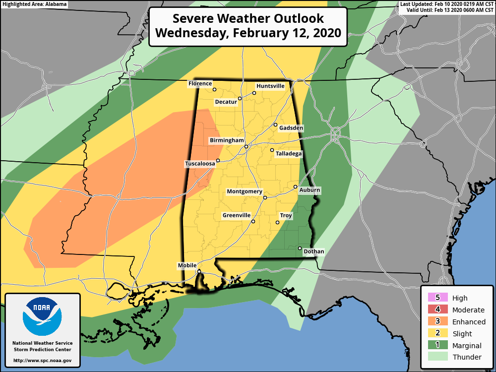
For now it looks like the main window for heavier storms will come from 6 p.m. Wednesday through 6 a.m. Thursday. If instability values can rise sufficiently, all modes of severe weather will be possible, including hail, damaging winds and a few tornadoes, somewhat similar to the event we experienced last Wednesday night. And more flooding is very possible.
THURSDAY/FRIDAY: Rain ends early in the day Thursday; some clearing is possible by afternoon with temperatures holding in the 50s. Friday will be mostly sunny; we start the day with a low between 28 and 32; the high will be close to 50 degrees.
THE ALABAMA WEEKEND: Saturday will be dry with a partly sunny sky and a high in the 50s. Clouds increase Saturday night, and wet weather returns Sunday with periods of rain. Sunday will be fairly mild with a high in the 60s.
NEXT WEEK: The pattern continues to favor mild, wet weather for a decent part of the week as the coldest air in the nation remains out west and over Alaska.
ON THIS DATE IN 1981: An EF-2 tornado moved through Bay Minette, striking the middle school shortly after the school day started. The school’s gymnasium was severely damaged and 62 people were hurt, including 44 students.
BEACH FORECAST: Click here to see the AlabamaWx Beach Forecast Center page.
WEATHER BRAINS: You can listen to our weekly 90-minute show any time on your favorite podcast app. This is the show all about weather featuring many familiar voices, including the meteorologists at ABC 33/40.
CONNECT: You can find me on the major social networks:
Facebook
Twitter
Instagram
Pinterest
Snapchat: spannwx
For more weather news and information from James Spann and his team, visit AlabamaWx.


