James Spann: Occasional showers, storms for Alabama through Wednesday
James Spann forecasts more unsettled weather for Alabama from Alabama NewsCenter on Vimeo.
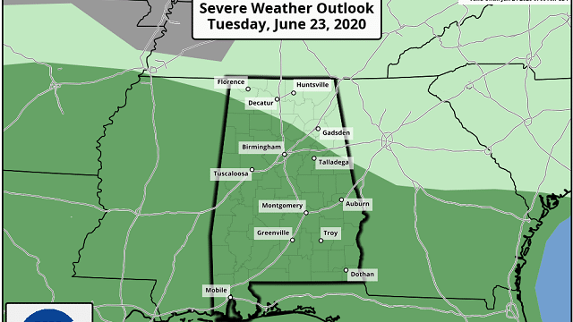
RADAR CHECK: A batch of showers is passing through the northern half of the state early this morning. There’s not much thunder, but the rain is heavy in spots. More showers and thunderstorms will form later today in the moist, unstable environment across Alabama, and a few strong storms are possible again. The Storm Prediction Center has a marginal risk (level 1 out of 5) of severe thunderstorms defined for roughly the southern two-thirds of the state.
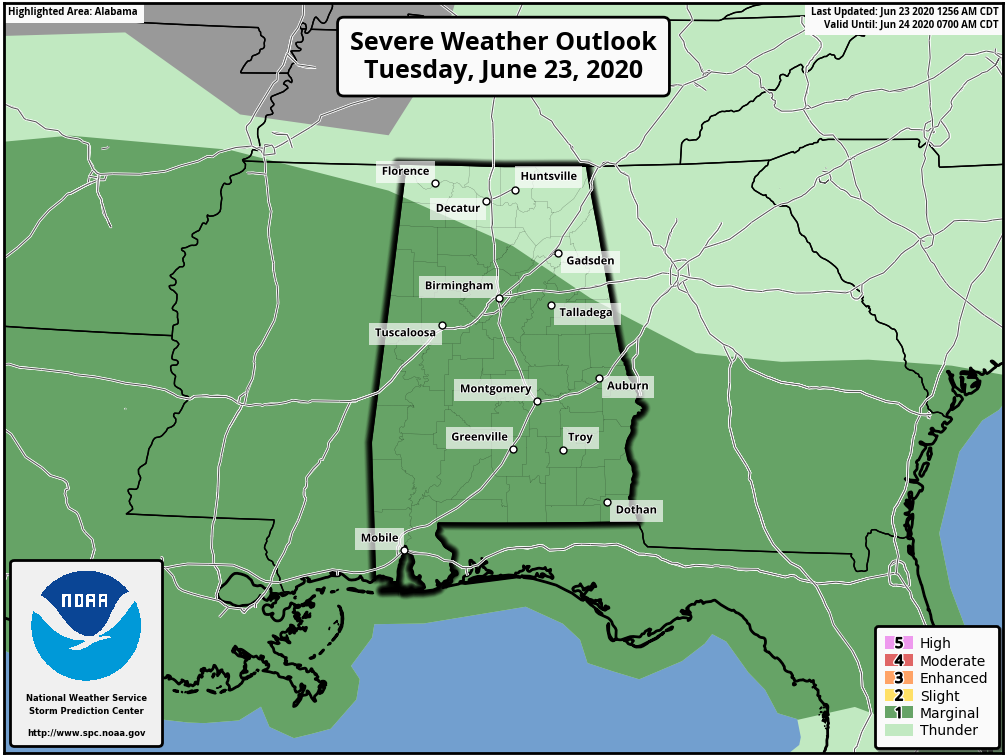
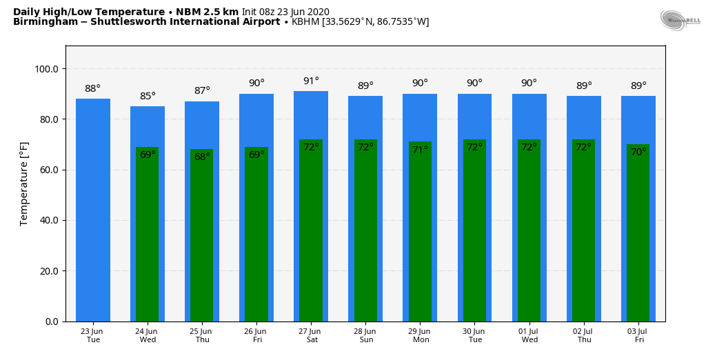
Heavier storms this afternoon will be capable of producing small hail and strong, gusty winds. Otherwise, today will feature more clouds than sun with a high in the mid 80s for most communities.
REST OF THE WEEK: Scattered to numerous showers and thunderstorms are likely Wednesday with a high in the 80- to 85-degree range. Showers should become a little more scattered Thursday and Friday, and mostly during the afternoon and evening. The high will be in the mid 80s Thursday, followed by upper 80s Friday.
ThE ALABAMA WEEKEND: Look for more warm, humid weather Saturday and Sunday with a mix of sun and clouds both days, along with random, scattered, mostly afternoon and evening showers and thunderstorms. Highs will be in the 85- to 90-degree range. Pretty standard summer weather for Alabama.
NEXT WEEK: We will roll with a persistence forecast through the week — partly sunny days and the usual risk of scattered, mostly afternoon and evening showers and thunderstorms. Highs through the week will be generally between 87 and 92.
TROPICS: Subtropical Depression Four formed Monday in the Atlantic well east of the U.S. coast. While it is possible the depression could become a storm later today, rapidly cooling sea surface temperatures should cause the system to weaken Wednesday and open up into a trough on or before Thursday. The rest of the Atlantic basin is quiet.
AFRICAN DUST: The Saharan Air Layer continues to move through the Caribbean, and the dry, dusty air should reach the southern U.S. by Thursday or Friday. This is not unusual and helps to mitigate tropical storm formation. It also brings potential for vivid sunrise and sunset scenes due to the scattering of sunlight. There can be some reduction in air quality, but it won’t affect most people.
ON THIS DATE IN 1944: The deadliest and strongest tornado in the state of West Virginia occurred. The Shinnston Tornado that ravaged a path of destruction from Shinnston to Cheat Mountain, then on to Maryland and ending in Pennsylvania in the Allegheny Mountains, is the only twister to produce F4 damage in West Virginia. This tornado killed 103 people.
BEACH FORECAST: Click here to see the AlabamaWx Beach Forecast Center page.
WEATHER BRAINS: You can listen to our weekly 90-minute show anytime on your favorite podcast app. This is the show all about weather featuring many familiar voices, including the meteorologists at ABC 33/40.
CONNECT: You can find me on all of the major social networks:
Facebook
Twitter
Instagram
Pinterest
Snapchat: spannwx
For more weather news and information from James Spann and his team, visit AlabamaWx.


