James Spann: Mixed sun, clouds for Alabama, with scattered storms
James Spann forecasts typical summer weather for Alabama through the weekend from Alabama NewsCenter on Vimeo.
HUMID SUMMER DAYS: Very moist air will hang over Alabama through the weekend, and we will still mention scattered showers and thunderstorms each day in the forecast. But the upper trough that has been parked over the region has lifted out, and we expect the showers to be a little more scattered in coming days. Most of them, but not necessarily all, will come from 1 until 9 p.m., and the odds of any one spot getting wet will be in the 30% to 40% range each day. There’s no way of knowing in advance exactly when and where the storms fire up; you just have to watch radar trends closely if you have something planned outdoors.
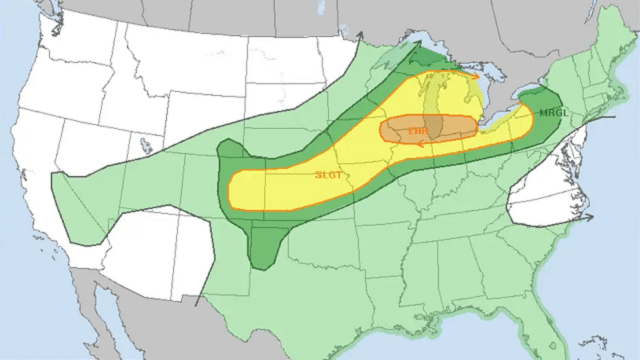
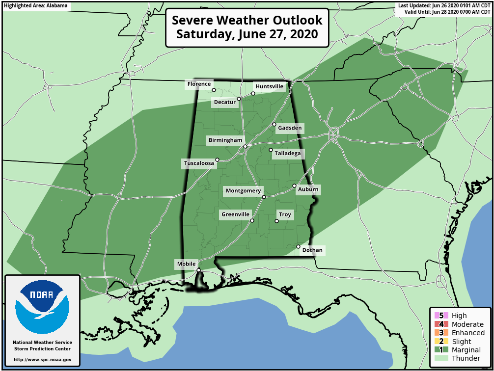
The Storm Prediction Center has most of Alabama in a marginal risk (level 1 out of 5) of severe thunderstorms Saturday; a weak short wave and pocket of colder air aloft will bring potential for a few storms with strong winds and small hail.
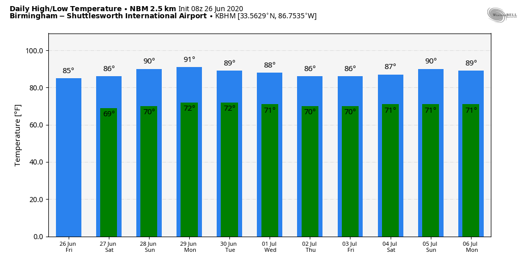
Highs over the weekend will be in the 85- to 90-degree range.
NEXT WEEK: Don’t expect much change. The main westerly winds aloft (the jet stream, as most know it) will remain well to the north of Alabama, so very humid air stays in place. Look for partly sunny days with the usual risk of random, scattered, mostly afternoon and evening showers and thunderstorms. Highs most days will be somewhere between 87 and 90 degrees.
TROPICS: The Atlantic basin remains very quiet, and tropical storm formation is not expected through next week.
DUSTY DAYS: The Saharan Air Layer (SAL) covers Alabama today. The dust, with origins from the African continent, is mostly several thousand feet off the ground and will give the sky a hazy appearance. There can be some reduction in air quality, but it will not affect most people. We had some glorious sunsets last night over north and east Alabama; expect the same this evening due to the scattering of the sunlight.
The SAL moves into the Deep South just about every year. This is nothing unusual and no emergency, despite some of the media hysteria.
ON THIS DATE IN 1957: Hurricane Audrey was in the western Gulf of Mexico as a Category 3 storm. Landfall would come the following day, June 27, between the mouth of the Sabine River and Cameron, Louisiana. It would go on to cause unprecedented destruction across the region. Prior to making landfall, Audrey severely disrupted offshore drilling operations in the Gulf of Mexico. Damages to offshore oil facilities alone was estimated at $16 million. Damage from the surge alone extended 25 miles inland. The rough seas killed nine people offshore after capsizing the boat they were in. Further inland in Louisiana, the storm spawned two tornadoes, causing additional damage. Audrey also dropped heavy rainfall, peaking at 10.63 inches near Basile. In Louisiana and Texas, where Audrey made its first impact, the damage toll was $128 million. The death toll was 416.
BEACH FORECAST: Click here to see the AlabamaWx Beach Forecast Center page.
WEATHER BRAINS: You can listen to our weekly 90-minute show anytime on your favorite podcast app. This is the show all about weather featuring many familiar voices, including the meteorologists at ABC 33/40.
CONNECT: You can find me on all of the major social networks:
Facebook
Twitter
Instagram
Pinterest
Snapchat: spannwx
For more weather news and information from James Spann and his team, visit AlabamaWx.


